
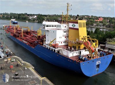
MOYRA
Oil/Chemical Tanker
Current Trip
| Time Travelled | 1 day |
|---|---|
| Remaining Time | --- |
| Distance Travelled | 330.19 nm |
| Remaining Distance | --- |
| AVG Speed | 13.3 Knop |
| MAX Speed | 15.1 Knop |
| AVG Wind | 13.4 knots |
| MAX Wind | 27 knots |
| MIN Temp | 15.3°C / 59.54°F |
| MAX Temp | 20.3°C / 68.54°F |
| Djupgående | 6.7 m |
| Position mottagen | 14 d sen |
Current Position
| Longitud | -56.96297° |
|---|---|
| Latitude | -38.33385° |
| Status | Under way using engine |
| Fart | 12.4 Knop |
| Kurs | 225.3° |
| Område | South Atlantic Ocean |
| Station | T-AIS |
| Position mottagen | 14 d sen |
Info
Information
The current position of MOYRA is in South Atlantic Ocean with coordinates -38.33385° / -56.96297° as reported on 2024-05-08 13:23 by AIS to our vessel tracker app. The vessel's current speed is 12.4 Knop and is heading at the port of BAHIA BLANCA.
The vessel MOYRA (IMO: 9271999, MMSI: 236271000) is a Oil/Chemical Tanker that was built in 2005 ( 19 År gammal ). It's sailing under the flag of [GI] Gibraltar.
In this page you can find informations about the vessels current position, last detected port calls, and current voyage information. If the vessels is not in coverage by AIS you will find the latest position.
The current position of MOYRA is detected by our AIS receivers and we are not responsible for the reliability of the data. The last position was recorded while the vessel was in Coverage by the Ais receivers of our vessel tracking app.
The current draught of MOYRA as reported by AIS is 6.7 meters
Weather
| Temperature | 16.3°C / 61.34°F |
|---|---|
| Wind Speed | 16 knots |
| Direction | 155° SSE |
| Pressure | 1011.6 hPa |
| Humidity | 98.2 % |
| Cloud Coverage | 100 % |
Featured Company
Last Port Calls
| Port | Arrival | Departure | Time In Port |
|---|---|---|---|
| 2024-05-21 04:17 | 2024-05-22 02:57 | 22 h | |
| 2024-05-10 18:41 | 2024-05-11 19:01 | 1 d | |
| 2024-05-05 11:15 | 2024-05-06 14:09 | 1 d | |
| 2024-04-25 01:39 | 2024-04-25 01:54 | 15 m | |
| 2024-04-16 17:13 | 2024-04-19 02:47 | 2 d | |
| 2024-04-13 11:00 | 2024-04-15 19:52 | 2 d | |
| 2024-04-07 22:38 | 2024-04-09 18:09 | 1 d | |
| 2024-03-24 09:37 | 2024-03-25 13:21 | 1 d | |
| 2024-03-05 16:49 | 2024-03-05 17:24 | 35 m | |
| 2024-03-02 04:50 |
Most Visited Ports (Last year)
| Port | Arrivals | |
|---|---|---|
| 13 | ||
| 8 | ||
| 7 | ||
| 5 | ||
| 3 | ||
| 1 |
Last Trips
| Origin | Departure | Destination | Arrival | Distance | |
|---|---|---|---|---|---|
| 2024-05-11 16:01 | 2024-05-21 01:17 | 1251.41 nm | |||
| 2024-05-06 11:09 | 2024-05-10 15:41 | 878.22 nm | |||
| 2024-04-24 22:54 | 2024-05-05 08:15 | 1298.83 nm | |||
| 2024-04-18 23:47 | 2024-04-24 22:39 | 1023.23 nm | |||
| 2024-04-15 16:52 | 2024-04-16 14:13 | 36.95 nm | |||
| 2024-04-09 15:09 | 2024-04-13 08:00 | 431.12 nm | |||
| 2024-03-25 10:21 | 2024-04-07 19:38 | 2469.01 nm | |||
| 2024-03-05 14:24 | 2024-03-24 06:37 | 1266.90 nm | |||
| 2024-03-02 01:50 | 2024-03-05 13:49 | 970.48 nm |
Events
| Tid | Event | Detaljer | Position / Dest | Information |
|---|---|---|---|---|
| 2024-05-23 03:37 | STOPPAR förflyttning | 14.08 nm, South East of RIO GRANDE |
-32.22408 / -51.93274
ARBHI
|
Fart: 0.3 kn Kurs: 256° |
| 2024-05-22 02:57 | AVGÅTT HAMN |
|
-28.21278 / -48.64590
ARBHI
|
Fart: 6.1 kn Kurs: 43° |
| 2024-05-22 02:45 | STARTAR förflyttning |
-28.22698 / -48.65428
[BR] IMBITUBA
|
Fart: 4.1 kn Kurs: 342° |
|
| 2024-05-21 04:34 | STOPPAR förflyttning |
-28.23062 / -48.65096
[BR] IMBITUBA
|
Fart: Kurs: 343° |
|
| 2024-05-21 04:17 | ANLÄNDER HAMN |
|
-28.22790 / -48.65439
[BR] IMBITUBA
|
Fart: 4.4 kn Kurs: 206° |
| 2024-05-21 03:29 | STARTAR förflyttning | 2.31 nm, East of IMBITUBA |
-28.22162 / -48.61171
ARBHI
|
Fart: 4.9 kn Kurs: 310° |
| 2024-05-17 06:29 | STOPPAR förflyttning | 2.72 nm, East of IMBITUBA |
-28.22509 / -48.60386
ARBHI
|
Fart: 0.2 kn Kurs: 207° |