
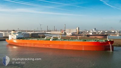
MORNING HOPE
Tanker
Current Trip
EG SKT
| Time Travelled | 6 days |
|---|---|
| Remaining Time | --- |
| Distance Travelled | 1532.53 nm |
| Remaining Distance | --- |
| AVG Speed | 12.6 Knots |
| MAX Speed | 14.4 Knots |
| AVG Wind | 10.9 knots |
| MAX Wind | 26 knots |
| MIN Temp | 15.3°C / 59.54°F |
| MAX Temp | 20.3°C / 68.54°F |
| Draught | 11 m |
| Position Received | 23 h, 26 m ago |
Current Position
| Longitude | 26.57190° |
|---|---|
| Latitude | 32.37450° |
| Status | Under way using engine |
| Speed | 1.5 Knots |
| Course | 112° |
| Area | Mediterranean Sea - Eastern Basin |
| Station | T-AIS |
| Position Received | 23 h, 26 m ago |
Info
Information
The current position of MORNING HOPE is in Mediterranean Sea - Eastern Basin with coordinates 32.37450° / 26.57190° as reported on 2024-04-30 21:03 by AIS to our vessel tracker app. The vessel's current speed is 1.5 Knots
The vessel MORNING HOPE (IMO: 9789283, MMSI: 538009825) is a Tanker It's sailing under the flag of [MH] Marshall Is.
In this page you can find informations about the vessels current position, last detected port calls, and current voyage information. If the vessels is not in coverage by AIS you will find the latest position.
The current position of MORNING HOPE is detected by our AIS receivers and we are not responsible for the reliability of the data. The last position was recorded while the vessel was in Coverage by the Ais receivers of our vessel tracking app.
The current draught of MORNING HOPE as reported by AIS is 11 meters
Weather
| Temperature | 19.4°C / 66.92°F |
|---|---|
| Wind Speed | 9 knots |
| Direction | 338° NNW |
| Pressure | 1014.3 hPa |
| Humidity | 76.6 % |
| Cloud Coverage | 100 % |
Featured Company
Last Port Calls
| Port | Arrival | Departure | Time In Port |
|---|---|---|---|
| 2024-04-23 06:23 | 2024-04-25 06:28 | 2 d | |
| 2024-04-21 09:48 | |||
| 2024-03-08 16:40 | 2024-03-09 19:16 | 1 d | |
| 2024-03-05 20:18 | 2024-03-08 16:12 | 2 d |
Most Visited Ports (Last year)
| Port | Arrivals | |
|---|---|---|
| 2 | ||
| 2 | ||
| 1 | ||
| 1 |
Last Trips
| Origin | Departure | Destination | Arrival | Distance | |
|---|---|---|---|---|---|
| 2024-04-21 11:48 | 2024-04-23 08:23 | 470.83 nm | |||
| 2024-03-08 17:12 | 2024-03-08 17:40 | 1.74 nm | |||
| 2024-02-04 04:02 | 2024-03-05 21:18 | 6678.93 nm |
Events
| Time | Event | Details | Position / Dest | Info |
|---|---|---|---|---|
| 2024-05-01 13:36 | START Moving |
32.00998 / 26.73350
EG SKT
|
Speed: 4.5 kn Course: 304° |
|
| 2024-04-30 21:04 | Status Changed | Default Under way using engine |
32.37387 / 26.57220
EG SKT
|
Speed: 1.5 kn Course: 112° |
| 2024-04-30 21:03 | OUT of Coverage |
32.37450 / 26.57190
Mediterranean Sea - Eastern Basin
EG SKT
|
Speed: 1.5 kn Course: 153.3° |
|
| 2024-04-30 21:01 | Change Sea Area | Egyptian part of the Mediterranean Sea - Eastern Basin Libyan part of the Mediterranean Sea - Eastern Basin |
32.37510 / 26.57156
Mediterranean Sea - Eastern Basin
EG SKT
|
Speed: 1.5 kn Course: 154° |
| 2024-04-30 20:59 | Status Changed | Under way using engine Default |
32.37590 / 26.57112
EG SKT
|
Speed: Course: -1° |
| 2024-04-30 20:46 | STOP Moving |
32.37667 / 26.56667
EG SKT
|
Speed: Course: -1° |
|
| 2024-04-30 20:46 | IN Coverage |
32.37510 / 26.57156
Mediterranean Sea - Eastern Basin
EG SKT
|
Speed: 1.5 kn Course: 154° |
|
| 2024-04-30 00:22 | STOP Moving |
32.31500 / 26.73333
EG SKT
|
Speed: Course: -1° |
|
| 2024-04-29 06:49 | Status Changed | Default Under way using engine |
33.46019 / 23.37181
EG SKT
|
Speed: 13 kn Course: 111.8° |
| 2024-04-29 06:41 | OUT of Coverage |
33.47119 / 23.33918
Mediterranean Sea - Eastern Basin
EG SKT
|
Speed: 13 kn Course: 111.8° |