
MORNING HOPE
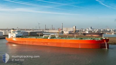
Tanker
Current Trip
| Time Travelled | 26 days |
|---|---|
| Remaining Time | 5 days |
| Distance Travelled | 3956.10 nm |
| Remaining Distance | 1527.22 nm |
| AVG Speed | 11.7 Noeuds |
| MAX Speed | 14.4 Noeuds |
| AVG Wind | 11.5 knots |
| MAX Wind | 26 knots |
| MIN Temp | 15.3°C / 59.54°F |
| MAX Temp | 25.3°C / 77.54°F |
| Tirant d eau | 21.4 m |
| Position reçue | 2 d depuis |
Current Position
| Longitude | 11.08535° |
|---|---|
| Latitude | 37.99744° |
| Etat | Under way using engine |
| Vitesse | 10.1 Noeuds |
| Parcours | 275.3° |
| Zone | Mediterranean Sea - Western Basin |
| Station | T-AIS |
| Position reçue | 2 d depuis |
Info
Information
The current position of MORNING HOPE is in Mediterranean Sea - Western Basin with coordinates 37.99744° / 11.08535° as reported on 2024-05-19 18:14 by AIS to our vessel tracker app. The vessel's current speed is 10.1 Noeuds and is heading at the port of ROTTERDAM. The estimated time of arrival as calculated by MyShipTracking vessel tracking app is 2024-05-27 22:54 LT
The vessel MORNING HOPE (IMO: 9789283, MMSI: 538009825) is a Tanker It's sailing under the flag of [MH] Marshall Is.
In this page you can find informations about the vessels current position, last detected port calls, and current voyage information. If the vessels is not in coverage by AIS you will find the latest position.
The current position of MORNING HOPE is detected by our AIS receivers and we are not responsible for the reliability of the data. The last position was recorded while the vessel was in Coverage by the Ais receivers of our vessel tracking app.
The current draught of MORNING HOPE as reported by AIS is 21.4 meters
Weather
| Temperature | 17.8°C / 64.04°F |
|---|---|
| Wind Speed | 18 knots |
| Direction | 259° W |
| Pressure | 1016.4 hPa |
| Humidity | 80.5 % |
| Cloud Coverage | --- |
Featured Company
Last Port Calls
| Port | Arrival | Departure | Time In Port |
|---|---|---|---|
| 2024-04-23 06:23 | 2024-04-25 06:28 | 2 d | |
| 2024-04-21 09:48 | |||
| 2024-03-08 16:40 | 2024-03-09 19:16 | 1 d | |
| 2024-03-05 20:18 | 2024-03-08 16:12 | 2 d |
Most Visited Ports (Last year)
| Port | Arrivals | |
|---|---|---|
| 2 | ||
| 2 | ||
| 1 | ||
| 1 |
Last Trips
| Origin | Departure | Destination | Arrival | Distance | |
|---|---|---|---|---|---|
| 2024-04-21 11:48 | 2024-04-23 08:23 | 470.83 nm | |||
| 2024-03-08 17:12 | 2024-03-08 17:40 | 1.74 nm | |||
| 2024-02-04 04:02 | 2024-03-05 21:18 | 6678.93 nm |
Events
| Heure | Evenement | Détails | Position/ Destination | Info |
|---|---|---|---|---|
| 2024-05-19 18:22 | Etat Changé | Default Under way using engine |
37.99833 / 11.05833
ROTTERDAM
|
Vitesse: 10.1 kn Parcours: 275.3° |
| 2024-05-19 18:14 | Hors de la zone couverte |
37.99744 / 11.08535
Mediterranean Sea - Western Basin
ROTTERDAM
|
Vitesse: 10.1 kn Parcours: 275.3° |
|
| 2024-05-19 18:11 | Etat Changé | Under way using engine Default |
37.99656 / 11.09597
ROTTERDAM
|
Vitesse: 10 kn Parcours: 302° |
| 2024-05-19 17:52 | Etat Changé | Default Under way using engine |
37.96333 / 11.15500
ROTTERDAM
|
Vitesse: 10.7 kn Parcours: 309.3° |
| 2024-05-19 17:35 | Etat Changé | Under way using engine Default |
37.93407 / 11.20469
ROTTERDAM
|
Vitesse: 10 kn Parcours: 307° |
| 2024-05-19 17:22 | Dans la zone couverte |
37.93684 / 11.20023
Mediterranean Sea - Western Basin
ROTTERDAM
|
Vitesse: 10.7 kn Parcours: 307.7° |
|
| 2024-05-19 16:10 | Etat Changé | Default Under way using engine |
37.77690 / 11.47690
ROTTERDAM
|
Vitesse: 12.1 kn Parcours: 307.8° |
| 2024-05-19 15:56 | Hors de la zone couverte |
37.75139 / 11.52360
Mediterranean Sea - Western Basin
ROTTERDAM
|
Vitesse: 12.1 kn Parcours: 307.8° |
|
| 2024-05-19 14:14 | Detecté en mer | Italian part of the Mediterranean Sea - Western Basin |
37.52393 / 11.87031
Mediterranean Sea - Western Basin
ROTTERDAM
|
Vitesse: 12.4 kn Parcours: 322.5° |
| 2024-05-19 13:06 | Etat Changé | Under way using engine Default |
37.34683 / 12.06754
ROTTERDAM
|
Vitesse: 12 kn Parcours: 315° |