
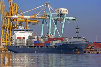
MORAGA
Container Ship
Current Trip
| Time Travelled | 19 h, 15 mins |
|---|---|
| Remaining Time | --- |
| Distance Travelled | 212.12 nm |
| Remaining Distance | --- |
| AVG Speed | 12.3 Knots |
| MAX Speed | 13.6 Knots |
| AVG Wind | 13.9 knots |
| MAX Wind | 19.4 knots |
| MIN Temp | 21.7°C / 71.06°F |
| MAX Temp | 22.9°C / 73.22°F |
| Draught | 9 m |
| Position Received | 6 d ago |
Current Position
| Longitude | 18.90730° |
|---|---|
| Latitude | 33.25034° |
| Status | Under way using engine |
| Speed | 13.3 Knots |
| Course | 255.7° |
| Area | Mediterranean Sea - Eastern Basin |
| Station | T-AIS |
| Position Received | 6 d ago |
Info
Information
The current position of MORAGA is in Mediterranean Sea - Eastern Basin with coordinates 33.25034° / 18.90730° as reported on 2024-06-01 16:05 by AIS to our vessel tracker app. The vessel's current speed is 13.3 Knots and is heading at the port of MISURATA. The estimated time of arrival as calculated by MyShipTracking vessel tracking app is 2024-06-02 09:00 LT
The vessel MORAGA (IMO: 9220067, MMSI: 538009489) is a Container Ship that was built in 2001 ( 23 years old ). It's sailing under the flag of [MH] Marshall Is.
In this page you can find informations about the vessels current position, last detected port calls, and current voyage information. If the vessels is not in coverage by AIS you will find the latest position.
The current position of MORAGA is detected by our AIS receivers and we are not responsible for the reliability of the data. The last position was recorded while the vessel was in Coverage by the Ais receivers of our vessel tracking app.
The current draught of MORAGA as reported by AIS is 9 meters
Weather
| Temperature | 22.9°C / 73.22°F |
|---|---|
| Wind Speed | 20 knots |
| Direction | 292° WNW |
| Pressure | 1011.7 hPa |
| Humidity | 86.1 % |
| Cloud Coverage | --- |
Featured Company
Last Port Calls
| Port | Arrival | Departure | Time In Port |
|---|---|---|---|
| 2024-06-04 19:07 | 2024-06-06 23:53 | 2 d | |
| 2024-06-02 10:31 | 2024-06-02 21:39 | 11 h | |
| 2024-05-29 07:16 | 2024-05-29 22:53 | 15 h | |
| 2024-05-24 20:51 | 2024-05-26 21:30 | 2 d | |
| 2024-05-17 11:41 | 2024-05-18 21:08 | 1 d | |
| 2024-05-13 13:36 | 2024-05-14 12:09 | 22 h | |
| 2024-05-06 13:13 | 2024-05-07 16:08 | 1 d | |
| 2024-05-04 17:29 | 2024-05-05 17:05 | 23 h | |
| 2024-04-30 15:12 | 2024-05-01 14:02 | 22 h | |
| 2024-04-27 02:11 | 2024-04-28 08:45 | 1 d |
Most Visited Ports (Last year)
| Port | Arrivals | |
|---|---|---|
| 12 | ||
| 10 | ||
| 8 | ||
| 6 | ||
| 6 | ||
| 4 |
Last Trips
| Origin | Departure | Destination | Arrival | Distance | |
|---|---|---|---|---|---|
| 2024-06-02 23:39 | 2024-06-04 21:07 | 247.43 nm | |||
| 2024-05-26 23:30 | 2024-06-02 12:31 | 1631.58 nm | |||
| 2024-05-26 23:30 | 2024-05-29 09:16 | 701.22 nm | |||
| 2024-05-18 23:08 | 2024-05-24 22:51 | 259.30 nm | |||
| 2024-05-07 18:08 | 2024-05-17 13:41 | 1648.48 nm | |||
| 2024-05-07 18:08 | 2024-05-13 15:36 | 729.13 nm | |||
| 2024-05-05 19:05 | 2024-05-06 15:13 | 246.03 nm | |||
| 2024-04-28 10:45 | 2024-05-04 19:29 | 1637.34 nm | |||
| 2024-04-28 10:45 | 2024-04-30 17:12 | 713.58 nm | |||
| 2024-04-22 00:24 | 2024-04-27 04:11 | 249.56 nm |
Events
| Time | Event | Details | Position / Dest | Info |
|---|---|---|---|---|
| 2024-06-06 23:53 | PORT DEPARTURE |
|
32.39859 / 20.17428
LYMRA
|
Speed: Course: -1° |
| 2024-06-04 19:37 | STOP Moving |
32.11489 / 20.04769
[LY] BENGHAZI
|
Speed: Course: -1° |
|
| 2024-06-04 19:07 | PORT ARRIVAL |
|
32.11662 / 20.03634
[LY] BENGHAZI
|
Speed: 3.4 kn Course: -1° |
| 2024-06-04 18:37 | START Moving | 2.49 nm, West of BENGHAZI |
32.10635 / 19.98849
LYMRA
|
Speed: 3.4 kn Course: -1° |
| 2024-06-03 16:43 | STOP Moving | 5.32 nm, West of BENGHAZI |
32.12249 / 19.93561
LYMRA
|
Speed: 0.3 kn Course: -1° |
| 2024-06-02 21:39 | PORT DEPARTURE |
|
32.36901 / 15.24217
LYMRA
|
Speed: 6.9 kn Course: -1° |
| 2024-06-02 21:26 | START Moving |
32.36975 / 15.21827
[LY] MISURATA
|
Speed: 4.1 kn Course: -1° |
|
| 2024-06-02 10:50 | STOP Moving |
32.36711 / 15.21700
[LY] MISURATA
|
Speed: 0.1 kn Course: -1° |
|
| 2024-06-02 10:31 | PORT ARRIVAL |
|
32.37179 / 15.22683
[LY] MISURATA
|
Speed: 4.6 kn Course: -1° |
| 2024-06-02 09:52 | START Moving | 3.41 nm, North East of MISURATA |
32.39074 / 15.29228
LYMRA
|
Speed: 3.7 kn Course: -1° |