
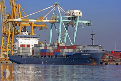
MORAGA
Container Ship
Current Trip
EGPSE
| Time Travelled | 2 h, 32 mins |
|---|---|
| Remaining Time | --- |
| Distance Travelled | 5.55 nm |
| Remaining Distance | --- |
| AVG Speed | 11.4 Knots |
| MAX Speed | 11.4 Knots |
| AVG Wind | 9.5 knots |
| MAX Wind | 11.2 knots |
| MIN Temp | 17.9°C / 64.22°F |
| MAX Temp | 18.8°C / 65.84°F |
| Dybgang | 6.9 m |
| Position Modtaget | 7 d siden |
Current Position
| Longitude | --- |
|---|---|
| Latitude | --- |
| Status | Under way using engine |
| Fart | 13.2 Knots |
| Kurs | 281.4° |
| Område | Mediterranean Sea - Eastern Basin |
| Station | T-AIS |
| Position Modtaget | 7 d siden |
Info
Information
The current position of MORAGA is in Mediterranean Sea - Eastern Basin with coordinates 32.55436° / 29.47568° as reported on 2024-11-23 11:25 by AIS to our vessel tracker app. The vessel's current speed is 13.2 Knots
The vessel MORAGA (IMO: 9220067, MMSI: 538009489) is a Container Ship that was built in 2001 ( 23 år gamle ). It's sailing under the flag of [MH] Marshall Is.
In this page you can find informations about the vessels current position, last detected port calls, and current voyage information. If the vessels is not in coverage by AIS you will find the latest position.
The current position of MORAGA is detected by our AIS receivers and we are not responsible for the reliability of the data. The last position was recorded while the vessel was in Coverage by the Ais receivers of our vessel tracking app.
The current draught of MORAGA as reported by AIS is 6.9 meters
Weather
| Temperature | 17.4°C / 63.32°F |
|---|---|
| Wind Speed | 10 knots |
| Direction | 301° WNW |
| Pressure | 1020.7 hPa |
| Humidity | 67.6 % |
| Cloud Coverage | 58 % |
Featured Company
Last Port Calls
| Port | Arrival | Departure | Time In Port |
|---|---|---|---|
| 2024-11-27 14:31 | 2024-12-01 07:52 | 3 d | |
| 2024-11-22 01:45 | 2024-11-22 21:06 | 19 h | |
| 2024-11-16 15:29 | 2024-11-19 16:49 | 3 d | |
| 2024-11-08 21:41 | 2024-11-09 16:03 | 18 h | |
| 2024-11-02 21:38 | 2024-11-06 08:40 | 3 d | |
| 2024-10-25 21:08 | 2024-10-27 01:05 | 1 d | |
| 2024-10-21 08:19 | 2024-10-23 14:14 | 2 d | |
| 2024-10-11 21:37 | 2024-10-12 14:01 | 16 h | |
| 2024-10-09 12:50 |
Most Visited Ports (Last year)
| Port | Arrivals | |
|---|---|---|
| 25 | ||
| 16 | ||
| 15 | ||
| 3 |
Last Trips
| Origin | Departure | Destination | Arrival | Distance | |
|---|---|---|---|---|---|
| 2024-11-19 18:49 | 2024-11-27 16:31 | 1400.87 nm | |||
| 2024-11-19 18:49 | 2024-11-22 03:45 | 698.31 nm | |||
| 2024-11-06 10:40 | 2024-11-16 17:29 | 1410.75 nm | |||
| 2024-11-06 10:40 | 2024-11-08 23:41 | 704.09 nm | |||
| 2024-10-23 16:14 | 2024-11-02 23:38 | 1405.57 nm | |||
| 2024-10-23 16:14 | 2024-10-25 23:08 | 705.80 nm | |||
| 2024-10-09 14:50 | 2024-10-21 10:19 | 1430.42 nm | |||
| 2024-10-09 14:50 | 2024-10-11 23:37 | 710.92 nm |
Events
| Tid | Hændelsen | Detaljer | Position / Dest | Info |
|---|---|---|---|---|
| 2024-12-01 08:02 | START Sejllads | 0.95 nm, North West of BENGHAZI |
32.11203 / 20.02482
EGPSE
|
Fart: 7.9 kn Kurs: 277° |
| 2024-12-01 07:52 | Afsejlet fra sidste havn |
|
32.11203 / 20.02482
EGPSE
|
Fart: 1.1 kn Kurs: 285° |
| 2024-11-27 15:07 | STOP Sejllads |
32.11505 / 20.04741
[LY] BENGHAZI
|
Fart: Kurs: 130° |
|
| 2024-11-27 14:31 | Skibe i havn |
|
32.11540 / 20.03266
[LY] BENGHAZI
|
Fart: 5.3 kn Kurs: 69° |
| 2024-11-23 11:30 | Status er ændret | Default Under way using engine |
32.55789 / 29.45445
EGPSE
|
Fart: 13.2 kn Kurs: 281.4° |
| 2024-11-23 11:25 | Status er ændret | Under way using engine Default |
32.55436 / 29.47568
EGPSE
|
Fart: 13.2 kn Kurs: 281° |
| 2024-11-23 11:25 | Udenfor Dækning |
32.55436 / 29.47568
Mediterranean Sea - Eastern Basin
|
Fart: 13.2 kn Kurs: 281.4° |
|
| 2024-11-23 11:15 | Indenfor Dækning |
32.55436 / 29.47568
Mediterranean Sea - Eastern Basin
|
Fart: 13.2 kn Kurs: 281.4° |
|
| 2024-11-23 07:23 | Status er ændret | Default Under way using engine |
32.37270 / 30.47008
EGPSE
|
Fart: 12.9 kn Kurs: 283° |
| 2024-11-23 07:22 | Udenfor Dækning |
32.37116 / 30.47764
Mediterranean Sea - Eastern Basin
|
Fart: 12.9 kn Kurs: 283° |