

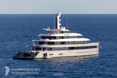
MOONRISE
Pleasure Craft

Current Trip
| Time Travelled | 3 days |
|---|---|
| Remaining Time | --- |
| Distance Travelled | 64.73 nm |
| Remaining Distance | --- |
| AVG Speed | 13.7 Knots |
| MAX Speed | 14 Knots |
| AVG Wind | 9.6 knots |
| MAX Wind | 11.5 knots |
| MIN Temp | 25.2°C / 77.36°F |
| MAX Temp | 25.4°C / 77.72°F |
| Draught | 4.3 m |
| Position Received | 3 d ago |
Current Position
| Longitude | --- |
|---|---|
| Latitude | --- |
| Status | Default |
| Speed | 13.6 Knots |
| Course | 91.4° |
| Area | Caribbean Sea |
| Station | T-AIS |
| Position Received | 3 d ago |
Information
The current position of MOONRISE is in Caribbean Sea with coordinates 17.99890° / -61.92681° as reported on 2025-03-17 18:20 by AIS to our vessel tracker app. The vessel's current speed is 13.6 Knots and is heading at the port of CARTAGENA. The estimated time of arrival as calculated by MyShipTracking vessel tracking app is 2025-03-28 07:00 LT
The vessel MOONRISE (IMO: 9816232, MMSI: 319178500) is a Pleasure Craft It's sailing under the flag of [KY] Cayman Is.
In this page you can find informations about the vessels current position, last detected port calls, and current voyage information. If the vessels is not in coverage by AIS you will find the latest position.
The current position of MOONRISE is detected by our AIS receivers and we are not responsible for the reliability of the data. The last position was recorded while the vessel was in Coverage by the Ais receivers of our vessel tracking app.
The current draught of MOONRISE as reported by AIS is 4.3 meters
Weather
| Temperature | 25.4°C / 77.72°F |
|---|---|
| Wind Speed | 4 knots |
| Direction | 32° NNE |
| Pressure | 1014.5 hPa |
| Humidity | 67.4 % |
| Cloud Coverage | 3 % |


Featured Company
Last Port Calls
| Port | Arrival | Departure | Time In Port |
|---|---|---|---|
| 2025-03-15 17:53 | 2025-03-17 13:40 | 1 d |
Last Trips
| Origin | Departure | Destination | Arrival | Distance |
|---|
Events
| Time | Event | Details | Position / Dest | Info |
|---|---|---|---|---|
| 2025-03-17 18:20 | OUT of Coverage |
17.99890 / -61.92681
Caribbean Sea
ESCAR
|
Speed: 13.6 kn Course: 91.4° |
|
| 2025-03-17 18:20 | Detected in Sea | Antigua and Barbuda part of the Caribbean Sea |
17.99890 / -61.92681
Caribbean Sea
ESCAR
|
Speed: 13.6 kn Course: 91.4° |
| 2025-03-17 18:20 | IN Coverage |
17.99890 / -61.92681
Caribbean Sea
ESCAR
|
Speed: 13.6 kn Course: 91.4° |
|
| 2025-03-17 16:17 | OUT of Coverage |
17.99642 / -62.43250
Caribbean Sea
ESCAR
|
Speed: 14 kn Course: 88° |
|
| 2025-03-17 14:07 | Change Sea Area | Saint-Martin part of the Caribbean Sea Sint-Maarten part of the Caribbean Sea |
17.99722 / -62.96598
Caribbean Sea
ESCAR
|
Speed: 14 kn Course: 90° |
| 2025-03-17 13:45 | Status Changed | Default Moored |
17.99972 / -63.04916
ESCAR
|
Speed: 8.6 kn Course: 123.5° |
| 2025-03-17 13:40 | PORT DEPARTURE |
|
18.00632 / -63.05179
ESCAR
|
Speed: 7.4 kn Course: 196° |
| 2025-03-17 13:39 | START Moving |
18.00941 / -63.05096
[SX] PHILIPSBURG
|
Speed: 3.3 kn Course: 193° |
|
| 2025-03-16 21:06 | Destination Changed | ESCAR SXM |
18.01463 / -63.04607
[SX] PHILIPSBURG
|
Speed: Course: 23° |
| 2025-03-16 21:06 | ETA Changed | 2025/03/28 07:00 2025/03/15 17:00 |
18.01463 / -63.04607
[SX] PHILIPSBURG
|
Speed: Course: 23° |