

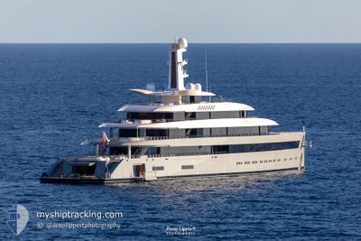
MOONRISE
Pleasure Craft

Current Trip
| Time Travelled | 11 days |
|---|---|
| Remaining Time | 4 h, 17 mins |
| Distance Travelled | 3428.00 nm |
| Remaining Distance | 57.93 nm |
| AVG Speed | 12.7 Knopen |
| MAX Speed | 15.5 Knopen |
| AVG Wind | 10.1 knots |
| MAX Wind | 18 knots |
| MIN Temp | 14.1°C / 57.38°F |
| MAX Temp | 25.4°C / 77.72°F |
| Diepgang | 4.3 M |
| Positie ontvangen | 1 m geleden |
Current Position
| Lengtegraad | --- |
|---|---|
| Breedtegraat | --- |
| Status | Under way using engine |
| Snelheid | 13.4 Knopen |
| Koers | 9.7° |
| Gebied | Mediterranean Sea - Western Basin |
| Station | T-AIS |
| Positie ontvangen | 1 m geleden |
Information
The current position of MOONRISE is in Mediterranean Sea - Western Basin with coordinates 36.81227° / -1.65904° as reported on 2025-03-29 02:45 by AIS to our vessel tracker app. The vessel's current speed is 13.4 Knopen and is heading at the port of CARTAGENA. The estimated time of arrival as calculated by MyShipTracking vessel tracking app is 2025-03-29 08:03 LT
The vessel MOONRISE (IMO: 9816232, MMSI: 319178500) is a Pleasure Craft It's sailing under the flag of [KY] Cayman Is.
In this page you can find informations about the vessels current position, last detected port calls, and current voyage information. If the vessels is not in coverage by AIS you will find the latest position.
The current position of MOONRISE is detected by our AIS receivers and we are not responsible for the reliability of the data. The last position was recorded while the vessel was in Coverage by the Ais receivers of our vessel tracking app.
The current draught of MOONRISE as reported by AIS is 4.3 meters
Weather
| Temperature | 16.5°C / 61.7°F |
|---|---|
| Wind Speed | 8 knots |
| Direction | 214° SW |
| Pressure | 1016.8 hPa |
| Humidity | 79.9 % |
| Cloud Coverage | --- |


Featured Company
Last Port Calls
| Port | Arrival | Departure | Time In Port |
|---|---|---|---|
| 2025-03-15 13:53 | 2025-03-17 09:40 | 1 d |
Last Trips
| Origin | Departure | Destination | Arrival | Distance |
|---|
Events
| Tijd | Evenement | Details | Positie / Bestemming | Info |
|---|---|---|---|---|
| 2025-03-29 01:54 | Wijzig zee gebeid | Spanish part of the Mediterranean Sea - Western Basin Spanish part of the Alboran Sea |
36.70514 / -1.82185
Mediterranean Sea - Western Basin
ESCAR
|
Snelheid: 12.8 kn Koers: 79.5° |
| 2025-03-29 01:53 | Binnenbereik |
36.70514 / -1.82185
Mediterranean Sea - Western Basin
ESCAR
|
Snelheid: 12.8 kn Koers: 79.5° |
|
| 2025-03-29 00:12 | Buitenbereik |
36.42221 / -2.11577
Alboran Sea
ESCAR
|
Snelheid: 13.1 kn Koers: 33.4° |
|
| 2025-03-28 23:28 | Binnenbereik |
36.34233 / -2.26877
Alboran Sea
ESCAR
|
Snelheid: 12.3 kn Koers: 69.5° |
|
| 2025-03-28 22:22 | Buitenbereik |
36.31296 / -2.53995
Alboran Sea
ESCAR
|
Snelheid: 12.5 kn Koers: 81.5° |
|
| 2025-03-28 21:26 | Binnenbereik |
36.28605 / -2.76921
Alboran Sea
ESCAR
|
Snelheid: 12.6 kn Koers: 79.4° |
|
| 2025-03-28 20:10 | Buitenbereik |
36.24798 / -3.08717
Alboran Sea
ESCAR
|
Snelheid: 12 kn Koers: 82.2° |
|
| 2025-03-28 18:23 | ETA Changed | 2025/03/29 08:00 2025/03/28 07:00 |
36.20150 / -3.50783
ESCAR
|
Snelheid: 11.6 kn Koers: 83.2° |
| 2025-03-28 11:13 | Wijzig zee gebeid | Spanish part of the Alboran Sea Spanish part of the Strait of Gibraltar |
35.97577 / -5.31706
Alboran Sea
ESCAR
|
Snelheid: 14.9 kn Koers: 88° |
| 2025-03-28 11:02 | Wijzig zee gebeid | Spanish part of the Strait of Gibraltar Moroccan part of the Strait of Gibraltar |
35.96992 / -5.37221
Strait of Gibraltar
ESCAR
|
Snelheid: 14.5 kn Koers: 78.5° |