
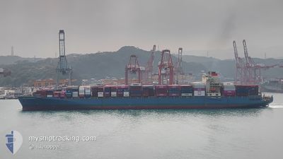
MOL ENDOWMENT
Container Ship
Current Trip
| Trip Time | 4 h, 15 mins |
|---|---|
| Trip Distance | 47.64 nm |
| AVG Speed | 11.1 Knots |
| MAX Speed | 14.4 Knots |
| Draught | 11.4 m |
| AVG Wind | 3.8 knots |
| MAX Wind | 7.2 knots |
| MIN Temp | 22.1°C / 71.78°F |
| MAX Temp | 26.6°C / 79.88°F |
| Position Received | 2 m ago |
Current Position
| Longitude | 29.53647° |
|---|---|
| Latitude | 40.76575° |
| Status | Moored |
| Speed | |
| Course | 116° |
| Area | Sea of Marmara |
| Station | T-AIS |
| Position Received | 2 m ago |
Info
Information
The current position of MOL ENDOWMENT is in Sea of Marmara with coordinates 40.76575° / 29.53647° as reported on 2024-06-06 23:29 by AIS to our vessel tracker app. The vessel's current speed is 0 Knots and is currently inside the port of DILISKELESI.
The vessel MOL ENDOWMENT (IMO: 9333852, MMSI: 371836000) is a Container Ship that was built in 2007 ( 17 years old ). It's sailing under the flag of [PA] Panama.
In this page you can find informations about the vessels current position, last detected port calls, and current voyage information. If the vessels is not in coverage by AIS you will find the latest position.
The current position of MOL ENDOWMENT is detected by our AIS receivers and we are not responsible for the reliability of the data. The last position was recorded while the vessel was in Coverage by the Ais receivers of our vessel tracking app.
The current draught of MOL ENDOWMENT as reported by AIS is 11.4 meters
Weather
| Temperature | 21.3°C / 70.34°F |
|---|---|
| Wind Speed | 8 knots |
| Direction | 86° E |
| Pressure | 1015.9 hPa |
| Humidity | 71 % |
| Cloud Coverage | 41 % |
Featured Company
Last Port Calls
| Port | Arrival | Departure | Time In Port |
|---|---|---|---|
| 2024-06-06 14:21 | |||
| 2024-06-04 23:39 | 2024-06-06 10:06 | 1 d | |
| 2024-05-30 07:10 | 2024-05-31 22:06 | 1 d | |
| 2024-05-22 23:36 | 2024-05-23 14:36 | 14 h | |
| 2024-05-21 01:34 | 2024-05-21 23:13 | 21 h | |
| 2024-05-19 20:12 | 2024-05-20 16:36 | 20 h | |
| 2024-05-18 11:16 | 2024-05-19 03:41 | 16 h | |
| 2024-05-12 21:49 | 2024-05-13 07:28 | 9 h | |
| 2024-05-04 23:19 | 2024-05-06 02:03 | 1 d | |
| 2024-05-02 14:15 | 2024-05-03 08:08 | 17 h |
Last Trips
| Origin | Departure | Destination | Arrival | Distance | |
|---|---|---|---|---|---|
| 2024-06-06 10:06 | 2024-06-06 14:21 | 47.64 nm | |||
| 2024-05-31 22:06 | 2024-06-04 23:39 | 877.09 nm | |||
| 2024-05-23 14:36 | 2024-05-30 07:10 | 2732.90 nm | |||
| 2024-05-21 23:13 | 2024-05-22 23:36 | 301.45 nm | |||
| 2024-05-20 16:36 | 2024-05-21 01:34 | 120.49 nm | |||
| 2024-05-19 03:41 | 2024-05-19 20:12 | 161.84 nm | |||
| 2024-05-13 07:28 | 2024-05-18 11:16 | 1402.86 nm | |||
| 2024-05-06 02:03 | 2024-05-12 21:49 | 1428.94 nm | |||
| 2024-05-03 08:08 | 2024-05-04 23:19 | 675.67 nm | |||
| 2024-04-22 11:43 | 2024-05-02 14:15 | 2328.84 nm |
Events
| Time | Event | Details | Position / Dest | Info |
|---|---|---|---|---|
| 2024-06-06 17:38 | IN Coverage |
40.76574 / 29.53641
Sea of Marmara
[TR] DILISKELESI
|
Speed: Course: 353.2° |
|
| 2024-06-06 16:38 | OUT of Coverage |
40.76570 / 29.53633
Sea of Marmara
[TR] DILISKELESI
|
Speed: Course: 353.2° |
|
| 2024-06-06 11:32 | Status Changed | Moored Under way using engine |
40.76573 / 29.53634
[TR] DILISKELESI
|
Speed: 0.1 kn Course: 116° |
| 2024-06-06 11:28 | STOP Moving |
40.76559 / 29.53609
[TR] DILISKELESI
|
Speed: 0.2 kn Course: 119° |
|
| 2024-06-06 11:21 | PORT ARRIVAL |
|
40.76440 / 29.53788
[TR] DILISKELESI
|
Speed: 0.8 kn Course: 117° |
| 2024-06-06 07:38 | ETA Changed | 2024/06/06 08:15 2024/06/06 11:00 |
40.89554 / 28.68195
TR GEB
|
Speed: 12.8 kn Course: 169.2° |
| 2024-06-06 07:12 | START Moving | 0.31 nm, South East of AMBARLI |
40.95565 / 28.67848
TR GEB
|
Speed: 3.6 kn Course: 241° |
| 2024-06-06 07:09 | STOP Moving | 0.37 nm, South East of AMBARLI |
40.95605 / 28.68088
TR GEB
|
Speed: 0.1 kn Course: 269° |
| 2024-06-06 07:06 | PORT DEPARTURE |
|
40.95627 / 28.67990
TR GEB
|
Speed: 3.3 kn Course: 325° |
| 2024-06-06 07:04 | START Moving |
40.95858 / 28.67801
[TR] AMBARLI
|
Speed: 3.4 kn Course: 345° |