

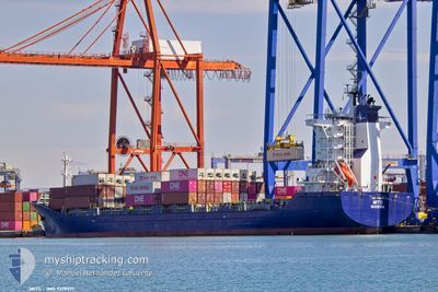
MITO
Cargo/Container Ship

Current Trip
| Trip Time | 20 h, 56 mins |
|---|---|
| Trip Distance | 161.24 nm |
| AVG Speed | 12.3 Knots |
| MAX Speed | 15 Knots |
| Draught | 7.2 m |
| AVG Wind | 11.7 knots |
| MAX Wind | 17.8 knots |
| MIN Temp | 16.3°C / 61.34°F |
| MAX Temp | 21.3°C / 70.34°F |
| Position Received | 19 h, 59 m ago |
Current Position
| Longitude | --- |
|---|---|
| Latitude | --- |
| Status | Under way using engine |
| Speed | 13.9 Knots |
| Course | 264.6° |
| Area | Mediterranean Sea - Eastern Basin |
| Station | T-AIS |
| Position Received | 19 h, 59 m ago |
Information
The current position of MITO is in Mediterranean Sea - Eastern Basin with coordinates 31.89079° / 34.29553° as reported on 2025-03-28 16:36 by AIS to our vessel tracker app. The vessel's current speed is 13.9 Knots and is currently inside the port of DAMIETTA.
The vessel MITO (IMO: 9319571, MMSI: 255806508) is a Cargo/Container Ship that was built in 2006 ( 19 years old ). It's sailing under the flag of [PT] Portugal.
In this page you can find informations about the vessels current position, last detected port calls, and current voyage information. If the vessels is not in coverage by AIS you will find the latest position.
The current position of MITO is detected by our AIS receivers and we are not responsible for the reliability of the data. The last position was recorded while the vessel was in Coverage by the Ais receivers of our vessel tracking app.
The current draught of MITO as reported by AIS is 7.2 meters
Weather
| Temperature | 18.6°C / 65.48°F |
|---|---|
| Wind Speed | 11 knots |
| Direction | 340° NNW |
| Pressure | 1011.4 hPa |
| Humidity | 64.7 % |
| Cloud Coverage | 18 % |


Featured Company
Last Port Calls
| Port | Arrival | Departure | Time In Port |
|---|---|---|---|
| 2025-03-29 14:11 | |||
| 2025-03-27 20:16 | 2025-03-28 18:15 | 20 h | |
| 2025-03-21 07:11 | 2025-03-22 20:28 | 1 d | |
| 2025-03-19 23:15 | 2025-03-20 21:08 | 21 h | |
| 2025-03-13 22:54 | 2025-03-15 00:36 | 1 d | |
| 2025-03-10 18:09 | 2025-03-11 18:19 | 1 d | |
| 2025-03-04 07:36 | 2025-03-05 19:59 | 1 d | |
| 2025-03-02 23:56 | 2025-03-03 14:38 | 14 h | |
| 2025-02-24 08:47 | 2025-02-25 14:25 | 1 d | |
| 2025-02-22 11:52 | 2025-02-23 21:18 | 1 d |
Last Trips
| Origin | Departure | Destination | Arrival | Distance | |
|---|---|---|---|---|---|
| 2025-03-28 18:15 | 2025-03-29 14:11 | 161.24 nm | |||
| 2025-03-22 20:28 | 2025-03-27 20:16 | 1419.26 nm | |||
| 2025-03-20 21:08 | 2025-03-21 07:11 | 72.45 nm | |||
| 2025-03-15 00:36 | 2025-03-19 23:15 | 1291.51 nm | |||
| 2025-03-11 18:19 | 2025-03-13 22:54 | 160.25 nm | |||
| 2025-03-05 19:59 | 2025-03-10 18:09 | 1416.42 nm | |||
| 2025-03-03 14:38 | 2025-03-04 07:36 | 70.66 nm | |||
| 2025-02-25 14:25 | 2025-03-02 23:56 | 1286.54 nm | |||
| 2025-02-23 21:18 | 2025-02-24 08:47 | 157.96 nm | |||
| 2025-02-17 22:34 | 2025-02-22 11:52 | 1417.32 nm |
Events
| Time | Event | Details | Position / Dest | Info |
|---|---|---|---|---|
| 2025-03-29 12:11 | PORT ARRIVAL |
|
31.47292 / 31.75421
[EG] DAMIETTA
|
Speed: 7.5 kn Course: 194° |
| 2025-03-29 10:26 | START Moving | 9.19 nm, North of DAMIETTA |
31.62073 / 31.76608
EG DAM
|
Speed: 3.5 kn Course: 201° |
| 2025-03-29 02:44 | STOP Moving | 9.22 nm, North of DAMIETTA |
31.62103 / 31.76995
EG DAM
|
Speed: 0.1 kn Course: 293° |
| 2025-03-28 16:39 | Status Changed | Default Under way using engine |
31.88953 / 34.28345
EG DAM
|
Speed: 13.9 kn Course: 264.6° |
| 2025-03-28 16:36 | OUT of Coverage |
31.89079 / 34.29553
Mediterranean Sea - Eastern Basin
EG DAM
|
Speed: 13.9 kn Course: 264.6° |
|
| 2025-03-28 15:46 | Status Changed | Under way using engine Moored |
31.88709 / 34.52509
EG DAM
|
Speed: 14.1 kn Course: 285.3° |
| 2025-03-28 15:15 | PORT DEPARTURE |
|
31.85107 / 34.64075
EG DAM
|
Speed: 10.3 kn Course: 355° |
| 2025-03-28 15:04 | Status Changed | Moored Default |
31.83266 / 34.64623
[IL] ASHDOD
|
Speed: 0.5 kn Course: 271° |
| 2025-03-28 15:04 | START Moving |
31.83266 / 34.64623
[IL] ASHDOD
|
Speed: 3.5 kn Course: 290° |
|
| 2025-03-28 15:01 | Status Changed | Default Moored |
31.83221 / 34.64758
[IL] ASHDOD
|
Speed: 0.5 kn Course: 271° |