
MISTRAL
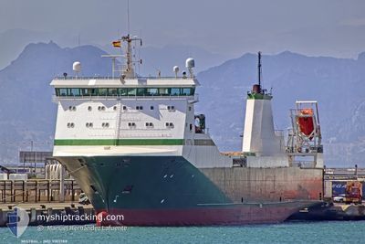
Ro-Ro Cargo
Current Trip
| Time Travelled | 9 days |
|---|---|
| Remaining Time | --- |
| Distance Travelled | 1514.55 nm |
| Remaining Distance | --- |
| AVG Speed | 10.8 Knots |
| MAX Speed | 15.6 Knots |
| AVG Wind | 12 knots |
| MAX Wind | 30.3 knots |
| MIN Temp | 10.5°C / 50.9°F |
| MAX Temp | 16.2°C / 61.16°F |
| Draught | 5.8 m |
| Position Received | 3 d ago |
Current Position
| Longitude | --- |
|---|---|
| Latitude | --- |
| Status | Under way using engine |
| Speed | 13.2 Knots |
| Course | 1.9° |
| Area | Aegean Sea |
| Station | T-AIS |
| Position Received | 3 d ago |
Info
Information
The current position of MISTRAL is in Aegean Sea with coordinates 39.24419° / 24.80204° as reported on 2025-03-07 22:30 by AIS to our vessel tracker app. The vessel's current speed is 13.2 Knots
The vessel MISTRAL (IMO: 9183788, MMSI: 230925000) is a Ro-Ro Cargo that was built in 1999 ( 26 years old ). It's sailing under the flag of [FI] Finland.
In this page you can find informations about the vessels current position, last detected port calls, and current voyage information. If the vessels is not in coverage by AIS you will find the latest position.
The current position of MISTRAL is detected by our AIS receivers and we are not responsible for the reliability of the data. The last position was recorded while the vessel was in Coverage by the Ais receivers of our vessel tracking app.
The current draught of MISTRAL as reported by AIS is 5.8 meters
Weather
| Temperature | 12.6°C / 54.68°F |
|---|---|
| Wind Speed | 4 knots |
| Direction | 254° WSW |
| Pressure | 1017.2 hPa |
| Humidity | 84.6 % |
| Cloud Coverage | 100 % |
Featured Company
Last Port Calls
| Port | Arrival | Departure | Time In Port |
|---|---|---|---|
| 2025-03-01 06:19 | 2025-03-01 13:43 | 7 h | |
| 2025-02-24 05:34 | 2025-02-24 13:06 | 7 h | |
| 2025-02-15 23:40 | 2025-02-18 05:08 | 2 d | |
| 2025-02-13 11:47 | 2025-02-15 16:23 | 2 d | |
| 2025-02-11 12:11 | 2025-02-12 12:59 | 1 d | |
| 2025-02-08 11:16 | 2025-02-09 05:29 | 18 h | |
| 2025-02-05 14:45 | 2025-02-06 17:53 | 1 d | |
| 2025-02-03 07:55 | 2025-02-03 13:13 | 5 h | |
| 2025-01-27 04:11 | 2025-01-28 15:20 | 1 d | |
| 2025-01-22 05:31 | 2025-01-22 13:26 | 7 h |
Last Trips
| Origin | Departure | Destination | Arrival | Distance | |
|---|---|---|---|---|---|
| 2025-02-24 15:06 | 2025-03-01 07:19 | 1487.81 nm | |||
| 2025-02-18 06:08 | 2025-02-24 07:34 | 1519.62 nm | |||
| 2025-02-15 17:23 | 2025-02-16 00:40 | 128.90 nm | |||
| 2025-02-12 13:59 | 2025-02-13 12:47 | 426.10 nm | |||
| 2025-02-09 06:29 | 2025-02-11 13:11 | 385.78 nm | |||
| 2025-02-06 18:53 | 2025-02-08 12:16 | 581.50 nm | |||
| 2025-02-03 15:13 | 2025-02-05 15:45 | 727.97 nm | |||
| 2025-01-28 16:20 | 2025-02-03 09:55 | 1497.27 nm | |||
| 2025-01-22 15:26 | 2025-01-27 05:11 | 1484.20 nm | |||
| 2025-01-16 19:31 | 2025-01-22 07:31 | 1677.27 nm |
Events
| Time | Event | Details | Position / Dest | Info |
|---|---|---|---|---|
| 2025-03-08 07:27 | STOP Moving | 2.94 nm, South West of ALEXANDROUPOLI |
40.79968 / 25.85736
GRAXD
|
Speed: 0.1 kn Course: 77° |
| 2025-03-07 22:42 | Status Changed | Default Under way using engine |
39.28736 / 24.80495
GRAXD
|
Speed: 13.2 kn Course: 1.9° |
| 2025-03-07 22:30 | OUT of Coverage |
39.24419 / 24.80204
Aegean Sea
GRAXD
|
Speed: 13.2 kn Course: 1.9° |
|
| 2025-03-07 22:25 | Status Changed | Under way using engine Default |
39.22592 / 24.80145
GRAXD
|
Speed: 12.9 kn Course: 358° |
| 2025-03-07 22:11 | Status Changed | Default Under way using engine |
39.17460 / 24.80155
GRAXD
|
Speed: 12.9 kn Course: 359.2° |
| 2025-03-07 20:53 | Status Changed | Under way using engine Default |
38.88267 / 24.80548
GRAXD
|
Speed: 13 kn Course: 359° |
| 2025-03-07 20:53 | IN Coverage |
38.89256 / 24.80560
Aegean Sea
GRAXD
|
Speed: 13.3 kn Course: 0.3° |
|
| 2025-03-07 17:59 | Status Changed | Default Under way using engine |
38.25617 / 24.71403
GRAXD
|
Speed: 12.7 kn Course: 10.2° |
| 2025-03-07 17:54 | OUT of Coverage |
38.23935 / 24.71020
Aegean Sea
GRAXD
|
Speed: 12.7 kn Course: 10.2° |
|
| 2025-03-07 17:29 | Status Changed | Under way using engine Default |
38.15417 / 24.68799
GRAXD
|
Speed: 11.7 kn Course: 13° |