

METEOR
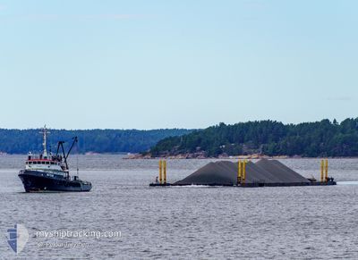
Tug

Current Trip
SEDOM
| Time Travelled | 4 days |
|---|---|
| Remaining Time | --- |
| Distance Travelled | 402.50 nm |
| Remaining Distance | --- |
| AVG Speed | 4 Knots |
| MAX Speed | 5.3 Knots |
| AVG Wind | 14.8 knots |
| MAX Wind | 21 knots |
| MIN Temp | 0.1°C / 32.18°F |
| MAX Temp | 5.1°C / 41.18°F |
| Draught | 4.2 m |
| Position Received | 22 h, 14 m ago |
Current Position
| Longitude | --- |
|---|---|
| Latitude | --- |
| Status | Restricted manoeuverability |
| Speed | 4.5 Knots |
| Course | 4° |
| Area | Gulf of Bothnia |
| Station | T-AIS |
| Position Received | 22 h, 14 m ago |
Information
The current position of METEOR is in Gulf of Bothnia with coordinates 61.25970° / 20.92467° as reported on 2025-03-29 23:19 by AIS to our vessel tracker app. The vessel's current speed is 4.5 Knots
The vessel METEOR (IMO: 5233547, MMSI: 230934000) is a Tug that was built in 1960 ( 65 years old ). It's sailing under the flag of [FI] Finland.
In this page you can find informations about the vessels current position, last detected port calls, and current voyage information. If the vessels is not in coverage by AIS you will find the latest position.
The current position of METEOR is detected by our AIS receivers and we are not responsible for the reliability of the data. The last position was recorded while the vessel was in Coverage by the Ais receivers of our vessel tracking app.
The current draught of METEOR as reported by AIS is 4.2 meters
Weather
| Temperature | 2.3°C / 36.14°F |
|---|---|
| Wind Speed | 3 knots |
| Direction | 37° NE |
| Pressure | 1012 hPa |
| Humidity | 87.2 % |
| Cloud Coverage | 100 % |


Featured Company
Last Port Calls
| Port | Arrival | Departure | Time In Port |
|---|---|---|---|
| 2025-03-25 11:18 | 2025-03-26 19:18 | 1 d | |
| 2025-03-23 09:17 | 2025-03-23 22:06 | 12 h | |
| 2025-03-14 17:42 | 2025-03-17 13:08 | 2 d | |
| 2025-03-10 16:05 | 2025-03-12 21:41 | 2 d | |
| 2025-03-06 08:13 | 2025-03-07 12:49 | 1 d | |
| 2025-03-02 19:35 | 2025-03-04 08:15 | 1 d | |
| 2025-02-23 11:02 | 2025-02-24 09:09 | 22 h | |
| 2025-02-21 00:45 | 2025-02-22 16:35 | 1 d | |
| 2025-02-11 15:48 | 2025-02-19 08:23 | 7 d | |
| 2025-02-09 18:41 | 2025-02-11 15:20 | 1 d |
Last Trips
| Origin | Departure | Destination | Arrival | Distance | |
|---|---|---|---|---|---|
| 2025-03-23 22:06 | 2025-03-25 11:18 | 260.66 nm | |||
| 2025-03-17 13:08 | 2025-03-23 09:17 | 570.35 nm | |||
| 2025-03-12 21:41 | 2025-03-14 17:42 | 271.26 nm | |||
| 2025-03-07 12:49 | 2025-03-10 16:05 | 295.26 nm | |||
| 2025-03-04 08:15 | 2025-03-06 08:13 | 323.92 nm | |||
| 2025-02-24 09:09 | 2025-03-02 19:35 | 423.23 nm | |||
| 2025-02-22 16:35 | 2025-02-23 11:02 | 62.63 nm | |||
| 2025-02-19 08:23 | 2025-02-21 00:45 | 252.06 nm | |||
| 2025-02-11 15:20 | 2025-02-11 15:48 | 0.94 nm | |||
| 2025-02-09 17:53 | 2025-02-09 18:41 | 0.39 nm |
Events
| Time | Event | Details | Position / Dest | Info |
|---|---|---|---|---|
| 2025-03-29 23:26 | Status Changed | Default Restricted manoeuverability |
61.26819 / 20.92538
SEDOM
|
Speed: 4.5 kn Course: 4° |
| 2025-03-29 23:19 | OUT of Coverage |
61.25970 / 20.92467
Gulf of Bothnia
SEDOM
|
Speed: 4.5 kn Course: 3° |
|
| 2025-03-29 20:55 | Status Changed | Restricted manoeuverability Default |
61.07955 / 20.90010
SEDOM
|
Speed: 4.4 kn Course: 3° |
| 2025-03-29 20:46 | IN Coverage |
61.08297 / 20.90028
Gulf of Bothnia
SEDOM
|
Speed: 4.5 kn Course: 2° |
|
| 2025-03-29 18:38 | Status Changed | Default Restricted manoeuverability |
60.90628 / 20.88517
SEDOM
|
Speed: 4.6 kn Course: 1° |
| 2025-03-29 18:32 | OUT of Coverage |
60.89923 / 20.88473
Gulf of Bothnia
SEDOM
|
Speed: 4.6 kn Course: 0° |
|
| 2025-03-29 18:30 | Status Changed | Restricted manoeuverability Default |
60.89645 / 20.88463
SEDOM
|
Speed: 4.6 kn Course: 1° |
| 2025-03-29 18:10 | Status Changed | Default Restricted manoeuverability |
60.87145 / 20.88345
SEDOM
|
Speed: 4.6 kn Course: 1° |
| 2025-03-29 18:03 | Status Changed | Restricted manoeuverability Default |
60.86268 / 20.88317
SEDOM
|
Speed: 4.6 kn Course: 0° |
| 2025-03-29 18:03 | IN Coverage |
60.86268 / 20.88317
Gulf of Bothnia
SEDOM
|
Speed: 4.6 kn Course: 1° |