
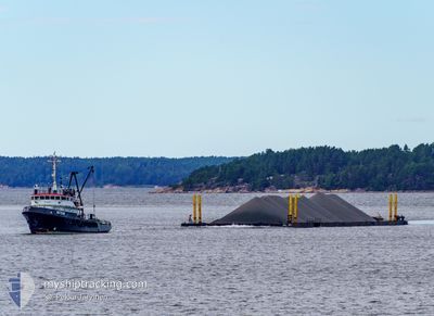
METEOR
Tug
Current Trip
KOPU ANCHOR
| Time Travelled | 9 days |
|---|---|
| Remaining Time | --- |
| Distance Travelled | 444.02 nm |
| Remaining Distance | --- |
| AVG Speed | 4.9 Knopen |
| MAX Speed | 7.6 Knopen |
| AVG Wind | 11.9 knots |
| MAX Wind | 24 knots |
| MIN Temp | -3.8°C / 25.16°F |
| MAX Temp | 9.9°C / 49.82°F |
| Diepgang | 4.2 M |
| Positie ontvangen | 2 d geleden |
Current Position
| Lengtegraad | 22.87543° |
|---|---|
| Breedtegraat | 59.33320° |
| Status | Restricted manoeuverability |
| Snelheid | 5.8 Knopen |
| Koers | 221° |
| Gebied | Baltic Sea |
| Station | T-AIS |
| Positie ontvangen | 2 d geleden |
Info
Information
The current position of METEOR is in Baltic Sea with coordinates 59.33320° / 22.87543° as reported on 2024-04-23 12:04 by AIS to our vessel tracker app. The vessel's current speed is 5.8 Knopen
The vessel METEOR (IMO: 5233547, MMSI: 230934000) is a Tug that was built in 1960 ( 64 Jaar oud ). It's sailing under the flag of [FI] Finland.
In this page you can find informations about the vessels current position, last detected port calls, and current voyage information. If the vessels is not in coverage by AIS you will find the latest position.
The current position of METEOR is detected by our AIS receivers and we are not responsible for the reliability of the data. The last position was recorded while the vessel was in Coverage by the Ais receivers of our vessel tracking app.
The current draught of METEOR as reported by AIS is 4.2 meters
Weather
| Temperature | 2.9°C / 37.22°F |
|---|---|
| Wind Speed | 21 knots |
| Direction | 57° ENE |
| Pressure | 1005.2 hPa |
| Humidity | 90.1 % |
| Cloud Coverage | 100 % |
Featured Company
Last Port Calls
| Port | Arrival | Departure | Time In Port |
|---|---|---|---|
| 2024-04-16 06:11 | 2024-04-16 11:11 | 5 h | |
| 2024-04-12 16:29 | 2024-04-16 05:39 | 3 d | |
| 2024-04-07 16:57 | 2024-04-10 06:21 | 2 d | |
| 2024-03-31 19:29 | 2024-04-05 06:40 | 4 d | |
| 2024-03-16 11:42 | 2024-03-22 19:39 | 6 d | |
| 2024-03-12 17:09 | 2024-03-12 18:20 | 1 h | |
| 2024-03-06 19:16 | 2024-03-12 16:58 | 5 d | |
| 2024-03-05 08:39 | 2024-03-06 19:10 | 1 d | |
| 2024-03-03 09:36 | 2024-03-05 08:23 | 1 d | |
| 2024-02-26 17:59 | 2024-02-28 10:14 | 1 d |
Most Visited Ports (Last year)
| Port | Arrivals | |
|---|---|---|
| 13 | ||
| 7 | ||
| 3 | ||
| 3 | ||
| 3 | ||
| 3 |
Last Trips
| Origin | Departure | Destination | Arrival | Distance | |
|---|---|---|---|---|---|
| 2024-04-16 08:39 | 2024-04-16 09:11 | 3.30 nm | |||
| 2024-04-10 09:21 | 2024-04-12 19:29 | 223.87 nm | |||
| 2024-04-05 08:40 | 2024-04-07 19:57 | 272.37 nm | |||
| 2024-03-22 20:39 | 2024-03-31 21:29 | 631.46 nm | |||
| 2024-03-12 20:20 | 2024-03-16 12:42 | 534.64 nm | |||
| 2024-03-12 18:58 | 2024-03-12 19:09 | 1.41 nm | |||
| 2024-03-06 21:10 | 2024-03-06 21:16 | 1.07 nm | |||
| 2024-03-05 10:23 | 2024-03-05 10:39 | 0.82 nm | |||
| 2024-02-28 12:14 | 2024-03-03 11:36 | 364.86 nm | |||
| 2024-02-24 14:36 | 2024-02-26 19:59 | 359.07 nm |
Events
| Tijd | Evenement | Details | Positie / Bestemming | Info |
|---|---|---|---|---|
| 2024-04-24 23:15 | Stop beweging | 17.08 nm, West of LEHTMA |
59.16993 / 22.18275
KOPU ANCHOR
|
Snelheid: Koers: 89° |
| 2024-04-24 22:45 | Start beweging | 17.85 nm, West of LEHTMA |
59.17832 / 22.16217
KOPU ANCHOR
|
Snelheid: 4.2 kn Koers: 126° |
| 2024-04-24 10:54 | Stop beweging | 18.1 nm, North West of LEHTMA |
59.18167 / 22.15620
KOPU ANCHOR
|
Snelheid: Koers: 228° |
| 2024-04-24 07:06 | Start beweging | 17.08 nm, West of LEHTMA |
58.95733 / 22.18882
KOPU ANCHOR
|
Snelheid: 5.3 kn Koers: 357° |
| 2024-04-23 12:04 | Buitenbereik |
59.33320 / 22.87543
Baltic Sea
KOPU ANCHOR
|
Snelheid: 5.8 kn Koers: 221° |
|
| 2024-04-23 09:28 | Wijzig zee gebeid | Estonian part of the Baltic Sea Estonian part of the Gulf of Finland |
59.51930 / 23.16710
Baltic Sea
KOPU ANCHOR
|
Snelheid: 5.7 kn Koers: 220° |
| 2024-04-23 09:19 | Wijzig zee gebeid | Estonian part of the Gulf of Finland Finnish part of the Gulf of Finland |
59.52743 / 23.18025
Gulf of Finland
KOPU ANCHOR
|
Snelheid: 3.8 kn Koers: 221° |
| 2024-04-23 06:32 | Destination Changed | KOPU ANCHOR JUSSARO ANCHOR |
59.78282 / 23.50348
KOPU ANCHOR
|
Snelheid: 5.6 kn Koers: 193° |
| 2024-04-23 06:32 | ETA Changed | 2024/04/23 18:00 2024/04/21 15:00 |
59.78282 / 23.50348
KOPU ANCHOR
|
Snelheid: 5.6 kn Koers: 193° |
| 2024-04-23 06:23 | Start beweging | 9.88 nm, South East of KOVERHAR |
59.79462 / 23.50910
JUSSARO ANCHOR
|
Snelheid: 4.5 kn Koers: 199° |