

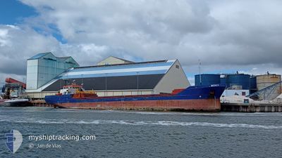
MERCY
General Cargo

Current Trip
| Time Travelled | 2 days |
|---|---|
| Remaining Time | 3 days |
| Distance Travelled | 385.28 nm |
| Remaining Distance | 609.40 nm |
| AVG Speed | 7.2 Knots |
| MAX Speed | 8.8 Knots |
| AVG Wind | 8.2 knots |
| MAX Wind | 19 knots |
| MIN Temp | 10.7°C / 51.26°F |
| MAX Temp | 15.4°C / 59.72°F |
| Draught | 5.3 m |
| Position Received | 30 m ago |
Current Position
| Longitude | --- |
|---|---|
| Latitude | --- |
| Status | Under way using engine |
| Speed | 6.9 Knots |
| Course | 212° |
| Area | Mediterranean Sea - Western Basin |
| Station | T-AIS |
| Position Received | 30 m ago |
Information
The current position of MERCY is in Mediterranean Sea - Western Basin with coordinates 38.31398° / 0.04485° as reported on 2025-03-25 00:21 by AIS to our vessel tracker app. The vessel's current speed is 6.9 Knots and is heading at the port of SETUBAL. The estimated time of arrival as calculated by MyShipTracking vessel tracking app is 2025-03-28 11:19 LT
The vessel MERCY (IMO: 9148104, MMSI: 305226000) is a General Cargo that was built in 1996 ( 29 years old ). It's sailing under the flag of [AG] Antigua Barbuda.
In this page you can find informations about the vessels current position, last detected port calls, and current voyage information. If the vessels is not in coverage by AIS you will find the latest position.
The current position of MERCY is detected by our AIS receivers and we are not responsible for the reliability of the data. The last position was recorded while the vessel was in Coverage by the Ais receivers of our vessel tracking app.
The current draught of MERCY as reported by AIS is 5.3 meters
Weather
| Temperature | 15°C / 59°F |
|---|---|
| Wind Speed | 16 knots |
| Direction | 250° WSW |
| Pressure | 1017.2 hPa |
| Humidity | 76.7 % |
| Cloud Coverage | 56 % |


Featured Company
Last Port Calls
| Port | Arrival | Departure | Time In Port |
|---|---|---|---|
| 2025-03-12 05:17 | 2025-03-22 21:57 | 10 d | |
| 2025-03-03 02:03 | 2025-03-03 22:52 | 20 h | |
| 2025-02-19 12:33 | 2025-02-21 13:42 | 2 d | |
| 2025-02-08 07:05 | 2025-02-13 10:10 | 5 d | |
| 2025-01-24 01:04 | 2025-01-31 09:30 | 7 d | |
| 2025-01-19 22:19 | 2025-01-20 17:26 | 19 h | |
| 2025-01-16 10:06 | 2025-01-17 18:24 | 1 d | |
| 2025-01-12 04:49 | 2025-01-13 13:07 | 1 d | |
| 2025-01-07 19:55 | 2025-01-09 12:59 | 1 d |
Most Visited Ports (Last year)
| Port | Arrivals | |
|---|---|---|
| 8 | ||
| 4 | ||
| 3 | ||
| 3 | ||
| 2 | ||
| 2 |
Last Trips
| Origin | Departure | Destination | Arrival | Distance | |
|---|---|---|---|---|---|
| 2025-03-03 22:52 | 2025-03-12 05:17 | 1497.33 nm | |||
| 2025-02-21 13:42 | 2025-03-03 02:03 | 656.24 nm | |||
| 2025-02-13 10:10 | 2025-02-19 12:33 | 1135.07 nm | |||
| 2025-01-31 09:30 | 2025-02-08 07:05 | 509.08 nm | |||
| 2025-01-20 17:26 | 2025-01-24 01:04 | 185.54 nm | |||
| 2025-01-17 18:24 | 2025-01-19 22:19 | 424.76 nm | |||
| 2025-01-13 13:07 | 2025-01-16 10:06 | 417.70 nm | |||
| 2025-01-09 12:59 | 2025-01-12 04:49 | 439.80 nm | |||
| 2024-12-27 20:41 | 2025-01-07 19:55 | 490.89 nm |
Events
| Time | Event | Details | Position / Dest | Info |
|---|---|---|---|---|
| 2025-03-25 00:30 | Status Changed | Default Under way using engine |
38.29855 / .03269
SETUBAL
|
Speed: 6.9 kn Course: 212° |
| 2025-03-25 00:21 | Status Changed | Under way using engine Default |
38.31437 / .04516
SETUBAL
|
Speed: 7.6 kn Course: 213° |
| 2025-03-25 00:18 | Status Changed | Default Under way using engine |
38.31996 / .04996
SETUBAL
|
Speed: 6.9 kn Course: 215° |
| 2025-03-24 23:41 | Change Sea Area | Spanish part of the Mediterranean Sea - Western Basin Spanish part of the Balearic Sea |
38.38428 / .10590
Mediterranean Sea - Western Basin
SETUBAL
|
Speed: 6.9 kn Course: 212° |
| 2025-03-24 23:41 | Status Changed | Under way using engine Default |
38.38428 / .10590
SETUBAL
|
Speed: 7.5 kn Course: 213° |
| 2025-03-24 23:34 | IN Coverage |
38.38428 / .10590
Mediterranean Sea - Western Basin
SETUBAL
|
Speed: 6.9 kn Course: 212° |
|
| 2025-03-23 20:37 | Status Changed | Default Under way using engine |
41.07989 / 2.69289
SETUBAL
|
Speed: 7.9 kn Course: 217.5° |
| 2025-03-23 20:22 | Status Changed | Under way using engine Default |
41.10626 / 2.71694
SETUBAL
|
Speed: 8.6 kn Course: 221° |
| 2025-03-23 20:22 | IN Coverage |
41.10626 / 2.71694
Balearic Sea
SETUBAL
|
Speed: 7.9 kn Course: 217.5° |
|
| 2025-03-23 20:22 | OUT of Coverage |
41.10626 / 2.71694
Balearic Sea
SETUBAL
|
Speed: 7.9 kn Course: 217.5° |