

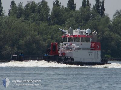
MEIBION ISLAND
Utility Vessel

Current Trip
RAS TANURAH
| Time Travelled | --- |
|---|---|
| Remaining Time | --- |
| Distance Travelled | 212.18 nm |
| Remaining Distance | --- |
| AVG Speed | 6 Knots |
| MAX Speed | 6 Knots |
| AVG Wind | 9.4 knots |
| MAX Wind | 25 knots |
| MIN Temp | 10.5°C / 50.9°F |
| MAX Temp | 23.9°C / 75.02°F |
| Draught | 3.2 m |
| Position Received | 1 h, 12 m ago |
Current Position
| Longitude | --- |
|---|---|
| Latitude | --- |
| Status | Under way using engine |
| Speed | 5.4 Knots |
| Course | 319.4° |
| Area | Persian Gulf |
| Station | T-AIS |
| Position Received | 1 h, 12 m ago |
Information
The current position of MEIBION ISLAND is in Persian Gulf with coordinates 28.08278° / 48.89132° as reported on 2025-03-29 05:42 by AIS to our vessel tracker app. The vessel's current speed is 5.4 Knots
The vessel MEIBION ISLAND (IMO: 9496991, MMSI: 210592000) is a Utility Vessel that was built in 2012 ( 13 years old ). It's sailing under the flag of [CY] Cyprus.
In this page you can find informations about the vessels current position, last detected port calls, and current voyage information. If the vessels is not in coverage by AIS you will find the latest position.
The current position of MEIBION ISLAND is detected by our AIS receivers and we are not responsible for the reliability of the data. The last position was recorded while the vessel was in Coverage by the Ais receivers of our vessel tracking app.
The current draught of MEIBION ISLAND as reported by AIS is 3.2 meters
Weather
| Temperature | 20.5°C / 68.9°F |
|---|---|
| Wind Speed | 6 knots |
| Direction | 172° S |
| Pressure | 1015.2 hPa |
| Humidity | 55.4 % |
| Cloud Coverage | 25 % |


Featured Company
Events
| Time | Event | Details | Position / Dest | Info |
|---|---|---|---|---|
| 2025-03-29 06:41 | STOP Moving | 13.87 nm, East of RAS AL MISHAB |
28.08573 / 48.89236
RAS TANURAH
|
Speed: 0.3 kn Course: 6° |
| 2025-03-29 06:31 | START Moving | 13.89 nm, East of RAS AL MISHAB |
28.08140 / 48.89201
RAS TANURAH
|
Speed: 3.8 kn Course: 359° |
| 2025-03-29 05:53 | STOP Moving | 13.84 nm, East of RAS AL MISHAB |
28.08362 / 48.89147
RAS TANURAH
|
Speed: 0.1 kn Course: 151° |
| 2025-03-29 05:45 | Status Changed | Default Under way using engine |
28.08387 / 48.89179
RAS TANURAH
|
Speed: 5.4 kn Course: 319.4° |
| 2025-03-29 05:42 | OUT of Coverage |
28.08278 / 48.89132
Persian Gulf
|
Speed: 5.4 kn Course: 319.4° |
|
| 2025-03-29 05:42 | START Moving | 13.86 nm, East of RAS AL MISHAB |
28.08236 / 48.89168
RAS TANURAH
|
Speed: 4.6 kn Course: 324° |
| 2025-03-29 03:15 | STOP Moving | 13.78 nm, East of RAS AL MISHAB |
28.08150 / 48.88983
RAS TANURAH
|
Speed: Course: 137° |
| 2025-03-29 03:15 | START Moving | 13.75 nm, East of RAS AL MISHAB |
28.08135 / 48.88928
RAS TANURAH
|
Speed: 46.5 kn Course: 252.4° |
| 2025-03-29 00:37 | STOP Moving | 13.89 nm, East of RAS AL MISHAB |
28.08237 / 48.89225
RAS TANURAH
|
Speed: 0.1 kn Course: 158° |
| 2025-03-29 00:33 | START Moving | 14.79 nm, East of RAS AL MISHAB |
28.09902 / 48.91159
RAS TANURAH
|
Speed: 94.4 kn Course: 225.9° |