

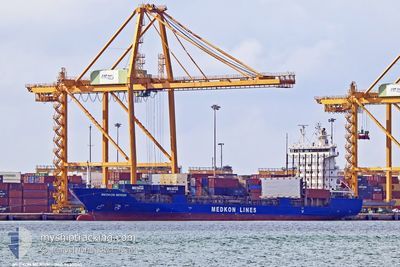
MEDKON MERSIN
Container Ship

Current Trip
| Time Travelled | 4 h, 53 mins |
|---|---|
| Remaining Time | 2 days |
| Distance Travelled | 54.29 nm |
| Remaining Distance | 631.70 nm |
| AVG Speed | 11.5 Knots |
| MAX Speed | 11.9 Knots |
| AVG Wind | 3.7 knots |
| MAX Wind | 5 knots |
| MIN Temp | 9.9°C / 49.82°F |
| MAX Temp | 14.2°C / 57.56°F |
| Draught | 7.9 m |
| Position Received | 23 m ago |
Current Position
| Longitude | --- |
|---|---|
| Latitude | --- |
| Status | Under way using engine |
| Speed | 11.5 Knots |
| Course | 228° |
| Area | Aegean Sea |
| Station | T-AIS |
| Position Received | 23 m ago |
Information
The current position of MEDKON MERSIN is in Aegean Sea with coordinates 38.61814° / 25.83473° as reported on 2025-03-10 05:37 by AIS to our vessel tracker app. The vessel's current speed is 11.5 Knots and is heading at the port of ASHDOD. The estimated time of arrival as calculated by MyShipTracking vessel tracking app is 2025-03-12 11:59 LT
The vessel MEDKON MERSIN (IMO: 9430040, MMSI: 352001710) is a Container Ship that was built in 2008 ( 17 years old ). It's sailing under the flag of [PA] Panama.
In this page you can find informations about the vessels current position, last detected port calls, and current voyage information. If the vessels is not in coverage by AIS you will find the latest position.
The current position of MEDKON MERSIN is detected by our AIS receivers and we are not responsible for the reliability of the data. The last position was recorded while the vessel was in Coverage by the Ais receivers of our vessel tracking app.
The current draught of MEDKON MERSIN as reported by AIS is 7.9 meters
Weather
| Temperature | 14°C / 57.2°F |
|---|---|
| Wind Speed | 4 knots |
| Direction | 184° S |
| Pressure | 1017.3 hPa |
| Humidity | 57.4 % |
| Cloud Coverage | --- |


Featured Company
Last Port Calls
| Port | Arrival | Departure | Time In Port |
|---|---|---|---|
| 2025-03-09 19:09 | 2025-03-10 01:07 | 5 h | |
| 2025-03-08 07:56 | 2025-03-08 19:22 | 11 h | |
| 2025-03-07 20:25 | 2025-03-08 01:17 | 4 h | |
| 2025-03-06 17:37 | 2025-03-07 15:06 | 21 h | |
| 2025-03-03 04:27 | 2025-03-03 12:41 | 8 h | |
| 2025-03-01 08:42 | 2025-03-02 21:10 | 1 d | |
| 2025-02-25 08:50 | 2025-02-25 23:09 | 14 h | |
| 2025-02-21 07:09 | 2025-02-21 21:05 | 13 h | |
| 2025-02-20 06:00 | 2025-02-20 21:01 | 15 h | |
| 2025-02-11 14:00 | 2025-02-11 21:03 | 7 h |
Last Trips
| Origin | Departure | Destination | Arrival | Distance | |
|---|---|---|---|---|---|
| 2025-03-08 22:22 | 2025-03-09 22:09 | 256.74 nm | |||
| 2025-03-08 04:17 | 2025-03-08 10:56 | 57.27 nm | |||
| 2025-03-07 18:06 | 2025-03-07 23:25 | 59.90 nm | |||
| 2025-03-03 14:41 | 2025-03-06 20:37 | 870.18 nm | |||
| 2025-03-02 23:10 | 2025-03-03 06:27 | 77.86 nm | |||
| 2025-02-26 02:09 | 2025-03-01 10:42 | 678.91 nm | |||
| 2025-02-21 22:05 | 2025-02-25 11:50 | 963.06 nm | |||
| 2025-02-20 22:01 | 2025-02-21 08:09 | 81.10 nm | |||
| 2025-02-11 23:03 | 2025-02-20 07:00 | 1411.46 nm | |||
| 2025-02-10 18:49 | 2025-02-11 16:00 | 81.97 nm |
Events
| Time | Event | Details | Position / Dest | Info |
|---|---|---|---|---|
| 2025-03-10 05:52 | Status Changed | Default Under way using engine |
38.58655 / 25.79030
IL ASH
|
Speed: 11.5 kn Course: 228° |
| 2025-03-10 05:18 | Status Changed | Under way using engine Default |
38.63943 / 25.90759
IL ASH
|
Speed: 11.6 kn Course: 251° |
| 2025-03-10 04:20 | Status Changed | Default Under way using engine |
38.68789 / 26.13586
IL ASH
|
Speed: 11.5 kn Course: 257° |
| 2025-03-10 04:04 | Change Sea Area | Greek part of the Aegean Sea Turkish part of the Aegean Sea |
38.69936 / 26.19877
Aegean Sea
|
Speed: 11.6 kn Course: 257° |
| 2025-03-10 04:03 | Status Changed | Under way using engine Default |
38.70006 / 26.20280
IL ASH
|
Speed: 11.9 kn Course: 256° |
| 2025-03-10 03:50 | Status Changed | Default Under way using engine |
38.71039 / 26.25701
IL ASH
|
Speed: 11.9 kn Course: 256° |
| 2025-03-10 03:48 | Status Changed | Under way using engine Default |
38.71209 / 26.26590
IL ASH
|
Speed: 11.7 kn Course: 266° |
| 2025-03-10 03:48 | IN Coverage |
38.71209 / 26.26590
Aegean Sea
|
Speed: 11.9 kn Course: 256° |
|
| 2025-03-10 02:24 | Status Changed | Default Under way using engine |
38.75861 / 26.60630
IL ASH
|
Speed: 11.6 kn Course: 256° |
| 2025-03-10 02:18 | OUT of Coverage |
38.76364 / 26.63301
Aegean Sea
|
Speed: 11.6 kn Course: 256° |