
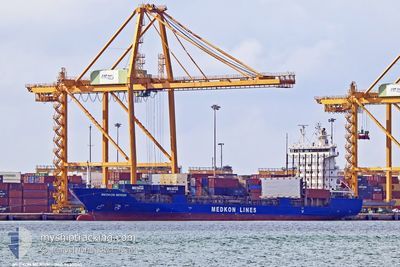
MEDKON MERSIN
Container Ship
Current Trip
| Time Travelled | 2 days |
|---|---|
| Remaining Time | --- |
| Distance Travelled | 240.55 nm |
| Remaining Distance | --- |
| AVG Speed | 9.3 Knots |
| MAX Speed | 12.3 Knots |
| AVG Wind | 16.3 knots |
| MAX Wind | 21.2 knots |
| MIN Temp | 4.6°C / 40.28°F |
| MAX Temp | 17°C / 62.6°F |
| Dybgang | 6.2 m |
| Position Modtaget | 1 h, 17 m siden |
Current Position
| Longitude | --- |
|---|---|
| Latitude | --- |
| Status | At anchor |
| Fart | |
| Kurs | 351° |
| Område | Mediterranean Sea - Eastern Basin |
| Station | T-AIS |
| Position Modtaget | 1 h, 17 m siden |
Info
Information
The current position of MEDKON MERSIN is in Mediterranean Sea - Eastern Basin with coordinates 36.71912° / 34.64662° as reported on 2026-01-03 22:33 by AIS to our vessel tracker app. The vessel's current speed is 0 Knots
The vessel MEDKON MERSIN (IMO: 9430040, MMSI: 352001710) is a Container Ship that was built in 2008 ( 18 år gamle ). It's sailing under the flag of [PA] Panama.
In this page you can find informations about the vessels current position, last detected port calls, and current voyage information. If the vessels is not in coverage by AIS you will find the latest position.
The current position of MEDKON MERSIN is detected by our AIS receivers and we are not responsible for the reliability of the data. The last position was recorded while the vessel was in Coverage by the Ais receivers of our vessel tracking app.
The current draught of MEDKON MERSIN as reported by AIS is 6.2 meters
Weather
| Temperature | 9.1°C / 48.38°F |
|---|---|
| Wind Speed | 8 knots |
| Direction | 34° NE |
| Pressure | 1030.3 hPa |
| Humidity | 61.5 % |
| Cloud Coverage | 99 % |
Featured Company
Last Port Calls
| Port | Arrival | Departure | Time In Port |
|---|---|---|---|
| 2025-12-31 23:09 | 2026-01-01 22:26 | 23 h | |
| 2025-12-31 05:16 | 2025-12-31 16:36 | 11 h | |
| 2025-12-28 16:24 | 2025-12-29 06:46 | 14 h | |
| 2025-12-24 06:13 | 2025-12-25 21:15 | 1 d | |
| 2025-12-21 09:38 | 2025-12-23 02:30 | 1 d | |
| 2025-12-18 11:10 | 2025-12-19 09:51 | 22 h | |
| 2025-12-14 18:09 | 2025-12-15 02:26 | 8 h | |
| 2025-12-12 14:39 | 2025-12-13 09:37 | 18 h | |
| 2025-12-09 12:56 | 2025-12-10 14:57 | 1 d | |
| 2025-12-08 01:20 | 2025-12-08 10:02 | 8 h |
Most Visited Ports (Last year)
| Port | Arrivals | |
|---|---|---|
| 41 | ||
| 27 | ||
| 25 | ||
| 16 | ||
| 7 | ||
| 6 |
Last Trips
| Origin | Departure | Destination | Arrival | Distance | |
|---|---|---|---|---|---|
| 2025-12-31 16:36 | 2025-12-31 23:09 | 72.23 nm | |||
| 2025-12-29 06:46 | 2025-12-31 05:16 | 331.73 nm | |||
| 2025-12-25 21:15 | 2025-12-28 16:24 | 335.68 nm | |||
| 2025-12-23 02:30 | 2025-12-24 06:13 | 316.41 nm | |||
| 2025-12-19 09:51 | 2025-12-21 09:38 | 311.28 nm | |||
| 2025-12-15 02:26 | 2025-12-18 11:10 | 93.86 nm | |||
| 2025-12-13 09:37 | 2025-12-14 18:09 | 263.63 nm | |||
| 2025-12-10 14:57 | 2025-12-12 14:39 | 315.09 nm | |||
| 2025-12-08 10:02 | 2025-12-09 12:56 | 99.26 nm | |||
| 2025-12-07 01:15 | 2025-12-08 01:20 | 242.44 nm |
Events
| Tid | Hændelsen | Detaljer | Position / Dest | Info |
|---|---|---|---|---|
| 2026-01-03 22:39 | Status er ændret | Default At anchor |
36.71912 / 34.64653
TR MER
|
Fart: Kurs: 351° |
| 2026-01-03 22:33 | Status er ændret | At anchor Default |
36.71912 / 34.64662
TR MER
|
Fart: Kurs: 351° |
| 2026-01-03 22:33 | Udenfor Dækning |
36.71912 / 34.64662
Mediterranean Sea - Eastern Basin
|
Fart: Kurs: 74.2° |
|
| 2026-01-03 22:24 | Status er ændret | Default At anchor |
36.71910 / 34.64667
TR MER
|
Fart: Kurs: 354° |
| 2026-01-03 22:15 | Status er ændret | At anchor Default |
36.71911 / 34.64664
TR MER
|
Fart: Kurs: 349° |
| 2026-01-03 22:09 | Indenfor Dækning |
36.71911 / 34.64664
Mediterranean Sea - Eastern Basin
|
Fart: Kurs: 74.2° |
|
| 2026-01-03 20:30 | Status er ændret | Default At anchor |
36.71914 / 34.64682
TR MER
|
Fart: Kurs: 348° |
| 2026-01-03 20:21 | Status er ændret | At anchor Default |
36.71912 / 34.64680
TR MER
|
Fart: Kurs: 351° |
| 2026-01-03 20:21 | Udenfor Dækning |
36.71912 / 34.64680
Mediterranean Sea - Eastern Basin
|
Fart: Kurs: 74.2° |
|
| 2026-01-03 20:12 | Indenfor Dækning |
36.71912 / 34.64680
Mediterranean Sea - Eastern Basin
|
Fart: Kurs: 74.2° |