
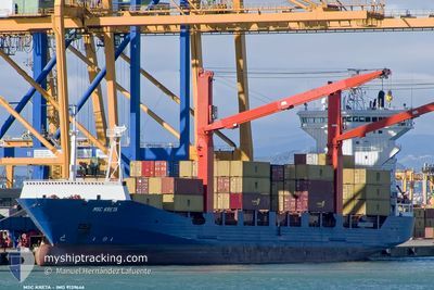
MEDKON LIA
Container Ship
Current Trip
| Time Travelled | 10 h, 16 mins |
|---|---|
| Remaining Time | --- |
| Distance Travelled | 57.33 nm |
| Remaining Distance | --- |
| AVG Speed | 8.3 Knots |
| MAX Speed | 12.1 Knots |
| AVG Wind | 26.6 knots |
| MAX Wind | 35.3 knots |
| MIN Temp | 11.3°C / 52.34°F |
| MAX Temp | 14.4°C / 57.92°F |
| Draught | 6.6 m |
| Position Received | 1 m ago |
Current Position
| Longitude | --- |
|---|---|
| Latitude | --- |
| Status | Under way using engine |
| Speed | 1.1 Knots |
| Course | 296° |
| Area | Sea of Marmara |
| Station | T-AIS |
| Position Received | 1 m ago |
Info
Information
The current position of MEDKON LIA is in Sea of Marmara with coordinates 40.65022° / 28.79900° as reported on 2026-01-03 22:05 by AIS to our vessel tracker app. The vessel's current speed is 1.1 Knots and is heading at the port of ALIAGA. The estimated time of arrival as calculated by MyShipTracking vessel tracking app is 2026-01-06 09:00 LT
The vessel MEDKON LIA (IMO: 9139646, MMSI: 352002790) is a Container Ship that was built in 1998 ( 28 years old ). It's sailing under the flag of [PA] Panama.
In this page you can find informations about the vessels current position, last detected port calls, and current voyage information. If the vessels is not in coverage by AIS you will find the latest position.
The current position of MEDKON LIA is detected by our AIS receivers and we are not responsible for the reliability of the data. The last position was recorded while the vessel was in Coverage by the Ais receivers of our vessel tracking app.
The current draught of MEDKON LIA as reported by AIS is 6.6 meters
Weather
| Temperature | 14.2°C / 57.56°F |
|---|---|
| Wind Speed | 31 knots |
| Direction | 209° SSW |
| Pressure | 1016.4 hPa |
| Humidity | 69.5 % |
| Cloud Coverage | 100 % |
Featured Company
Last Port Calls
| Port | Arrival | Departure | Time In Port |
|---|---|---|---|
| 2026-01-02 18:50 | 2026-01-03 14:50 | 19 h | |
| 2025-12-28 22:26 | 2025-12-30 21:21 | 1 d | |
| 2025-12-26 15:58 | 2025-12-28 01:40 | 1 d | |
| 2025-12-22 17:30 | 2025-12-23 06:42 | 13 h | |
| 2025-12-20 03:09 | 2025-12-21 13:33 | 1 d | |
| 2025-12-19 15:06 | 2025-12-19 20:09 | 5 h | |
| 2025-12-18 04:13 | 2025-12-18 22:52 | 18 h | |
| 2025-12-15 02:14 | |||
| 2025-12-10 19:41 | 2025-12-12 03:26 | 1 d | |
| 2025-12-06 23:13 | 2025-12-07 05:41 | 6 h |
Last Trips
| Origin | Departure | Destination | Arrival | Distance | |
|---|---|---|---|---|---|
| 2025-12-30 21:21 | 2026-01-02 18:50 | 763.67 nm | |||
| 2025-12-28 01:40 | 2025-12-28 22:26 | 244.11 nm | |||
| 2025-12-23 06:42 | 2025-12-26 15:58 | 785.03 nm | |||
| 2025-12-21 13:33 | 2025-12-22 17:30 | 313.81 nm | |||
| 2025-12-19 20:09 | 2025-12-20 03:09 | 76.95 nm | |||
| 2025-12-18 22:52 | 2025-12-19 15:06 | 52.91 nm | |||
| 2025-12-15 02:14 | 2025-12-18 04:13 | 762.47 nm | |||
| 2025-12-07 05:41 | 2025-12-10 19:41 | 726.25 nm | |||
| 2025-12-05 20:32 | 2025-12-06 23:13 | 296.04 nm | |||
| 2025-12-05 09:23 | 2025-12-05 16:25 | 74.03 nm |
Events
| Time | Event | Details | Position / Dest | Info |
|---|---|---|---|---|
| 2026-01-03 18:46 | Status Changed | Under way using engine Default |
40.59172 / 28.70942
TRALI
|
Speed: 1.8 kn Course: -1° |
| 2026-01-03 18:43 | Status Changed | Default Under way using engine |
40.59084 / 28.70906
TRALI
|
Speed: 1.6 kn Course: 293° |
| 2026-01-03 12:06 | Draught Changed | 6.6 6.4 |
40.73566 / 29.76533
TRALI
|
Speed: 11.4 kn Course: 270.6° |
| 2026-01-03 12:06 | Destination Changed | TRALI TRIZT |
40.73566 / 29.76533
TRALI
|
Speed: 11.4 kn Course: 270.6° |
| 2026-01-03 12:06 | ETA Changed | 2026/01/06 06:00 2026/01/02 19:00 |
40.73566 / 29.76533
TRALI
|
Speed: 11.4 kn Course: 270.6° |
| 2026-01-03 12:06 | Status Changed | Under way using engine Moored |
40.73566 / 29.76533
TRIZT
|
Speed: 11.4 kn Course: 270.5° |
| 2026-01-03 11:50 | PORT DEPARTURE |
|
40.74253 / 29.82113
TRIZT
|
Speed: 6.6 kn Course: 256.4° |
| 2026-01-03 11:41 | START Moving |
40.74640 / 29.83780
[TR] DERINCE
|
Speed: 3.6 kn Course: 249.8° |
|
| 2026-01-02 16:12 | Status Changed | Moored Under way using engine |
40.74778 / 29.83991
[TR] DERINCE
|
Speed: Course: 511° |
| 2026-01-02 16:09 | STOP Moving |
40.74780 / 29.84002
[TR] DERINCE
|
Speed: 0.2 kn Course: 511° |