
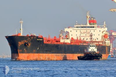
MATRAH
Oil/Chemical Tanker
Current Trip
| Time Travelled | 3 days |
|---|---|
| Remaining Time | 8 days |
| Distance Travelled | 1007.89 nm |
| Remaining Distance | 2990.08 nm |
| AVG Speed | 11.1 Knots |
| MAX Speed | 15.1 Knots |
| AVG Wind | 5.2 knots |
| MAX Wind | 10.1 knots |
| MIN Temp | 25.4°C / 77.72°F |
| MAX Temp | 32.9°C / 91.22°F |
| Draught | 8.3 m |
| Position Received | 18 h, 3 m ago |
Current Position
| Longitude | 103.50994° |
|---|---|
| Latitude | 1.20391° |
| Status | At anchor |
| Speed | 13.9 Knots |
| Course | 284.3° |
| Area | Singapore Strait |
| Station | T-AIS |
| Position Received | 18 h, 3 m ago |
Info
Information
The current position of MATRAH is in Singapore Strait with coordinates 1.20391° / 103.50994° as reported on 2024-05-02 07:05 by AIS to our vessel tracker app. The vessel's current speed is 13.9 Knots and is heading at the port of SALALAH. The estimated time of arrival as calculated by MyShipTracking vessel tracking app is 2024-05-11 15:51 LT
The vessel MATRAH (IMO: 9405849, MMSI: 370985000) is a Oil/Chemical Tanker that was built in 2008 ( 16 years old ). It's sailing under the flag of [PA] Panama.
In this page you can find informations about the vessels current position, last detected port calls, and current voyage information. If the vessels is not in coverage by AIS you will find the latest position.
The current position of MATRAH is detected by our AIS receivers and we are not responsible for the reliability of the data. The last position was recorded while the vessel was in Coverage by the Ais receivers of our vessel tracking app.
The current draught of MATRAH as reported by AIS is 8.3 meters
Weather
| Temperature | 29.6°C / 85.28°F |
|---|---|
| Wind Speed | 9 knots |
| Direction | 132° SE |
| Pressure | 1009.3 hPa |
| Humidity | 74.5 % |
| Cloud Coverage | 100 % |
Featured Company
Last Port Calls
| Port | Arrival | Departure | Time In Port |
|---|---|---|---|
| 2024-04-28 01:20 | 2024-04-29 02:12 | 1 d | |
| 2024-04-20 19:35 | 2024-04-22 07:05 | 1 d | |
| 2024-04-19 16:00 | 2024-04-20 07:32 | 15 h | |
| 2024-04-15 23:03 | 2024-04-19 11:35 | 3 d | |
| 2024-04-06 15:51 | 2024-04-08 02:29 | 1 d | |
| 2024-03-26 07:03 | 2024-03-27 18:29 | 1 d | |
| 2024-03-09 22:51 | 2024-03-11 17:25 | 1 d | |
| 2024-03-03 05:24 | 2024-03-04 19:56 | 1 d | |
| 2024-03-01 02:01 |
Most Visited Ports (Last year)
| Port | Arrivals | |
|---|---|---|
| 6 | ||
| 4 | ||
| 3 | ||
| 2 | ||
| 2 | ||
| 2 |
Last Trips
| Origin | Departure | Destination | Arrival | Distance | |
|---|---|---|---|---|---|
| 2024-04-22 15:05 | 2024-04-28 08:20 | 1827.95 nm | |||
| 2024-04-20 15:32 | 2024-04-21 03:35 | 141.47 nm | |||
| 2024-04-19 19:35 | 2024-04-20 00:00 | 1.02 nm | |||
| 2024-04-08 10:29 | 2024-04-16 07:03 | 1915.00 nm | |||
| 2024-03-27 22:29 | 2024-04-06 23:51 | 3034.64 nm | |||
| 2024-03-12 01:25 | 2024-03-26 11:03 | 3036.49 nm | |||
| 2024-03-05 03:56 | 2024-03-10 06:51 | 478.45 nm | |||
| 2024-03-01 10:01 | 2024-03-03 13:24 | 270.58 nm |
Events
| Time | Event | Details | Position / Dest | Info |
|---|---|---|---|---|
| 2024-05-02 07:12 | Status Changed | Default At anchor |
1.21154 / 103.48265
OM SLL
|
Speed: 13.9 kn Course: 284.3° |
| 2024-05-02 07:05 | OUT of Coverage |
1.20391 / 103.50994
Singapore Strait
OM SLL
|
Speed: 13.9 kn Course: 284.3° |
|
| 2024-05-02 06:47 | Change Sea Area | Malaysian part of the Singapore Strait Indonesian part of the Singapore Strait |
1.18833 / 103.57767
Singapore Strait
OM SLL
|
Speed: 13.7 kn Course: 280.5° |
| 2024-05-02 06:02 | Change Sea Area | Indonesian part of the Singapore Strait Singaporean part of the Singapore Strait |
1.13750 / 103.72675
Singapore Strait
OM SLL
|
Speed: 10.6 kn Course: 276.7° |
| 2024-05-02 05:02 | START Moving | 3.2 nm, South West of SINGAPORE |
1.21769 / 103.81904
OM SLL
|
Speed: 3.1 kn Course: 181° |
| 2024-05-02 04:35 | Draught Changed | 8.3 8 |
1.21815 / 103.82004
OM SLL
|
Speed: 0.1 kn Course: 272° |
| 2024-05-02 04:35 | Destination Changed | OM SLL PEBGC |
1.21815 / 103.82004
OM SLL
|
Speed: 0.1 kn Course: 272° |
| 2024-05-02 04:35 | ETA Changed | 2024/05/12 10:00 2024/05/01 21:45 |
1.21815 / 103.82004
OM SLL
|
Speed: 0.1 kn Course: 272° |
| 2024-05-01 15:18 | Status Changed | At anchor Under way using engine |
1.21844 / 103.81729
PEBGC
|
Speed: 0.3 kn Course: 70° |
| 2024-05-01 15:17 | STOP Moving | 3.24 nm, South West of SINGAPORE |
1.21843 / 103.81734
PEBGC
|
Speed: 0.3 kn Course: 69° |