
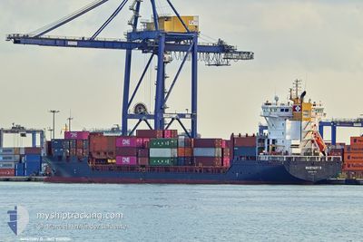
MASTERY D
General Cargo
Current Trip
| Time Travelled | 1 day |
|---|---|
| Remaining Time | 1 day |
| Distance Travelled | 357.50 nm |
| Remaining Distance | 548.65 nm |
| AVG Speed | 13.7 Knots |
| MAX Speed | 16 Knots |
| AVG Wind | 10.5 knots |
| MAX Wind | 24 knots |
| MIN Temp | 9°C / 48.2°F |
| MAX Temp | 15.8°C / 60.44°F |
| Draught | 7.7 m |
| Position Received | 10 m ago |
Current Position
| Longitude | --- |
|---|---|
| Latitude | --- |
| Status | Under way using engine |
| Speed | 14.6 Knots |
| Course | 212.6° |
| Area | Aegean Sea |
| Station | T-AIS |
| Position Received | 10 m ago |
Info
Information
The current position of MASTERY D is in Aegean Sea with coordinates 37.25598° / 23.95557° as reported on 2025-12-26 03:34 by AIS to our vessel tracker app. The vessel's current speed is 14.6 Knots and is heading at the port of MISURATA. The estimated time of arrival as calculated by MyShipTracking vessel tracking app is 2025-12-27 16:20 LT
The vessel MASTERY D (IMO: 9301201, MMSI: 255915744) is a General Cargo that was built in 2006 ( 19 years old ). It's sailing under the flag of [PT] Portugal.
In this page you can find informations about the vessels current position, last detected port calls, and current voyage information. If the vessels is not in coverage by AIS you will find the latest position.
The current position of MASTERY D is detected by our AIS receivers and we are not responsible for the reliability of the data. The last position was recorded while the vessel was in Coverage by the Ais receivers of our vessel tracking app.
The current draught of MASTERY D as reported by AIS is 7.7 meters
Weather
| Temperature | 15.1°C / 59.18°F |
|---|---|
| Wind Speed | 16 knots |
| Direction | 335° NNW |
| Pressure | 1020.5 hPa |
| Humidity | 68 % |
| Cloud Coverage | 43 % |
Featured Company
Last Port Calls
| Port | Arrival | Departure | Time In Port |
|---|---|---|---|
| 2025-12-24 15:13 | 2025-12-25 00:20 | 9 h | |
| 2025-12-23 07:43 | 2025-12-24 08:10 | 1 d | |
| 2025-12-19 08:25 | 2025-12-20 11:27 | 1 d | |
| 2025-12-17 00:10 | 2025-12-18 23:10 | 1 d | |
| 2025-12-13 01:06 | 2025-12-13 19:23 | 18 h | |
| 2025-12-11 22:21 | 2025-12-11 22:30 | 9 m | |
| 2025-12-07 09:06 | 2025-12-10 17:27 | 3 d | |
| 2025-12-06 12:06 | 2025-12-06 13:23 | 1 h | |
| 2025-11-19 17:00 | 2025-12-06 00:09 | 16 d | |
| 2025-11-18 07:58 | 2025-11-19 01:45 | 17 h |
Last Trips
| Origin | Departure | Destination | Arrival | Distance | |
|---|---|---|---|---|---|
| 2025-12-24 11:10 | 2025-12-24 18:13 | 79.03 nm | |||
| 2025-12-20 13:27 | 2025-12-23 10:43 | 993.68 nm | |||
| 2025-12-19 01:10 | 2025-12-19 10:25 | 119.10 nm | |||
| 2025-12-13 22:23 | 2025-12-17 02:10 | 919.38 nm | |||
| 2025-12-12 01:30 | 2025-12-13 04:06 | 71.82 nm | |||
| 2025-12-10 19:27 | 2025-12-12 01:21 | 164.19 nm | |||
| 2025-12-06 16:23 | 2025-12-07 11:06 | 179.72 nm | |||
| 2025-12-06 03:09 | 2025-12-06 15:06 | 46.34 nm | |||
| 2025-11-19 04:45 | 2025-11-19 20:00 | 65.46 nm | |||
| 2025-11-13 03:28 | 2025-11-18 10:58 | 1604.99 nm |
Events
| Time | Event | Details | Position / Dest | Info |
|---|---|---|---|---|
| 2025-12-26 03:40 | Status Changed | Default Under way using engine |
37.23433 / 23.93880
LYMRA
|
Speed: 14.6 kn Course: 212.6° |
| 2025-12-26 03:34 | Status Changed | Under way using engine Default |
37.25598 / 23.95557
LYMRA
|
Speed: 14.5 kn Course: 212° |
| 2025-12-26 03:28 | Status Changed | Default Under way using engine |
37.27598 / 23.97133
LYMRA
|
Speed: 14.6 kn Course: 212.7° |
| 2025-12-26 03:23 | Status Changed | Under way using engine Default |
37.29318 / 23.98490
LYMRA
|
Speed: 14.5 kn Course: 213° |
| 2025-12-26 03:05 | Status Changed | Default Under way using engine |
37.35863 / 24.03445
LYMRA
|
Speed: 14.7 kn Course: 206.8° |
| 2025-12-26 02:47 | Status Changed | Under way using engine Default |
37.42283 / 24.07313
LYMRA
|
Speed: 14.4 kn Course: 196° |
| 2025-12-26 02:24 | Status Changed | Default Under way using engine |
37.51333 / 24.10228
LYMRA
|
Speed: 14.7 kn Course: 207.9° |
| 2025-12-26 01:46 | Status Changed | Under way using engine Default |
37.65562 / 24.19165
LYMRA
|
Speed: 14.8 kn Course: 203° |
| 2025-12-26 01:41 | Status Changed | Default Under way using engine |
37.67762 / 24.20368
LYMRA
|
Speed: 14.6 kn Course: 208° |
| 2025-12-26 01:30 | Status Changed | Under way using engine Default |
37.71490 / 24.22708
LYMRA
|
Speed: 14.4 kn Course: 210° |