

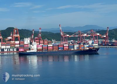
MARTINIQUE
Container Ship

Current Trip
| Time Travelled | 17 h, 34 mins |
|---|---|
| Remaining Time | 1 day |
| Distance Travelled | 348.32 nm |
| Remaining Distance | 1279.65 nm |
| AVG Speed | 20 Knots |
| MAX Speed | 22.1 Knots |
| AVG Wind | 9.1 knots |
| MAX Wind | 11.8 knots |
| MIN Temp | 14.8°C / 58.64°F |
| MAX Temp | 17.7°C / 63.86°F |
| Draught | 7.4 m |
| Position Received | 14 h, 38 m ago |
Current Position
| Longitude | --- |
|---|---|
| Latitude | --- |
| Status | Under way using engine |
| Speed | 19.7 Knots |
| Course | 347° |
| Area | South Pacific Ocean |
| Station | T-AIS |
| Position Received | 14 h, 38 m ago |
Information
The current position of MARTINIQUE is in South Pacific Ocean with coordinates -32.72405° / -71.99163° as reported on 2025-03-24 00:42 by AIS to our vessel tracker app. The vessel's current speed is 19.7 Knots and is heading at the port of CALLAO. The estimated time of arrival as calculated by MyShipTracking vessel tracking app is 2025-03-26 09:53 LT
The vessel MARTINIQUE (IMO: 9314985, MMSI: 636091232) is a Container Ship that was built in 2007 ( 18 years old ). It's sailing under the flag of [LR] Liberia.
In this page you can find informations about the vessels current position, last detected port calls, and current voyage information. If the vessels is not in coverage by AIS you will find the latest position.
The current position of MARTINIQUE is detected by our AIS receivers and we are not responsible for the reliability of the data. The last position was recorded while the vessel was in Coverage by the Ais receivers of our vessel tracking app.
The current draught of MARTINIQUE as reported by AIS is 7.4 meters
Weather
| Temperature | 17.7°C / 63.86°F |
|---|---|
| Wind Speed | 8 knots |
| Direction | 177° S |
| Pressure | 1014.8 hPa |
| Humidity | 72.5 % |
| Cloud Coverage | 100 % |


Featured Company
Last Port Calls
| Port | Arrival | Departure | Time In Port |
|---|---|---|---|
| 2025-03-22 06:17 | 2025-03-23 18:46 | 1 d | |
| 2025-03-15 16:46 | 2025-03-16 11:26 | 18 h | |
| 2025-03-11 10:38 | 2025-03-11 22:46 | 12 h | |
| 2025-03-05 07:42 | 2025-03-05 08:42 | 1 h | |
| 2025-03-04 10:11 | 2025-03-04 11:20 | 1 h | |
| 2025-03-02 08:50 | 2025-03-02 23:29 | 14 h | |
| 2025-02-26 14:50 | 2025-02-27 01:06 | 10 h | |
| 2025-02-26 14:03 | 2025-02-26 14:19 | 15 m | |
| 2025-02-23 04:09 | 2025-02-23 17:30 | 13 h | |
| 2025-02-14 15:13 | 2025-02-15 13:49 | 22 h |
Most Visited Ports (Last year)
| Port | Arrivals | |
|---|---|---|
| 10 | ||
| 9 | ||
| 9 | ||
| 9 | ||
| 6 | ||
| 5 |
Last Trips
| Origin | Departure | Destination | Arrival | Distance | |
|---|---|---|---|---|---|
| 2025-03-16 11:26 | 2025-03-22 06:17 | 2016.20 nm | |||
| 2025-03-11 22:46 | 2025-03-15 16:46 | 1111.68 nm | |||
| 2025-03-05 08:42 | 2025-03-11 10:38 | 1933.19 nm | |||
| 2025-03-04 11:20 | 2025-03-05 07:42 | 2.78 nm | |||
| 2025-03-02 23:29 | 2025-03-04 10:11 | 244.09 nm | |||
| 2025-02-27 01:06 | 2025-03-02 08:50 | 1126.15 nm | |||
| 2025-02-26 14:19 | 2025-02-26 14:50 | 0.96 nm | |||
| 2025-02-23 17:30 | 2025-02-26 14:03 | 1155.21 nm | |||
| 2025-02-15 13:49 | 2025-02-23 04:09 | 1163.26 nm | |||
| 2025-02-12 11:46 | 2025-02-14 15:13 | 711.82 nm |
Events
| Time | Event | Details | Position / Dest | Info |
|---|---|---|---|---|
| 2025-03-24 00:45 | Status Changed | Default Under way using engine |
-32.70433 / -71.99680
PE CLL
|
Speed: 19.7 kn Course: 347° |
| 2025-03-24 00:42 | OUT of Coverage |
-32.72405 / -71.99163
South Pacific Ocean
PE CLL
|
Speed: 19.7 kn Course: 347° |
|
| 2025-03-24 00:03 | Draught Changed | 7.4 8.2 |
-32.93759 / -71.92957
PE CLL
|
Speed: 20.4 kn Course: 342.2° |
| 2025-03-24 00:03 | Destination Changed | PE CLL CL SAI |
-32.93759 / -71.92957
PE CLL
|
Speed: 20.4 kn Course: 342.2° |
| 2025-03-24 00:03 | ETA Changed | 2025/03/26 04:00 2025/03/22 09:00 |
-32.93759 / -71.92957
PE CLL
|
Speed: 20.4 kn Course: 342.2° |
| 2025-03-23 23:41 | Status Changed | Under way using engine Default |
-33.05681 / -71.89084
CL SAI
|
Speed: 20.5 kn Course: 346° |
| 2025-03-23 23:38 | IN Coverage |
-33.04225 / -71.89620
South Pacific Ocean
|
Speed: 20.6 kn Course: 339.8° |
|
| 2025-03-23 21:46 | START Moving | 0.54 nm, West of SAN ANTONIO |
-33.58452 / -71.63133
CL SAI
|
Speed: 4.6 kn Course: 300° |
| 2025-03-23 21:46 | PORT DEPARTURE |
|
-33.58452 / -71.63133
CL SAI
|
Speed: 0.4 kn Course: 253° |
| 2025-03-22 09:38 | STOP Moving |
-33.59273 / -71.61748
[CL] SAN ANTONIO
|
Speed: Course: 182° |