
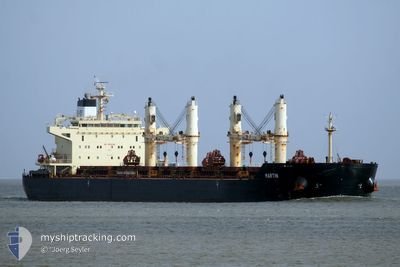
MARTIN
Bulk Carrier
Current Trip
| Time Travelled | 21 days |
|---|---|
| Remaining Time | --- |
| Distance Travelled | 4180.44 nm |
| Remaining Distance | --- |
| AVG Speed | 8.6 Knots |
| MAX Speed | 13 Knots |
| AVG Wind | 20.9 knots |
| MAX Wind | 46.8 knots |
| MIN Temp | -5.9°C / 21.38°F |
| MAX Temp | 24.1°C / 75.38°F |
| Draught | 13.2 m |
| Position Received | 3 d ago |
Current Position
| Longitude | --- |
|---|---|
| Latitude | --- |
| Status | Under way using engine |
| Speed | 10.5 Knots |
| Course | 207.8° |
| Area | North Atlantic Ocean |
| Station | T-AIS |
| Position Received | 3 d ago |
Info
Information
The current position of MARTIN is in North Atlantic Ocean with coordinates 27.46203° / -15.45922° as reported on 2025-12-15 06:41 by AIS to our vessel tracker app. The vessel's current speed is 10.5 Knots and is heading at the port of KANDLA. The estimated time of arrival as calculated by MyShipTracking vessel tracking app is 2026-01-20 17:30 LT
The vessel MARTIN (IMO: 9441350, MMSI: 538003973) is a Bulk Carrier that was built in 2010 ( 15 years old ). It's sailing under the flag of [MH] Marshall Is.
In this page you can find informations about the vessels current position, last detected port calls, and current voyage information. If the vessels is not in coverage by AIS you will find the latest position.
The current position of MARTIN is detected by our AIS receivers and we are not responsible for the reliability of the data. The last position was recorded while the vessel was in Coverage by the Ais receivers of our vessel tracking app.
The current draught of MARTIN as reported by AIS is 13.2 meters
Weather
| Temperature | 24.1°C / 75.38°F |
|---|---|
| Wind Speed | 21 knots |
| Direction | 30° NNE |
| Pressure | 1013.7 hPa |
| Humidity | 62 % |
| Cloud Coverage | 100 % |
Featured Company
Most Visited Ports (Last year)
| Port | Arrivals | |
|---|---|---|
| 2 | ||
| 2 | ||
| 1 | ||
| 1 | ||
| 1 | ||
| 1 |
Events
| Time | Event | Details | Position / Dest | Info |
|---|---|---|---|---|
| 2025-12-15 06:48 | Status Changed | Default Under way using engine |
27.44507 / -15.46943
KANDLA
|
Speed: 10.5 kn Course: 207.8° |
| 2025-12-15 06:41 | Status Changed | Under way using engine Default |
27.46203 / -15.45922
KANDLA
|
Speed: 10.5 kn Course: 207° |
| 2025-12-15 06:41 | OUT of Coverage |
27.46203 / -15.45922
North Atlantic Ocean
|
Speed: 10.5 kn Course: 207.8° |
|
| 2025-12-15 06:31 | Status Changed | Default Under way using engine |
27.48873 / -15.44381
KANDLA
|
Speed: 10.5 kn Course: 206.7° |
| 2025-12-15 06:23 | Status Changed | Under way using engine Default |
27.51167 / -15.43075
KANDLA
|
Speed: 10.6 kn Course: 208° |
| 2025-12-15 06:19 | Status Changed | Default Under way using engine |
27.51992 / -15.42574
KANDLA
|
Speed: 10.6 kn Course: 207.4° |
| 2025-12-15 06:19 | Status Changed | Under way using engine Default |
27.52128 / -15.42493
KANDLA
|
Speed: 10 kn Course: 209° |
| 2025-12-15 06:12 | Status Changed | Default Under way using engine |
27.53995 / -15.41338
KANDLA
|
Speed: 10.6 kn Course: 209° |
| 2025-12-15 06:03 | Status Changed | Under way using engine Default |
27.56276 / -15.39899
KANDLA
|
Speed: 10.7 kn Course: 210° |
| 2025-12-15 06:00 | Status Changed | Default Under way using engine |
27.57148 / -15.39356
KANDLA
|
Speed: 10.7 kn Course: 209° |