
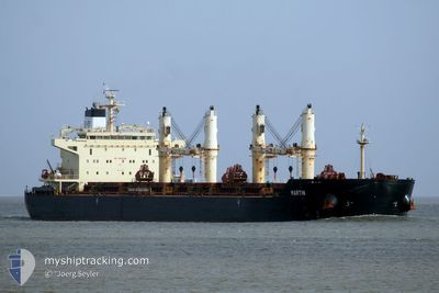
MARTIN
Bulk Carrier
Current Trip
| Time Travelled | 16 days |
|---|---|
| Remaining Time | 1 day |
| Distance Travelled | 2870.61 nm |
| Remaining Distance | 573.70 nm |
| AVG Speed | 8.3 Knopen |
| MAX Speed | 13 Knopen |
| AVG Wind | 22.3 knots |
| MAX Wind | 46.8 knots |
| MIN Temp | -5.9°C / 21.38°F |
| MAX Temp | 17°C / 62.6°F |
| Diepgang | 13.2 M |
| Positie ontvangen | 6 d geleden |
Current Position
| Lengtegraad | --- |
|---|---|
| Breedtegraat | --- |
| Status | Under way using engine |
| Snelheid | 3.8 Knopen |
| Koers | 238° |
| Gebied | English Channel |
| Station | T-AIS |
| Positie ontvangen | 6 d geleden |
Info
Information
The current position of MARTIN is in English Channel with coordinates 49.23349° / -4.98179° as reported on 2025-12-07 03:57 by AIS to our vessel tracker app. The vessel's current speed is 3.8 Knopen and is heading at the port of LAS PALMAS. The estimated time of arrival as calculated by MyShipTracking vessel tracking app is 2025-12-14 17:10 LT
The vessel MARTIN (IMO: 9441350, MMSI: 538003973) is a Bulk Carrier that was built in 2010 ( 15 Jaar oud ). It's sailing under the flag of [MH] Marshall Is.
In this page you can find informations about the vessels current position, last detected port calls, and current voyage information. If the vessels is not in coverage by AIS you will find the latest position.
The current position of MARTIN is detected by our AIS receivers and we are not responsible for the reliability of the data. The last position was recorded while the vessel was in Coverage by the Ais receivers of our vessel tracking app.
The current draught of MARTIN as reported by AIS is 13.2 meters
Weather
| Temperature | 16.4°C / 61.52°F |
|---|---|
| Wind Speed | 39 knots |
| Direction | 353° N |
| Pressure | 1013.3 hPa |
| Humidity | 72.3 % |
| Cloud Coverage | 100 % |
Featured Company
Most Visited Ports (Last year)
| Port | Arrivals | |
|---|---|---|
| 2 | ||
| 2 | ||
| 1 | ||
| 1 | ||
| 1 | ||
| 1 |
Events
| Tijd | Evenement | Details | Positie / Bestemming | Info |
|---|---|---|---|---|
| 2025-12-07 04:02 | Status Changed | Default Under way using engine |
49.23101 / -4.98812
LAS PALMAS
|
Snelheid: 3.8 kn Koers: 238° |
| 2025-12-07 03:57 | Status Changed | Under way using engine Default |
49.23349 / -4.98179
LAS PALMAS
|
Snelheid: 4.3 kn Koers: 236° |
| 2025-12-07 03:57 | Buitenbereik |
49.23349 / -4.98179
English Channel
LAS PALMAS
|
Snelheid: 3.8 kn Koers: 237.9° |
|
| 2025-12-07 03:39 | Status Changed | Default Under way using engine |
49.24452 / -4.95084
LAS PALMAS
|
Snelheid: 4.5 kn Koers: 243° |
| 2025-12-07 03:32 | Wijzig zee gebeid | French part of the English Channel United Kingdom part of the English Channel |
49.24762 / -4.93829
English Channel
LAS PALMAS
|
Snelheid: 4.5 kn Koers: 252.8° |
| 2025-12-07 03:32 | Status Changed | Under way using engine Default |
49.24762 / -4.93829
LAS PALMAS
|
Snelheid: 4.6 kn Koers: 245° |
| 2025-12-07 03:23 | Binnenbereik |
49.24762 / -4.93829
English Channel
LAS PALMAS
|
Snelheid: 4.5 kn Koers: 252.8° |
|
| 2025-12-06 01:19 | Status Changed | Default Under way using engine |
50.26991 / -1.36282
LAS PALMAS
|
Snelheid: 11.2 kn Koers: 255.8° |
| 2025-12-06 01:13 | Buitenbereik |
50.27482 / -1.33732
English Channel
LAS PALMAS
|
Snelheid: 11.2 kn Koers: 255.8° |
|
| 2025-12-06 00:12 | Buitenbereik |
50.32219 / -1.06961
English Channel
LAS PALMAS
|
Snelheid: 9.6 kn Koers: 253.6° |