

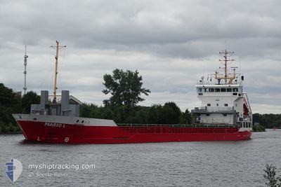
MARIO L
General Cargo

Current Trip
| Time Travelled | 5 days |
|---|---|
| Remaining Time | 1 h, 41 mins |
| Distance Travelled | 1151.00 nm |
| Remaining Distance | 48.48 nm |
| AVG Speed | 8 Knots |
| MAX Speed | 14.8 Knots |
| AVG Wind | 19.1 knots |
| MAX Wind | 27.6 knots |
| MIN Temp | 3.2°C / 37.76°F |
| MAX Temp | 16.8°C / 62.24°F |
| Draught | 6.3 m |
| Position Received | 2 m ago |
Current Position
| Longitude | --- |
|---|---|
| Latitude | --- |
| Status | At anchor |
| Speed | 0.4 Knots |
| Course | 333° |
| Area | North Atlantic Ocean |
| Station | T-AIS |
| Position Received | 2 m ago |
Information
The current position of MARIO L is in North Atlantic Ocean with coordinates 36.77429° / -6.46503° as reported on 2025-02-20 08:47 by AIS to our vessel tracker app. The vessel's current speed is 0.4 Knots and is heading at the port of SEVILLA. The estimated time of arrival as calculated by MyShipTracking vessel tracking app is 2025-02-20 11:30 LT
The vessel MARIO L (IMO: 9195834, MMSI: 212710000) is a General Cargo that was built in 2000 ( 25 years old ). It's sailing under the flag of [CY] Cyprus.
In this page you can find informations about the vessels current position, last detected port calls, and current voyage information. If the vessels is not in coverage by AIS you will find the latest position.
The current position of MARIO L is detected by our AIS receivers and we are not responsible for the reliability of the data. The last position was recorded while the vessel was in Coverage by the Ais receivers of our vessel tracking app.
The current draught of MARIO L as reported by AIS is 6.3 meters
Weather
| Temperature | 14.3°C / 57.74°F |
|---|---|
| Wind Speed | 8 knots |
| Direction | 56° NE |
| Pressure | 1025.7 hPa |
| Humidity | 80.2 % |
| Cloud Coverage | 5 % |


Featured Company
Last Port Calls
| Port | Arrival | Departure | Time In Port |
|---|---|---|---|
| 2025-02-13 18:02 | 2025-02-14 19:19 | 1 d | |
| 2025-02-10 04:54 | 2025-02-13 07:32 | 3 d | |
| 2025-02-06 06:04 | 2025-02-07 02:33 | 20 h | |
| 2025-02-01 10:11 | 2025-02-04 20:19 | 3 d | |
| 2025-01-28 03:32 | 2025-01-30 00:14 | 1 d | |
| 2025-01-23 08:54 | 2025-01-24 06:33 | 21 h | |
| 2025-01-18 08:25 | 2025-01-20 15:16 | 2 d | |
| 2025-01-16 20:49 | 2025-01-17 19:42 | 22 h | |
| 2025-01-13 07:12 | 2025-01-15 16:42 | 2 d | |
| 2025-01-09 20:53 | 2025-01-11 18:21 | 1 d |
Last Trips
| Origin | Departure | Destination | Arrival | Distance | |
|---|---|---|---|---|---|
| 2025-02-13 07:32 | 2025-02-13 18:02 | 41.36 nm | |||
| 2025-02-07 02:33 | 2025-02-10 04:54 | 626.61 nm | |||
| 2025-02-04 20:19 | 2025-02-06 06:04 | 205.33 nm | |||
| 2025-01-30 00:14 | 2025-02-01 10:11 | 372.86 nm | |||
| 2025-01-24 06:33 | 2025-01-28 03:32 | 301.16 nm | |||
| 2025-01-20 15:16 | 2025-01-23 08:54 | 627.48 nm | |||
| 2025-01-17 19:42 | 2025-01-18 08:25 | 135.91 nm | |||
| 2025-01-15 16:42 | 2025-01-16 20:49 | 205.54 nm | |||
| 2025-01-11 18:21 | 2025-01-13 07:12 | 209.93 nm | |||
| 2025-01-08 20:22 | 2025-01-09 20:53 | 209.55 nm |
Events
| Time | Event | Details | Position / Dest | Info |
|---|---|---|---|---|
| 2025-02-20 06:01 | Status Changed | At anchor Under way using engine |
36.77568 / -6.46458
SEVILLE
|
Speed: 0.1 kn Course: 240° |
| 2025-02-20 05:48 | STOP Moving | 2.43 nm, North West of CHIPIONA |
36.77538 / -6.46565
SEVILLE
|
Speed: 0.3 kn Course: 238° |
| 2025-02-20 03:36 | Status Changed | Under way using engine Default |
36.75066 / -6.83292
SEVILLE
|
Speed: 7 kn Course: 84° |
| 2025-02-20 03:31 | Status Changed | Default Under way using engine |
36.74932 / -6.84759
SEVILLE
|
Speed: 7 kn Course: 86.5° |
| 2025-02-20 02:42 | Status Changed | Under way using engine Default |
36.73691 / -6.96135
SEVILLE
|
Speed: 7.1 kn Course: 82° |
| 2025-02-20 02:27 | Status Changed | Default Under way using engine |
36.73195 / -6.99901
SEVILLE
|
Speed: 7.4 kn Course: 83.5° |
| 2025-02-20 01:16 | Detected in Sea | Spanish part of the North Atlantic Ocean |
36.71375 / -7.17738
North Atlantic Ocean
SEVILLE
|
Speed: 7.1 kn Course: 83.2° |
| 2025-02-20 01:16 | Status Changed | Under way using engine Default |
36.71375 / -7.17738
SEVILLE
|
Speed: 7.2 kn Course: 82° |
| 2025-02-20 00:59 | IN Coverage |
36.71375 / -7.17738
North Atlantic Ocean
SEVILLE
|
Speed: 7.1 kn Course: 83.2° |
|
| 2025-02-19 23:32 | OUT of Coverage |
36.69155 / -7.42578
North Atlantic Ocean
SEVILLE
|
Speed: 6.9 kn Course: 85.5° |