
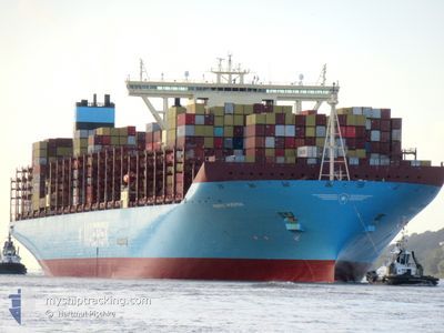
MARIE MAERSK
Container Ship
Current Trip
| Time Travelled | 4 days |
|---|---|
| Remaining Time | --- |
| Distance Travelled | 1715.64 nm |
| Remaining Distance | --- |
| AVG Speed | 16.4 Knots |
| MAX Speed | 20.8 Knots |
| AVG Wind | 15.7 knots |
| MAX Wind | 25.9 knots |
| MIN Temp | 11.8°C / 53.24°F |
| MAX Temp | 23.2°C / 73.76°F |
| Draught | 16.2 m |
| Position Received | 1 m ago |
Current Position
| Longitude | -9.29200° |
|---|---|
| Latitude | 33.23635° |
| Status | Under way using engine |
| Speed | 19.6 Knots |
| Course | 219.7° |
| Area | North Atlantic Ocean |
| Station | T-AIS |
| Position Received | 1 m ago |
Info
Information
The current position of MARIE MAERSK is in North Atlantic Ocean with coordinates 33.23635° / -9.29200° as reported on 2024-05-29 12:03 by AIS to our vessel tracker app. The vessel's current speed is 19.6 Knots and is heading at the port of TANJUNG PELEPAS. The estimated time of arrival as calculated by MyShipTracking vessel tracking app is 2024-06-22 06:00 LT
The vessel MARIE MAERSK (IMO: 9619933, MMSI: 219018765) is a Container Ship that was built in 2013 ( 11 years old ). It's sailing under the flag of [DK] Denmark.
In this page you can find informations about the vessels current position, last detected port calls, and current voyage information. If the vessels is not in coverage by AIS you will find the latest position.
The current position of MARIE MAERSK is detected by our AIS receivers and we are not responsible for the reliability of the data. The last position was recorded while the vessel was in Coverage by the Ais receivers of our vessel tracking app.
The current draught of MARIE MAERSK as reported by AIS is 16.2 meters
Weather
| Temperature | 19.5°C / 67.1°F |
|---|---|
| Wind Speed | 14 knots |
| Direction | 2° N |
| Pressure | 1013.7 hPa |
| Humidity | 90.9 % |
| Cloud Coverage | 1 % |
Featured Company
Last Port Calls
| Port | Arrival | Departure | Time In Port |
|---|---|---|---|
| 2024-05-23 23:10 | 2024-05-25 10:12 | 1 d | |
| 2024-05-21 09:03 | 2024-05-22 23:51 | 1 d | |
| 2024-05-12 14:59 | 2024-05-14 22:41 | 2 d | |
| 2024-05-08 11:55 | 2024-05-10 00:34 | 1 d | |
| 2024-05-03 18:30 | 2024-05-04 20:26 | 1 d | |
| 2024-04-08 22:37 | 2024-04-10 10:21 | 1 d | |
| 2024-04-04 04:41 | 2024-04-05 00:33 | 19 h | |
| 2024-03-26 18:23 | 2024-03-27 13:59 | 19 h | |
| 2024-03-06 21:21 | 2024-03-13 06:53 | 6 d | |
| 2024-03-02 06:44 |
Most Visited Ports (Last year)
| Port | Arrivals | |
|---|---|---|
| 5 | ||
| 4 | ||
| 3 | ||
| 3 | ||
| 2 | ||
| 2 |
Last Trips
| Origin | Departure | Destination | Arrival | Distance | |
|---|---|---|---|---|---|
| 2024-05-22 23:51 | 2024-05-23 23:10 | 295.42 nm | |||
| 2024-05-14 22:41 | 2024-05-21 09:03 | 4332.00 nm | |||
| 2024-05-10 00:34 | 2024-05-12 14:59 | 914.60 nm | |||
| 2024-05-04 20:26 | 2024-05-08 11:55 | 1657.45 nm | |||
| 2024-04-10 10:21 | 2024-05-03 18:30 | 10743.82 nm | |||
| 2024-04-05 00:33 | 2024-04-08 22:37 | 1498.09 nm | |||
| 2024-03-27 13:59 | 2024-04-04 04:41 | 882.84 nm | |||
| 2024-03-13 06:53 | 2024-03-26 18:23 | 5563.68 nm | |||
| 2024-03-02 06:44 | 2024-03-06 21:21 | 95.55 nm |
Events
| Time | Event | Details | Position / Dest | Info |
|---|---|---|---|---|
| 2024-05-29 10:05 | Status Changed | Under way using engine Default |
33.74907 / -8.82290
ESALR>MYTPP
|
Speed: 19.6 kn Course: 210° |
| 2024-05-29 10:01 | Status Changed | Default Under way using engine |
33.76808 / -8.80915
ESALR>MYTPP
|
Speed: 19.5 kn Course: 210.6° |
| 2024-05-29 09:54 | Destination Changed | ESALR>MYTPP ALG ANCHORAGE>MYTPP |
33.80282 / -8.78352
ESALR>MYTPP
|
Speed: 19.5 kn Course: 214.2° |
| 2024-05-29 08:20 | ETA Changed | 2024/06/21 22:00 2024/06/21 10:00 |
34.18983 / -8.38242
ALG ANCHORAGE>MYTPP
|
Speed: 20.2 kn Course: 225° |
| 2024-05-29 05:57 | Status Changed | Under way using engine Default |
34.75943 / -7.69927
ALG ANCHORAGE>MYTPP
|
Speed: 20.1 kn Course: 224° |
| 2024-05-29 05:56 | Status Changed | Default Under way using engine |
34.76622 / -7.69120
ALG ANCHORAGE>MYTPP
|
Speed: 20.1 kn Course: 224.5° |
| 2024-05-29 01:26 | ETA Changed | 2024/06/21 10:00 2024/06/21 09:30 |
35.85870 / -6.39175
ALG ANCHORAGE>MYTPP
|
Speed: 19.8 kn Course: 223.9° |
| 2024-05-29 01:16 | Change Sea Area | Moroccan part of the North Atlantic Ocean Moroccan part of the Strait of Gibraltar |
35.89710 / -6.34385
North Atlantic Ocean
ALG ANCHORAGE>MYTPP
|
Speed: 19.9 kn Course: 225.6° |
| 2024-05-29 01:15 | Status Changed | Under way using engine Default |
35.89827 / -6.34238
ALG ANCHORAGE>MYTPP
|
Speed: 20 kn Course: 226° |
| 2024-05-29 01:15 | IN Coverage |
35.89710 / -6.34385
North Atlantic Ocean
ALG ANCHORAGE>MYTPP
|
Speed: 19.9 kn Course: 225.6° |