
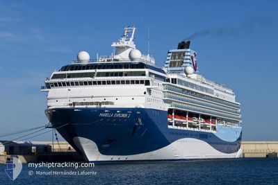
MARELLA EXPLORER 2
Passengers Ship
Current Trip
DOPUD
| Time Travelled | 1 h, 42 mins |
|---|---|
| Remaining Time | --- |
| Distance Travelled | 25.07 nm |
| Remaining Distance | --- |
| AVG Speed | 15.3 Knots |
| MAX Speed | 19.3 Knots |
| AVG Wind | 16.5 knots |
| MAX Wind | 17 knots |
| MIN Temp | 25.8°C / 78.44°F |
| MAX Temp | 26°C / 78.8°F |
| Draught | 8 m |
| Position Received | 1 m ago |
Current Position
| Longitude | --- |
|---|---|
| Latitude | --- |
| Status | Under way using engine |
| Speed | 19.4 Knots |
| Course | 324.7° |
| Area | Caribbean Sea |
| Station | T-AIS |
| Position Received | 1 m ago |
Info
Information
The current position of MARELLA EXPLORER 2 is in Caribbean Sea with coordinates 18.70134° / -64.63297° as reported on 2025-02-16 21:41 by AIS to our vessel tracker app. The vessel's current speed is 19.4 Knots
The vessel MARELLA EXPLORER 2 (IMO: 9072446, MMSI: 249054000) is a Passengers Ship that was built in 1995 ( 30 years old ). It's sailing under the flag of [MT] Malta.
In this page you can find informations about the vessels current position, last detected port calls, and current voyage information. If the vessels is not in coverage by AIS you will find the latest position.
The current position of MARELLA EXPLORER 2 is detected by our AIS receivers and we are not responsible for the reliability of the data. The last position was recorded while the vessel was in Coverage by the Ais receivers of our vessel tracking app.
The current draught of MARELLA EXPLORER 2 as reported by AIS is 8 meters
Weather
| Temperature | 25.9°C / 78.62°F |
|---|---|
| Wind Speed | 16 knots |
| Direction | 103° ESE |
| Pressure | 1016.3 hPa |
| Humidity | 72.9 % |
| Cloud Coverage | 5 % |
Featured Company
Last Port Calls
| Port | Arrival | Departure | Time In Port |
|---|---|---|---|
| 2025-02-16 11:41 | 2025-02-16 20:00 | 8 h | |
| 2025-02-15 11:07 | 2025-02-15 22:18 | 11 h | |
| 2025-02-14 11:17 | 2025-02-14 22:23 | 11 h | |
| 2025-02-13 12:12 | 2025-02-13 22:06 | 9 h | |
| 2025-02-11 11:15 | 2025-02-12 00:10 | 12 h | |
| 2025-02-08 11:23 | 2025-02-09 00:15 | 12 h | |
| 2025-02-05 11:41 | 2025-02-05 23:52 | 12 h | |
| 2025-02-04 11:17 | 2025-02-05 00:41 | 13 h | |
| 2025-02-02 11:17 | 2025-02-02 22:00 | 10 h | |
| 2025-02-01 11:25 | 2025-02-01 22:12 | 10 h |
Last Trips
| Origin | Departure | Destination | Arrival | Distance | |
|---|---|---|---|---|---|
| 2025-02-15 18:18 | 2025-02-16 07:41 | 95.79 nm | |||
| 2025-02-14 18:23 | 2025-02-15 07:07 | 92.07 nm | |||
| 2025-02-13 18:06 | 2025-02-14 07:17 | 136.15 nm | |||
| 2025-02-11 20:10 | 2025-02-13 08:12 | 488.72 nm | |||
| 2025-02-08 20:15 | 2025-02-11 07:15 | 458.35 nm | |||
| 2025-02-05 19:52 | 2025-02-08 07:23 | 432.00 nm | |||
| 2025-02-04 20:41 | 2025-02-05 07:41 | 101.17 nm | |||
| 2025-02-02 18:00 | 2025-02-04 07:17 | 488.60 nm | |||
| 2025-02-01 18:12 | 2025-02-02 07:17 | 132.75 nm | |||
| 2025-01-31 18:06 | 2025-02-01 07:25 | 103.67 nm |
Events
| Time | Event | Details | Position / Dest | Info |
|---|---|---|---|---|
| 2025-02-16 21:18 | Destination Changed | DOPUD VGRAD |
18.60036 / -64.55927
DOPUD
|
Speed: 18.1 kn Course: 325.7° |
| 2025-02-16 21:18 | ETA Changed | 2025/02/17 14:00 2025/02/16 11:00 |
18.60036 / -64.55927
DOPUD
|
Speed: 18.1 kn Course: 325.7° |
| 2025-02-16 20:00 | PORT DEPARTURE |
|
18.41909 / -64.60832
VGRAD
|
Speed: 3.3 kn Course: 135° |
| 2025-02-16 19:59 | START Moving |
18.42000 / -64.60917
[VG] ROAD TOWN
|
Speed: 3.3 kn Course: 135° |
|
| 2025-02-16 19:50 | Status Changed | Under way using engine Moored |
18.42147 / -64.61135
[VG] ROAD TOWN
|
Speed: Course: 125° |
| 2025-02-16 11:46 | Status Changed | Moored Under way using engine |
18.42140 / -64.61129
[VG] ROAD TOWN
|
Speed: 0.2 kn Course: 127° |
| 2025-02-16 11:45 | STOP Moving |
18.42140 / -64.61123
[VG] ROAD TOWN
|
Speed: 0.3 kn Course: 127° |
|
| 2025-02-16 11:41 | PORT ARRIVAL |
|
18.42113 / -64.61048
[VG] ROAD TOWN
|
Speed: 2.2 kn Course: 125° |
| 2025-02-16 05:30 | Detected in Sea | British Virgin Islands part of the Caribbean Sea |
18.20010 / -64.02518
Caribbean Sea
VGRAD
|
Speed: 7.7 kn Course: 283.1° |
| 2025-02-16 05:30 | Status Changed | Under way using engine Default |
18.20010 / -64.02518
VGRAD
|
Speed: 7.7 kn Course: 284° |