
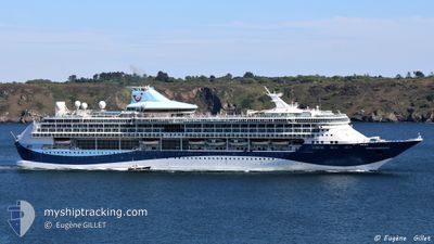
MARELLA DISCOVERY
Passenger
Current Trip
| Trip Time | 15 h, 15 mins |
|---|---|
| Trip Distance | 221.95 nm |
| AVG Speed | 14.3 Knots |
| MAX Speed | 16.1 Knots |
| Draught | 8 m |
| AVG Wind | 11.9 knots |
| MAX Wind | 16.4 knots |
| MIN Temp | 27.9°C / 82.22°F |
| MAX Temp | 29°C / 84.2°F |
| Position Received | 15 h, 42 m ago |
Current Position
| Longitude | --- |
|---|---|
| Latitude | --- |
| Status | Under way using engine |
| Speed | 15.2 Knots |
| Course | 155.6° |
| Area | Caribbean Sea |
| Station | T-AIS |
| Position Received | 15 h, 42 m ago |
Info
Information
The current position of MARELLA DISCOVERY is in Caribbean Sea with coordinates 14.55655° / -60.48094° as reported on 2024-11-24 04:16 by AIS to our vessel tracker app. The vessel's current speed is 15.2 Knots and is currently inside the port of BRIDGETOWN.
The vessel MARELLA DISCOVERY (MMSI: 249639000) is a Passenger It's sailing under the flag of [MT] Malta.
In this page you can find informations about the vessels current position, last detected port calls, and current voyage information. If the vessels is not in coverage by AIS you will find the latest position.
The current position of MARELLA DISCOVERY is detected by our AIS receivers and we are not responsible for the reliability of the data. The last position was recorded while the vessel was in Coverage by the Ais receivers of our vessel tracking app.
The current draught of MARELLA DISCOVERY as reported by AIS is 8 meters
Weather
| Temperature | 28.8°C / 83.84°F |
|---|---|
| Wind Speed | 17 knots |
| Direction | 90° E |
| Pressure | 1012 hPa |
| Humidity | 75.8 % |
| Cloud Coverage | --- |
Featured Company
Last Port Calls
| Port | Arrival | Departure | Time In Port |
|---|---|---|---|
| 2024-11-24 11:18 | |||
| 2024-11-23 11:19 | 2024-11-23 20:03 | 8 h | |
| 2024-11-22 11:25 | 2024-11-22 21:45 | 10 h | |
| 2024-11-21 09:46 | 2024-11-21 22:28 | 12 h | |
| 2024-11-14 02:02 | 2024-11-14 17:54 | 15 h | |
| 2024-11-12 07:21 | 2024-11-12 17:51 | 10 h | |
| 2024-11-10 04:18 | 2024-11-10 21:22 | 17 h | |
| 2024-11-08 06:09 | 2024-11-08 15:21 | 9 h | |
| 2024-11-06 02:36 | 2024-11-06 15:35 | 12 h | |
| 2024-11-04 03:48 | 2024-11-04 20:50 | 17 h |
Last Trips
| Origin | Departure | Destination | Arrival | Distance | |
|---|---|---|---|---|---|
| 2024-11-23 16:03 | 2024-11-24 07:18 | 221.95 nm | |||
| 2024-11-22 17:45 | 2024-11-23 07:19 | 156.77 nm | |||
| 2024-11-21 18:28 | 2024-11-22 07:25 | 124.05 nm | |||
| 2024-11-14 17:54 | 2024-11-21 05:46 | 2655.80 nm | |||
| 2024-11-12 18:51 | 2024-11-14 02:02 | 617.72 nm | |||
| 2024-11-10 22:22 | 2024-11-12 08:21 | 459.04 nm | |||
| 2024-11-08 16:21 | 2024-11-10 05:18 | 640.58 nm | |||
| 2024-11-06 17:35 | 2024-11-08 07:09 | 526.17 nm | |||
| 2024-11-04 23:50 | 2024-11-06 04:36 | 321.19 nm | |||
| 2024-11-03 16:58 | 2024-11-04 06:48 | 191.52 nm |
Events
| Time | Event | Details | Position / Dest | Info |
|---|---|---|---|---|
| 2024-11-24 11:29 | STOP Moving |
13.10229 / -59.62891
[BB] BRIDGETOWN
|
Speed: Course: 160° |
|
| 2024-11-24 11:18 | PORT ARRIVAL |
|
13.10252 / -59.62901
[BB] BRIDGETOWN
|
Speed: 5.2 kn Course: 108° |
| 2024-11-24 04:21 | Status Changed | Default Under way using engine |
14.53753 / -60.47236
BBBGI
|
Speed: 15.2 kn Course: 155.6° |
| 2024-11-24 04:16 | Status Changed | Under way using engine Default |
14.55655 / -60.48094
BBBGI
|
Speed: 14.6 kn Course: 154° |
| 2024-11-24 04:16 | OUT of Coverage |
14.55655 / -60.48094
Caribbean Sea
|
Speed: 15.2 kn Course: 155.6° |
|
| 2024-11-24 03:52 | Status Changed | Default Under way using engine |
14.64721 / -60.52175
BBBGI
|
Speed: 14.6 kn Course: 157° |
| 2024-11-24 03:46 | Status Changed | Under way using engine Default |
14.66873 / -60.53174
BBBGI
|
Speed: 14.6 kn Course: 156° |
| 2024-11-24 03:31 | IN Coverage |
14.66873 / -60.53174
Caribbean Sea
|
Speed: 14.6 kn Course: 157° |
|
| 2024-11-23 21:41 | Status Changed | Default Under way using engine |
15.87940 / -61.36666
BBBGI
|
Speed: 14.8 kn Course: 146° |
| 2024-11-23 21:34 | OUT of Coverage |
15.90385 / -61.38297
Caribbean Sea
|
Speed: 14.8 kn Course: 146° |