
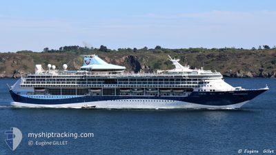
MARELLA DISCOVERY
Passengers Ship
Current Trip
| Time Travelled | 15 h, 31 mins |
|---|---|
| Remaining Time | 12 h, 20 mins |
| Distance Travelled | 175.65 nm |
| Remaining Distance | 144.44 nm |
| AVG Speed | 11.7 Noeuds |
| MAX Speed | 12.3 Noeuds |
| AVG Wind | 9.8 knots |
| MAX Wind | 17 knots |
| MIN Temp | 23°C / 73.4°F |
| MAX Temp | 25.6°C / 78.08°F |
| Tirant d eau | 8 m |
| Position reçue | 1 m depuis |
Current Position
| Longitude | 25.06968° |
|---|---|
| Latitude | 36.00527° |
| Etat | Under way using engine |
| Vitesse | 11.4 Noeuds |
| Parcours | 310.5° |
| Zone | Aegean Sea |
| Station | T-AIS |
| Position reçue | 1 m depuis |
Info
Information
The current position of MARELLA DISCOVERY is in Aegean Sea with coordinates 36.00527° / 25.06968° as reported on 2024-06-18 14:06 by AIS to our vessel tracker app. The vessel's current speed is 11.4 Noeuds and is heading at the port of PIRAEUS. The estimated time of arrival as calculated by MyShipTracking vessel tracking app is 2024-06-19 02:27 LT
The vessel MARELLA DISCOVERY (IMO: 9070632, MMSI: 249639000) is a Passengers Ship that was built in 1996 ( 28 Age ). It's sailing under the flag of [MT] Malta.
In this page you can find informations about the vessels current position, last detected port calls, and current voyage information. If the vessels is not in coverage by AIS you will find the latest position.
The current position of MARELLA DISCOVERY is detected by our AIS receivers and we are not responsible for the reliability of the data. The last position was recorded while the vessel was in Coverage by the Ais receivers of our vessel tracking app.
The current draught of MARELLA DISCOVERY as reported by AIS is 8 meters
Weather
| Temperature | 25.6°C / 78.08°F |
|---|---|
| Wind Speed | 11 knots |
| Direction | 319° NW |
| Pressure | 1012.5 hPa |
| Humidity | 74.6 % |
| Cloud Coverage | --- |
Featured Company
Last Port Calls
| Port | Arrival | Departure | Time In Port |
|---|---|---|---|
| 2024-06-17 03:44 | 2024-06-17 22:36 | 18 h | |
| 2024-06-16 04:08 | 2024-06-16 14:18 | 10 h | |
| 2024-06-14 05:33 | 2024-06-14 15:26 | 9 h | |
| 2024-06-12 03:42 | 2024-06-12 16:33 | 12 h | |
| 2024-06-10 03:24 | 2024-06-10 22:19 | 18 h | |
| 2024-06-09 04:02 | 2024-06-09 14:25 | 10 h | |
| 2024-06-08 04:25 | 2024-06-08 15:02 | 10 h | |
| 2024-06-07 05:17 | 2024-06-07 16:02 | 10 h | |
| 2024-06-06 05:30 | 2024-06-06 14:20 | 8 h | |
| 2024-06-05 04:20 |
Most Visited Ports (Last year)
| Port | Arrivals | |
|---|---|---|
| 23 | ||
| 18 | ||
| 11 | ||
| 11 | ||
| 11 | ||
| 10 |
Last Trips
| Origin | Departure | Destination | Arrival | Distance | |
|---|---|---|---|---|---|
| 2024-06-16 17:18 | 2024-06-17 06:44 | 201.72 nm | |||
| 2024-06-14 18:26 | 2024-06-16 07:08 | 332.28 nm | |||
| 2024-06-12 19:33 | 2024-06-14 08:33 | 383.23 nm | |||
| 2024-06-11 01:19 | 2024-06-12 06:42 | 415.20 nm | |||
| 2024-06-09 17:25 | 2024-06-10 06:24 | 200.95 nm | |||
| 2024-06-08 18:02 | 2024-06-09 07:02 | 152.57 nm | |||
| 2024-06-07 19:02 | 2024-06-08 07:25 | 147.95 nm | |||
| 2024-06-06 17:20 | 2024-06-07 08:17 | 186.08 nm | |||
| 2024-06-06 17:20 | 2024-06-06 08:30 | 186.08 nm | |||
| 2024-06-04 01:30 | 2024-06-05 07:20 | 319.07 nm |
Events
| Heure | Evenement | Détails | Position/ Destination | Info |
|---|---|---|---|---|
| 2024-06-18 07:46 | Etat Changé | Under way using engine Default |
36.15716 / 26.50220
GRPIR
|
Vitesse: 11.4 kn Parcours: 274° |
| 2024-06-18 07:30 | Etat Changé | Default Under way using engine |
36.15339 / 26.56199
GRPIR
|
Vitesse: 11.6 kn Parcours: 274.9° |
| 2024-06-18 07:24 | Etat Changé | Under way using engine Default |
36.15178 / 26.58546
GRPIR
|
Vitesse: 11.8 kn Parcours: 273° |
| 2024-06-18 07:24 | Dans la zone couverte |
36.15211 / 26.57990
Aegean Sea
GRPIR
|
Vitesse: 11.8 kn Parcours: 273.9° |
|
| 2024-06-18 06:22 | Etat Changé | Default Under way using engine |
36.14940 / 26.83605
GRPIR
|
Vitesse: 11.6 kn Parcours: 251.2° |
| 2024-06-18 06:20 | Hors de la zone couverte |
36.15149 / 26.84434
Aegean Sea
GRPIR
|
Vitesse: 11.6 kn Parcours: 251.2° |
|
| 2024-06-18 05:07 | Etat Changé | Under way using engine Default |
36.21981 / 27.12665
GRPIR
|
Vitesse: 11.7 kn Parcours: 259° |
| 2024-06-18 05:03 | Etat Changé | Default Under way using engine |
36.22225 / 27.14103
GRPIR
|
Vitesse: 11.7 kn Parcours: 258.7° |
| 2024-06-18 03:00 | Etat Changé | Under way using engine Default |
36.35294 / 27.60247
GRPIR
|
Vitesse: 11.9 kn Parcours: 246° |
| 2024-06-18 02:34 | Etat Changé | Default Under way using engine |
36.38557 / 27.69909
GRPIR
|
Vitesse: 12.1 kn Parcours: 246.3° |