
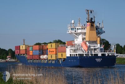
MAIKE D
Container Ship
Current Trip
| Time Travelled | 15 h, 8 mins |
|---|---|
| Remaining Time | 43 mins |
| Distance Travelled | 209.30 nm |
| Remaining Distance | 11.96 nm |
| AVG Speed | 13.9 Knots |
| MAX Speed | 16 Knots |
| AVG Wind | 15.8 knots |
| MAX Wind | 22 knots |
| MIN Temp | 2.3°C / 36.14°F |
| MAX Temp | 6.1°C / 42.98°F |
| Draught | 7.3 m |
| Position Received | 1 m ago |
Current Position
| Longitude | --- |
|---|---|
| Latitude | --- |
| Status | Under way using engine |
| Speed | 13.5 Knots |
| Course | 128.5° |
| Area | Kattegat |
| Station | T-AIS |
| Position Received | 1 m ago |
Info
Information
The current position of MAIKE D is in Kattegat with coordinates 56.11676° / 12.50996° as reported on 2025-02-06 05:45 by AIS to our vessel tracker app. The vessel's current speed is 13.5 Knots and is heading at the port of HELSINGBORG. The estimated time of arrival as calculated by MyShipTracking vessel tracking app is 2025-02-06 06:30 LT
The vessel MAIKE D (IMO: 9226372, MMSI: 636092635) is a Container Ship that was built in 2000 ( 25 years old ). It's sailing under the flag of [LR] Liberia.
In this page you can find informations about the vessels current position, last detected port calls, and current voyage information. If the vessels is not in coverage by AIS you will find the latest position.
The current position of MAIKE D is detected by our AIS receivers and we are not responsible for the reliability of the data. The last position was recorded while the vessel was in Coverage by the Ais receivers of our vessel tracking app.
The current draught of MAIKE D as reported by AIS is 7.3 meters
Weather
| Temperature | 2.4°C / 36.32°F |
|---|---|
| Wind Speed | 6 knots |
| Direction | 308° NW |
| Pressure | 1039.3 hPa |
| Humidity | 93.2 % |
| Cloud Coverage | 99 % |
Featured Company
Last Port Calls
| Port | Arrival | Departure | Time In Port |
|---|---|---|---|
| 2025-02-05 05:15 | 2025-02-05 14:39 | 9 h | |
| 2025-02-03 08:09 | 2025-02-03 17:49 | 9 h | |
| 2025-02-03 01:19 | 2025-02-03 08:04 | 6 h | |
| 2025-02-01 06:29 | 2025-02-03 01:17 | 1 d | |
| 2025-01-31 21:29 | 2025-02-01 05:12 | 7 h | |
| 2025-01-30 18:39 | 2025-01-31 01:42 | 7 h | |
| 2025-01-28 07:12 | 2025-01-29 00:26 | 17 h | |
| 2025-01-25 17:00 | 2025-01-26 05:30 | 12 h | |
| 2025-01-23 01:46 | 2025-01-23 13:08 | 11 h | |
| 2025-01-18 21:45 | 2025-01-19 14:34 | 16 h |
Most Visited Ports (Last year)
| Port | Arrivals | |
|---|---|---|
| 33 | ||
| 16 | ||
| 12 | ||
| 12 | ||
| 10 | ||
| 9 |
Last Trips
| Origin | Departure | Destination | Arrival | Distance | |
|---|---|---|---|---|---|
| 2025-02-03 18:49 | 2025-02-05 06:15 | 493.74 nm | |||
| 2025-02-03 09:04 | 2025-02-03 09:09 | 1.11 nm | |||
| 2025-02-03 02:17 | 2025-02-03 02:19 | 0.45 nm | |||
| 2025-02-01 06:12 | 2025-02-01 07:29 | 14.99 nm | |||
| 2025-01-31 02:42 | 2025-01-31 22:29 | 267.95 nm | |||
| 2025-01-29 01:26 | 2025-01-30 19:39 | 482.85 nm | |||
| 2025-01-26 06:30 | 2025-01-28 08:12 | 450.07 nm | |||
| 2025-01-23 14:08 | 2025-01-25 18:00 | 113.13 nm | |||
| 2025-01-19 15:34 | 2025-01-23 02:46 | 496.98 nm | |||
| 2025-01-17 09:20 | 2025-01-18 22:45 | 359.32 nm |
Events
| Time | Event | Details | Position / Dest | Info |
|---|---|---|---|---|
| 2025-02-06 05:01 | Change Sea Area | Danish part of the Kattegat Swedish part of the Kattegat |
56.23257 / 12.31088
Kattegat
SEHEL
|
Speed: 13.1 kn Course: 143.9° |
| 2025-02-05 22:23 | Change Sea Area | Swedish part of the Kattegat Danish part of the Kattegat |
57.62789 / 11.23234
Kattegat
SEHEL
|
Speed: 14.7 kn Course: 138.9° |
| 2025-02-05 22:13 | Change Sea Area | Danish part of the Kattegat Swedish part of the Kattegat |
57.66289 / 11.19557
Kattegat
SEHEL
|
Speed: 14.6 kn Course: 163.4° |
| 2025-02-05 21:32 | Change Sea Area | Swedish part of the Kattegat Swedish part of the Skaggerak |
57.82219 / 11.09907
Kattegat
SEHEL
|
Speed: 16 kn Course: 159.4° |
| 2025-02-05 17:49 | Change Sea Area | Swedish part of the Skaggerak Norwegian part of the Skaggerak |
58.61451 / 10.34406
Skaggerak
SEHEL
|
Speed: 14.4 kn Course: 152.4° |
| 2025-02-05 14:45 | Status Changed | Under way using engine Moored |
59.00819 / 10.06052
SEHEL
|
Speed: 13.4 kn Course: 152.7° |
| 2025-02-05 14:39 | PORT DEPARTURE |
|
59.02882 / 10.04002
SEHEL
|
Speed: 9.2 kn Course: 157° |
| 2025-02-05 14:37 | START Moving |
59.03493 / 10.03427
[NO] LARVIK
|
Speed: 9.2 kn Course: 157° |
|
| 2025-02-05 14:28 | Draught Changed | 7.3 7.2 |
59.03888 / 10.04053
[NO] LARVIK
|
Speed: Course: 217° |
| 2025-02-05 14:28 | Destination Changed | SEHEL SEHELL |
59.03888 / 10.04053
[NO] LARVIK
|
Speed: Course: 217° |