
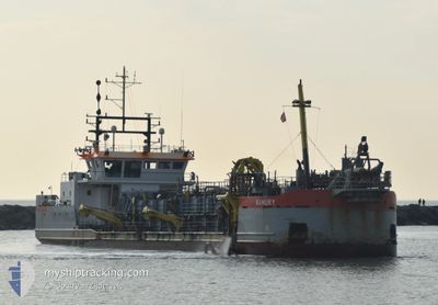
MAHURY
Dredging or underwater ops
Current Trip
NEELTJE JANS
| Time Travelled | 7 h, 35 mins |
|---|---|
| Remaining Time | --- |
| Distance Travelled | 36.10 nm |
| Remaining Distance | --- |
| AVG Speed | 7.3 Knots |
| MAX Speed | 8.3 Knots |
| AVG Wind | 8 knots |
| MAX Wind | 14.3 knots |
| MIN Temp | 2.3°C / 36.14°F |
| MAX Temp | 5.8°C / 42.44°F |
| Draught | 2.4 m |
| Position Received | 1 m ago |
Current Position
| Longitude | --- |
|---|---|
| Latitude | --- |
| Status | Restricted manoeuverability |
| Speed | 0.1 Knots |
| Course | 2° |
| Area | North Sea |
| Station | T-AIS |
| Position Received | 1 m ago |
Info
Information
The current position of MAHURY is in North Sea with coordinates 51.69188° / 4.54725° as reported on 2024-11-21 19:00 by AIS to our vessel tracker app. The vessel's current speed is 0.1 Knots
The vessel MAHURY (IMO: 9762027, MMSI: 244850565) is a Dredging or underwater ops It's sailing under the flag of [NL] Netherlands.
In this page you can find informations about the vessels current position, last detected port calls, and current voyage information. If the vessels is not in coverage by AIS you will find the latest position.
The current position of MAHURY is detected by our AIS receivers and we are not responsible for the reliability of the data. The last position was recorded while the vessel was in Coverage by the Ais receivers of our vessel tracking app.
The current draught of MAHURY as reported by AIS is 2.4 meters
Weather
| Temperature | 2.4°C / 36.32°F |
|---|---|
| Wind Speed | 6 knots |
| Direction | 311° NW |
| Pressure | 994.9 hPa |
| Humidity | 60.9 % |
| Cloud Coverage | 98 % |
Featured Company
Last Port Calls
| Port | Arrival | Departure | Time In Port |
|---|---|---|---|
| 2024-11-21 11:48 | 2024-11-21 12:26 | 38 m | |
| 2024-11-21 06:36 | 2024-11-21 10:22 | 3 h | |
| 2024-11-21 05:24 | 2024-11-21 06:01 | 36 m | |
| 2024-11-20 09:30 | 2024-11-20 10:11 | 41 m | |
| 2024-11-20 04:37 | 2024-11-20 07:53 | 3 h | |
| 2024-11-20 03:21 | 2024-11-20 03:57 | 35 m | |
| 2024-11-19 12:28 | 2024-11-19 13:01 | 33 m | |
| 2024-11-19 08:03 | 2024-11-19 11:04 | 3 h | |
| 2024-11-18 23:16 | 2024-11-19 02:12 | 2 h | |
| 2024-11-18 04:58 | 2024-11-18 08:58 | 3 h |
Most Visited Ports (Last year)
| Port | Arrivals | |
|---|---|---|
| 486 | ||
| 201 | ||
| 195 | ||
| 189 | ||
| 160 | ||
| 112 |
Last Trips
| Origin | Departure | Destination | Arrival | Distance | |
|---|---|---|---|---|---|
| 2024-11-21 10:22 | 2024-11-21 11:48 | 11.26 nm | |||
| 2024-11-21 06:01 | 2024-11-21 06:36 | 3.72 nm | |||
| 2024-11-20 10:11 | 2024-11-21 05:24 | 71.95 nm | |||
| 2024-11-20 07:53 | 2024-11-20 09:30 | 11.50 nm | |||
| 2024-11-20 03:57 | 2024-11-20 04:37 | 3.67 nm | |||
| 2024-11-19 13:01 | 2024-11-20 03:21 | 72.06 nm | |||
| 2024-11-19 11:04 | 2024-11-19 12:28 | 11.24 nm | |||
| 2024-11-19 02:12 | 2024-11-19 08:03 | 34.23 nm | |||
| 2024-11-18 08:58 | 2024-11-18 23:16 | 92.68 nm | |||
| 2024-11-17 22:39 | 2024-11-18 04:58 | 43.39 nm |
Events
| Time | Event | Details | Position / Dest | Info |
|---|---|---|---|---|
| 2024-11-21 18:44 | STOP Moving | 0.82 nm, North East of NOORDSCHANS |
51.69183 / 4.54727
NEELTJE JANS
|
Speed: 0.3 kn Course: 0° |
| 2024-11-21 17:53 | START Moving | 1.14 nm, West of WILLEMSTAD |
51.69026 / 4.40996
NEELTJE JANS
|
Speed: 3.1 kn Course: 49° |
| 2024-11-21 16:40 | STOP Moving | 1.64 nm, West of WILLEMSTAD |
51.68494 / 4.39862
NEELTJE JANS
|
Speed: 0.3 kn Course: 46° |
| 2024-11-21 15:04 | START Moving | 2.69 nm, East of BRUINISSE |
51.66194 / 4.16177
NEELTJE JANS
|
Speed: 3.1 kn Course: 87° |
| 2024-11-21 14:53 | Status Changed | Restricted manoeuverability Default |
51.66179 / 4.15770
NEELTJE JANS
|
Speed: 0.2 kn Course: 86° |
| 2024-11-21 14:50 | Status Changed | Default Restricted manoeuverability |
51.66170 / 4.15756
NEELTJE JANS
|
Speed: 0.1 kn Course: 86° |
| 2024-11-21 14:43 | Status Changed | Restricted manoeuverability Default |
51.66160 / 4.15752
NEELTJE JANS
|
Speed: 0.2 kn Course: 86° |
| 2024-11-21 14:38 | Status Changed | Default Restricted manoeuverability |
51.66175 / 4.15763
NEELTJE JANS
|
Speed: 0.3 kn Course: 86° |
| 2024-11-21 14:25 | STOP Moving | 2.54 nm, East of BRUINISSE |
51.66175 / 4.15762
NEELTJE JANS
|
Speed: 0.2 kn Course: 86° |
| 2024-11-21 14:18 | Status Changed | Restricted manoeuverability Default |
51.66171 / 4.15647
NEELTJE JANS
|
Speed: 2.9 kn Course: 94° |