
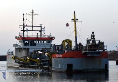
MAHURY
Dredging or underwater ops
Current Trip
| Time Travelled | 1 day |
|---|---|
| Remaining Time | 1 h, 48 mins |
| Distance Travelled | 181.30 nm |
| Remaining Distance | 14.24 nm |
| AVG Speed | 6.4 Noeuds |
| MAX Speed | 9.4 Noeuds |
| AVG Wind | 8.3 knots |
| MAX Wind | 14 knots |
| MIN Temp | 8.1°C / 46.58°F |
| MAX Temp | 13.3°C / 55.94°F |
| Tirant d eau | 2.5 m |
| Position reçue | 1 m depuis |
Current Position
| Longitude | --- |
|---|---|
| Latitude | --- |
| Etat | Restricted manoeuverability |
| Vitesse | 9.4 Noeuds |
| Parcours | 184.4° |
| Zone | North Sea |
| Station | T-AIS |
| Position reçue | 1 m depuis |
Information
The current position of MAHURY is in North Sea with coordinates 51.87349° / 3.89007° as reported on 2025-03-23 14:02 by AIS to our vessel tracker app. The vessel's current speed is 9.4 Noeuds and is heading at the port of ROTTERDAM. The estimated time of arrival as calculated by MyShipTracking vessel tracking app is 2025-03-23 15:51 LT
The vessel MAHURY (IMO: 9762027, MMSI: 244850565) is a Dredging or underwater ops It's sailing under the flag of [NL] Netherlands.
In this page you can find informations about the vessels current position, last detected port calls, and current voyage information. If the vessels is not in coverage by AIS you will find the latest position.
The current position of MAHURY is detected by our AIS receivers and we are not responsible for the reliability of the data. The last position was recorded while the vessel was in Coverage by the Ais receivers of our vessel tracking app.
The current draught of MAHURY as reported by AIS is 2.5 meters
Weather
| Temperature | 8.9°C / 48.02°F |
|---|---|
| Wind Speed | 6 knots |
| Direction | 252° WSW |
| Pressure | 1004.4 hPa |
| Humidity | 91.7 % |
| Cloud Coverage | 69 % |
Featured Company
Last Port Calls
| Port | Arrival | Departure | Time In Port |
|---|---|---|---|
| 2025-03-21 15:21 | 2025-03-21 17:34 | 2 h | |
| 2025-03-20 19:14 | 2025-03-20 21:22 | 2 h | |
| 2025-03-20 11:13 | 2025-03-20 11:35 | 22 m | |
| 2025-03-20 08:19 | 2025-03-20 08:40 | 21 m | |
| 2025-03-19 12:44 | 2025-03-19 13:20 | 35 m | |
| 2025-03-18 20:31 | 2025-03-18 21:08 | 36 m | |
| 2025-03-18 17:36 | 2025-03-18 18:22 | 46 m | |
| 2025-03-18 10:02 | 2025-03-18 12:32 | 2 h | |
| 2025-03-18 08:15 | 2025-03-18 09:57 | 1 h | |
| 2025-03-18 05:15 | 2025-03-18 05:55 | 39 m |
Most Visited Ports (Last year)
| Port | Arrivals | |
|---|---|---|
| 308 | ||
| 204 | ||
| 189 | ||
| 170 | ||
| 147 | ||
| 139 |
Last Trips
| Origin | Departure | Destination | Arrival | Distance | |
|---|---|---|---|---|---|
| 2025-03-20 22:22 | 2025-03-21 16:21 | 70.94 nm | |||
| 2025-03-20 12:35 | 2025-03-20 20:14 | 33.54 nm | |||
| 2025-03-20 09:40 | 2025-03-20 12:13 | 17.40 nm | |||
| 2025-03-19 14:20 | 2025-03-20 09:19 | 76.52 nm | |||
| 2025-03-18 22:08 | 2025-03-19 13:44 | 73.06 nm | |||
| 2025-03-18 19:22 | 2025-03-18 21:31 | 9.43 nm | |||
| 2025-03-18 13:32 | 2025-03-18 18:36 | 32.82 nm | |||
| 2025-03-18 10:57 | 2025-03-18 11:02 | 0.16 nm | |||
| 2025-03-18 06:55 | 2025-03-18 09:15 | 16.67 nm | |||
| 2025-03-18 05:51 | 2025-03-18 06:15 | 1.79 nm |
Events
| Heure | Evenement | Détails | Position/ Destination | Info |
|---|---|---|---|---|
| 2025-03-23 08:35 | Démarrage | 2.94 nm, North of OUDDORP |
51.84666 / 3.93423
NL RTM
|
Vitesse: 3.1 kn Parcours: 270° |
| 2025-03-23 08:11 | Arret | 2.99 nm, North of OUDDORP |
51.84734 / 3.94007
NL RTM
|
Vitesse: 0.3 kn Parcours: 68° |
| 2025-03-23 05:04 | Démarrage | 5.29 nm, North of OUDDORP |
51.88118 / 3.88924
NL RTM
|
Vitesse: 3.4 kn Parcours: 176° |
| 2025-03-23 04:55 | Arret | 5.42 nm, North of OUDDORP |
51.88352 / 3.88958
NL RTM
|
Vitesse: 0.1 kn Parcours: 256° |
| 2025-03-23 01:37 | Démarrage | 0.71 nm, North of STELLENDAM |
51.83541 / 4.03669
NL RTM
|
Vitesse: 3.7 kn Parcours: 14° |
| 2025-03-23 01:34 | Arret | 0.6 nm, North of STELLENDAM |
51.83360 / 4.03666
NL RTM
|
Vitesse: 0.3 kn Parcours: 78° |
| 2025-03-23 00:19 | Démarrage | 5.35 nm, North of OUDDORP |
51.88005 / 3.87930
NL RTM
|
Vitesse: 5.2 kn Parcours: 137.1° |
| 2025-03-23 00:10 | Arret | 5.47 nm, North of OUDDORP |
51.88203 / 3.87863
NL RTM
|
Vitesse: 0.3 kn Parcours: 86° |
| 2025-03-22 21:29 | Démarrage | 3.35 nm, North of OUDDORP |
51.85229 / 3.91511
NL RTM
|
Vitesse: 3.2 kn Parcours: 310° |
| 2025-03-22 21:12 | Arret | 2.95 nm, North of OUDDORP |
51.84660 / 3.92606
NL RTM
|
Vitesse: 0.2 kn Parcours: 288° |