
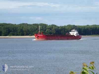
MAGDALENA
Lpg Tanker
Current Trip
TAICHUNG,TW
| Time Travelled | 4 days |
|---|---|
| Remaining Time | --- |
| Distance Travelled | 860.08 nm |
| Remaining Distance | --- |
| AVG Speed | 11.9 Knots |
| MAX Speed | 14.5 Knots |
| AVG Wind | 7.3 knots |
| MAX Wind | 15 knots |
| MIN Temp | 26.7°C / 80.06°F |
| MAX Temp | 31.8°C / 89.24°F |
| Draught | 5.4 m |
| Position Received | 7 d ago |
Current Position
| Longitude | 125.87233° |
|---|---|
| Latitude | 36.60418° |
| Status | Under way using engine |
| Speed | 14.5 Knots |
| Course | 200° |
| Area | Yellow Sea |
| Station | T-AIS |
| Position Received | 7 d ago |
Info
Information
The current position of MAGDALENA is in Yellow Sea with coordinates 36.60418° / 125.87233° as reported on 2024-05-27 00:27 by AIS to our vessel tracker app. The vessel's current speed is 14.5 Knots
The vessel MAGDALENA (IMO: 9434541, MMSI: 477625200) is a Lpg Tanker that was built in 2008 ( 16 years old ). It's sailing under the flag of [HK] Hong Kong.
In this page you can find informations about the vessels current position, last detected port calls, and current voyage information. If the vessels is not in coverage by AIS you will find the latest position.
The current position of MAGDALENA is detected by our AIS receivers and we are not responsible for the reliability of the data. The last position was recorded while the vessel was in Coverage by the Ais receivers of our vessel tracking app.
The current draught of MAGDALENA as reported by AIS is 5.4 meters
Weather
| Temperature | 30.2°C / 86.36°F |
|---|---|
| Wind Speed | 7 knots |
| Direction | 303° WNW |
| Pressure | 1007.1 hPa |
| Humidity | 71.6 % |
| Cloud Coverage | 100 % |
Featured Company
Last Port Calls
| Port | Arrival | Departure | Time In Port |
|---|---|---|---|
| 2024-05-29 22:49 | 2024-05-30 21:30 | 22 h | |
| 2024-05-26 11:14 | 2024-05-27 06:25 | 19 h | |
| 2024-05-23 14:30 | 2024-05-24 15:24 | 1 d | |
| 2024-05-20 22:49 | 2024-05-21 21:45 | 22 h | |
| 2024-05-19 06:51 | 2024-05-20 07:40 | 1 d | |
| 2024-05-17 20:53 | 2024-05-18 21:44 | 1 d | |
| 2024-05-06 08:32 | 2024-05-07 00:32 | 16 h | |
| 2024-04-30 00:24 | 2024-04-30 18:09 | 17 h | |
| 2024-04-21 03:37 | 2024-04-22 21:09 | 1 d | |
| 2024-04-06 09:01 | 2024-04-06 19:37 | 10 h |
Most Visited Ports (Last year)
| Port | Arrivals | |
|---|---|---|
| 8 | ||
| 4 | ||
| 4 | ||
| 4 | ||
| 3 | ||
| 2 |
Last Trips
| Origin | Departure | Destination | Arrival | Distance | |
|---|---|---|---|---|---|
| 2024-05-27 06:25 | 2024-05-29 22:49 | 853.80 nm | |||
| 2024-05-24 15:24 | 2024-05-26 11:14 | 527.03 nm | |||
| 2024-05-21 21:45 | 2024-05-23 14:30 | 479.98 nm | |||
| 2024-05-20 07:40 | 2024-05-20 22:49 | 18.98 nm | |||
| 2024-05-18 21:44 | 2024-05-19 06:51 | 68.94 nm | |||
| 2024-05-07 00:32 | 2024-05-17 20:53 | 2505.13 nm | |||
| 2024-04-30 18:09 | 2024-05-06 08:32 | 1768.48 nm | |||
| 2024-04-22 21:09 | 2024-04-30 00:24 | 2034.48 nm | |||
| 2024-04-06 19:37 | 2024-04-21 03:37 | 2711.32 nm | |||
| 2024-04-05 23:31 | 2024-04-06 09:01 | 72.70 nm |
Events
| Time | Event | Details | Position / Dest | Info |
|---|---|---|---|---|
| 2024-06-02 16:42 | START Moving | 4.17 nm, South of BATANGAS |
13.68347 / 121.04495
TAICHUNG,TW
|
Speed: 4.1 kn Course: 265° |
| 2024-06-02 04:26 | STOP Moving | 4.17 nm, South of BATANGAS |
13.68398 / 121.04885
TAICHUNG,TW
|
Speed: 0.1 kn Course: 179° |
| 2024-06-02 03:46 | START Moving | 3.67 nm, South of BATANGAS |
13.69158 / 121.04238
TAICHUNG,TW
|
Speed: 3.6 kn Course: 180° |
| 2024-06-02 03:34 | STOP Moving | 3.56 nm, South of BATANGAS |
13.69328 / 121.03978
TAICHUNG,TW
|
Speed: 0.2 kn Course: 162° |
| 2024-05-30 13:30 | PORT DEPARTURE |
|
24.29932 / 120.47308
TAICHUNG,TW
|
Speed: 10.4 kn Course: 290° |
| 2024-05-30 13:10 | START Moving |
24.27480 / 120.50898
[TW] TAICHUNG
|
Speed: 4.5 kn Course: 30° |
|
| 2024-05-29 15:10 | STOP Moving |
24.27312 / 120.50777
[TW] TAICHUNG
|
Speed: Course: 20° |
|
| 2024-05-29 14:49 | PORT ARRIVAL |
|
24.28863 / 120.50905
[TW] TAICHUNG
|
Speed: 7.9 kn Course: 80° |
| 2024-05-27 00:33 | Status Changed | Default Under way using engine |
36.58453 / 125.86098
TAICHUNG,TW
|
Speed: 14.5 kn Course: 200° |
| 2024-05-27 00:27 | OUT of Coverage |
36.60418 / 125.87233
Yellow Sea
TAICHUNG,TW
|
Speed: 14.5 kn Course: 200° |