
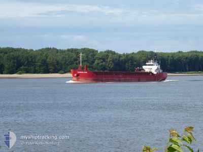
MAGDALENA
Lpg Tanker
Current Trip
| Time Travelled | 4 days |
|---|---|
| Remaining Time | 9 h, 16 mins |
| Distance Travelled | 1056.44 nm |
| Remaining Distance | 1375.71 nm |
| AVG Speed | 12.9 Noeuds |
| MAX Speed | 14.9 Noeuds |
| AVG Wind | 10.9 knots |
| MAX Wind | 16.9 knots |
| MIN Temp | 29°C / 84.2°F |
| MAX Temp | 30.9°C / 87.62°F |
| Tirant d eau | 4.8 m |
| Position reçue | 9 d depuis |
Current Position
| Longitude | 119.90597° |
|---|---|
| Latitude | 22.47460° |
| Etat | Under way using engine |
| Vitesse | 14.1 Noeuds |
| Parcours | 185° |
| Zone | South China Sea |
| Station | T-AIS |
| Position reçue | 9 d depuis |
Info
Information
The current position of MAGDALENA is in South China Sea with coordinates 22.47460° / 119.90597° as reported on 2024-04-30 21:39 by AIS to our vessel tracker app. The vessel's current speed is 14.1 Noeuds and is heading at the port of BATANGAS. The estimated time of arrival as calculated by MyShipTracking vessel tracking app is 2024-05-11 06:16 LT
The vessel MAGDALENA (IMO: 9434541, MMSI: 477625200) is a Lpg Tanker that was built in 2008 ( 16 Age ). It's sailing under the flag of [HK] Hong Kong.
In this page you can find informations about the vessels current position, last detected port calls, and current voyage information. If the vessels is not in coverage by AIS you will find the latest position.
The current position of MAGDALENA is detected by our AIS receivers and we are not responsible for the reliability of the data. The last position was recorded while the vessel was in Coverage by the Ais receivers of our vessel tracking app.
The current draught of MAGDALENA as reported by AIS is 4.8 meters
Weather
| Temperature | 29°C / 84.2°F |
|---|---|
| Wind Speed | 10 knots |
| Direction | 117° ESE |
| Pressure | 1011.3 hPa |
| Humidity | 77.9 % |
| Cloud Coverage | 3 % |
Featured Company
Last Port Calls
| Port | Arrival | Departure | Time In Port |
|---|---|---|---|
| 2024-05-06 01:32 | 2024-05-06 17:32 | 16 h | |
| 2024-04-29 16:24 | 2024-04-30 10:09 | 17 h | |
| 2024-04-20 19:37 | 2024-04-22 13:09 | 1 d | |
| 2024-04-06 00:01 | 2024-04-06 10:37 | 10 h | |
| 2024-04-04 05:47 | 2024-04-05 14:31 | 1 d | |
| 2024-04-01 17:48 | 2024-04-02 03:01 | 9 h | |
| 2024-03-19 17:13 | 2024-03-20 09:24 | 16 h | |
| 2024-03-18 03:36 | 2024-03-18 22:34 | 18 h |
Most Visited Ports (Last year)
| Port | Arrivals | |
|---|---|---|
| 6 | ||
| 4 | ||
| 4 | ||
| 3 | ||
| 3 | ||
| 2 |
Last Trips
| Origin | Departure | Destination | Arrival | Distance | |
|---|---|---|---|---|---|
| 2024-04-30 18:09 | 2024-05-06 08:32 | 1768.48 nm | |||
| 2024-04-22 21:09 | 2024-04-30 00:24 | 2034.48 nm | |||
| 2024-04-06 19:37 | 2024-04-21 03:37 | 2711.32 nm | |||
| 2024-04-05 23:31 | 2024-04-06 09:01 | 72.70 nm | |||
| 2024-04-02 12:01 | 2024-04-04 14:47 | 20.47 nm | |||
| 2024-03-20 17:24 | 2024-04-02 02:48 | 2591.50 nm | |||
| 2024-03-19 06:34 | 2024-03-20 01:13 | 60.69 nm | |||
| 2024-03-01 01:18 | 2024-03-18 11:36 | 3692.78 nm |
Events
| Heure | Evenement | Détails | Position/ Destination | Info |
|---|---|---|---|---|
| 2024-05-06 17:32 | Démarrage | 1.47 nm, South West of MAP TA PHUT |
12.63162 / 101.13603
PH BTG
|
Vitesse: 7.8 kn Parcours: 141° |
| 2024-05-06 17:32 | PORT DE DEPART |
|
12.63162 / 101.13603
PH BTG
|
Vitesse: 2.9 kn Parcours: 128° |
| 2024-05-06 01:32 | Arret |
12.63918 / 101.13005
[TH] MAP TA PHUT
|
Vitesse: Parcours: 224° |
|
| 2024-05-06 01:32 | Port d'arrivée |
|
12.63918 / 101.13005
[TH] MAP TA PHUT
|
Vitesse: 0.8 kn Parcours: 229° |
| 2024-04-30 21:44 | Etat Changé | Default Under way using engine |
22.45371 / 119.90389
PH BTG
|
Vitesse: 14.1 kn Parcours: 185° |
| 2024-04-30 21:39 | Hors de la zone couverte |
22.47460 / 119.90597
South China Sea
|
Vitesse: 14.1 kn Parcours: 185° |
|
| 2024-04-30 21:27 | Etat Changé | Under way using engine Default |
22.52270 / 119.90932
PH BTG
|
Vitesse: 13.9 kn Parcours: 183° |
| 2024-04-30 21:16 | Etat Changé | Default Under way using engine |
22.56487 / 119.91193
PH BTG
|
Vitesse: 14.1 kn Parcours: 184° |
| 2024-04-30 21:10 | Etat Changé | Under way using engine Default |
22.58647 / 119.91375
PH BTG
|
Vitesse: 14.1 kn Parcours: 185° |
| 2024-04-30 21:04 | Etat Changé | Default Under way using engine |
22.60923 / 119.91589
PH BTG
|
Vitesse: 14 kn Parcours: 176° |