

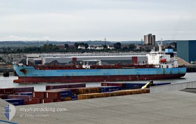
MAERSK TACOMA
Tanker

Current Trip
| Time Travelled | 1 h, 29 mins |
|---|---|
| Remaining Time | --- |
| Distance Travelled | 16.85 nm |
| Remaining Distance | --- |
| AVG Speed | 13.1 Knots |
| MAX Speed | 13.8 Knots |
| AVG Wind | 12 knots |
| MAX Wind | 13.3 knots |
| MIN Temp | 27.6°C / 81.68°F |
| MAX Temp | 28.2°C / 82.76°F |
| Draught | 8.1 m |
| Position Received | 19 m ago |
Current Position
| Longitude | --- |
|---|---|
| Latitude | --- |
| Status | Under way using engine |
| Speed | 13.1 Knots |
| Course | 123.1° |
| Area | Bay of Bengal |
| Station | T-AIS |
| Position Received | 19 m ago |
Information
The current position of MAERSK TACOMA is in Bay of Bengal with coordinates 17.65618° / 83.57088° as reported on 2025-03-28 16:49 by AIS to our vessel tracker app. The vessel's current speed is 13.1 Knots and is heading at the port of FUJAIRAH. The estimated time of arrival as calculated by MyShipTracking vessel tracking app is 2025-03-19 10:00 LT
The vessel MAERSK TACOMA (IMO: 9708617, MMSI: 219179000) is a Tanker It's sailing under the flag of [DK] Denmark.
In this page you can find informations about the vessels current position, last detected port calls, and current voyage information. If the vessels is not in coverage by AIS you will find the latest position.
The current position of MAERSK TACOMA is detected by our AIS receivers and we are not responsible for the reliability of the data. The last position was recorded while the vessel was in Coverage by the Ais receivers of our vessel tracking app.
The current draught of MAERSK TACOMA as reported by AIS is 8.1 meters
Weather
| Temperature | 28.2°C / 82.76°F |
|---|---|
| Wind Speed | 12 knots |
| Direction | 226° SW |
| Pressure | 1007.6 hPa |
| Humidity | 83.8 % |
| Cloud Coverage | 70 % |


Featured Company
Last Port Calls
| Port | Arrival | Departure | Time In Port |
|---|---|---|---|
| 2025-03-26 00:35 | 2025-03-28 21:09 | 2 d | |
| 2025-02-26 16:44 | 2025-03-01 09:33 | 2 d | |
| 2025-01-19 11:34 | 2025-01-21 04:28 | 1 d | |
| 2025-01-02 12:28 |
Most Visited Ports (Last year)
| Port | Arrivals | |
|---|---|---|
| 2 | ||
| 1 | ||
| 1 | ||
| 1 | ||
| 1 | ||
| 1 |
Last Trips
| Origin | Departure | Destination | Arrival | Distance | |
|---|---|---|---|---|---|
| 2025-03-01 09:33 | 2025-03-26 00:35 | 5408.44 nm | |||
| 2025-01-21 04:28 | 2025-02-26 16:44 | 6886.48 nm | |||
| 2025-01-02 12:28 | 2025-01-19 11:34 | 1927.79 nm |
Events
| Time | Event | Details | Position / Dest | Info |
|---|---|---|---|---|
| 2025-03-28 16:54 | Status Changed | Default Under way using engine |
17.64466 / 83.58599
AE FJR
|
Speed: 13.1 kn Course: 123.1° |
| 2025-03-28 16:46 | Change Sea Area | Indian part of the Bay of Bengal South African part of the Indian Ocean |
17.66244 / 83.56086
Bay of Bengal
|
Speed: 13 kn Course: 122.6° |
| 2025-03-28 16:46 | Status Changed | Under way using engine Default |
17.66244 / 83.56086
AE FJR
|
Speed: 12.9 kn Course: 122° |
| 2025-03-28 16:46 | IN Coverage |
17.66244 / 83.56086
Bay of Bengal
|
Speed: 13 kn Course: 122.6° |
|
| 2025-03-28 15:39 | PORT DEPARTURE |
|
17.68786 / 83.32245
AE FJR
|
Speed: 5.5 kn Course: 102° |
| 2025-03-28 15:11 | START Moving |
17.69231 / 83.27969
[IN] VISAKHAPATNAM
|
Speed: 3.3 kn Course: 140° |
|
| 2025-03-25 20:01 | STOP Moving |
17.69436 / 83.27643
[IN] VISAKHAPATNAM
|
Speed: Course: 105° |
|
| 2025-03-25 19:05 | PORT ARRIVAL |
|
17.68690 / 83.30318
[IN] VISAKHAPATNAM
|
Speed: 6.3 kn Course: 269° |
| 2025-03-25 17:26 | START Moving | 10.12 nm, South East of VISAKHAPATNAM |
17.56465 / 83.42538
AE FJR
|
Speed: 7.6 kn Course: 330° |
| 2025-03-20 10:58 | STOP Moving | 10.71 nm, South East of VISAKHAPATNAM |
17.55835 / 83.43336
AE FJR
|
Speed: 0.3 kn Course: 216° |