
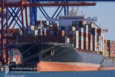
MAERSK PANGANI
Cargo
Current Trip
| Time Travelled | 10 h, 51 mins |
|---|---|
| Remaining Time | 4 h, 38 mins |
| Distance Travelled | 104.64 nm |
| Remaining Distance | 61.50 nm |
| AVG Speed | 11.1 Knots |
| MAX Speed | 14.8 Knots |
| AVG Wind | 4.3 knots |
| MAX Wind | 9.9 knots |
| MIN Temp | 26.8°C / 80.24°F |
| MAX Temp | 28.2°C / 82.76°F |
| Draught | 13.5 m |
| Position Received | 4 h, 56 m ago |
Current Position
| Longitude | --- |
|---|---|
| Latitude | --- |
| Status | Under way using engine |
| Speed | 9.6 Knots |
| Course | 51.2° |
| Area | Singapore Strait |
| Station | T-AIS |
| Position Received | 4 h, 56 m ago |
Info
Information
The current position of MAERSK PANGANI is in Singapore Strait with coordinates 1.30106° / 104.34710° as reported on 2024-11-28 11:44 by AIS to our vessel tracker app. The vessel's current speed is 9.6 Knots and is heading at the port of SINGAPORE. The estimated time of arrival as calculated by MyShipTracking vessel tracking app is 2024-11-28 21:18 LT
The vessel MAERSK PANGANI (IMO: 9786097, MMSI: 636020928) is a Cargo It's sailing under the flag of [LR] Liberia.
In this page you can find informations about the vessels current position, last detected port calls, and current voyage information. If the vessels is not in coverage by AIS you will find the latest position.
The current position of MAERSK PANGANI is detected by our AIS receivers and we are not responsible for the reliability of the data. The last position was recorded while the vessel was in Coverage by the Ais receivers of our vessel tracking app.
The current draught of MAERSK PANGANI as reported by AIS is 13.5 meters
Weather
| Temperature | 28.2°C / 82.76°F |
|---|---|
| Wind Speed | 9 knots |
| Direction | 75° ENE |
| Pressure | 1008.9 hPa |
| Humidity | 78.4 % |
| Cloud Coverage | 100 % |
Featured Company
Last Port Calls
| Port | Arrival | Departure | Time In Port |
|---|---|---|---|
| 2024-11-27 05:28 | 2024-11-28 05:49 | 1 d | |
| 2024-11-24 04:57 | 2024-11-25 07:34 | 1 d | |
| 2024-10-31 13:04 | 2024-11-01 03:08 | 14 h | |
| 2024-10-26 11:05 | 2024-10-29 13:20 | 3 d | |
| 2024-10-21 21:06 | 2024-10-25 07:36 | 3 d | |
| 2024-10-19 08:17 | 2024-10-20 03:09 | 18 h | |
| 2024-09-27 12:21 | 2024-09-28 19:26 | 1 d | |
| 2024-09-23 05:27 | 2024-09-24 16:18 | 1 d |
Last Trips
| Origin | Departure | Destination | Arrival | Distance | |
|---|---|---|---|---|---|
| 2024-11-25 15:34 | 2024-11-27 13:28 | 40.57 nm | |||
| 2024-11-01 04:08 | 2024-11-24 12:57 | 9266.77 nm | |||
| 2024-10-29 14:20 | 2024-10-31 14:04 | 432.34 nm | |||
| 2024-10-25 08:36 | 2024-10-26 12:05 | 392.07 nm | |||
| 2024-10-20 03:09 | 2024-10-21 22:06 | 156.48 nm | |||
| 2024-09-29 03:26 | 2024-10-19 08:17 | 8216.05 nm | |||
| 2024-09-25 00:18 | 2024-09-27 20:21 | 58.56 nm | |||
| 2024-08-30 17:49 | 2024-09-23 13:27 | 9617.43 nm |
Events
| Time | Event | Details | Position / Dest | Info |
|---|---|---|---|---|
| 2024-11-28 11:49 | Status Changed | Default Under way using engine |
1.30915 / 104.35730
SINGAPORE
|
Speed: 9.6 kn Course: 51.2° |
| 2024-11-28 11:44 | OUT of Coverage |
1.30106 / 104.34710
Singapore Strait
SINGAPORE
|
Speed: 9.6 kn Course: 51.2° |
|
| 2024-11-28 11:35 | Status Changed | Under way using engine Default |
1.28682 / 104.32922
SINGAPORE
|
Speed: 9.8 kn Course: 60° |
| 2024-11-28 10:41 | Status Changed | Default Under way using engine |
1.25956 / 104.17944
SINGAPORE
|
Speed: 10.7 kn Course: 82.4° |
| 2024-11-28 10:35 | Change Sea Area | Malaysian part of the Singapore Strait Indonesian part of the Singapore Strait |
1.25769 / 104.16262
Singapore Strait
SINGAPORE
|
Speed: 10.7 kn Course: 82.7° |
| 2024-11-28 06:53 | Change Sea Area | Indonesian part of the Singapore Strait Malaysian part of the Singapore Strait |
1.12620 / 103.53153
Singapore Strait
SINGAPORE
|
Speed: 14.6 kn Course: 162.7° |
| 2024-11-28 05:49 | Draught Changed | 13.5 13 |
1.32676 / 103.55501
SINGAPORE
|
Speed: 5 kn Course: 169.1° |
| 2024-11-28 05:49 | Destination Changed | SINGAPORE TANJUNG PELEPAS |
1.32676 / 103.55501
SINGAPORE
|
Speed: 5 kn Course: 169.1° |
| 2024-11-28 05:49 | ETA Changed | 2024/11/29 05:30 2024/11/27 05:47 |
1.32676 / 103.55501
SINGAPORE
|
Speed: 5 kn Course: 169.1° |
| 2024-11-28 05:49 | PORT DEPARTURE |
|
1.32724 / 103.55492
TANJUNG PELEPAS
|
Speed: 3.8 kn Course: 170° |