
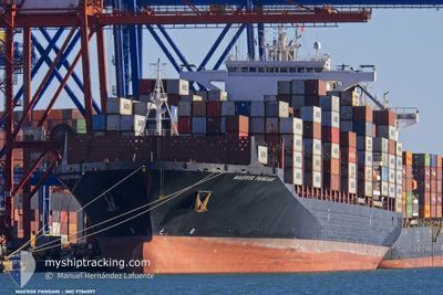
MAERSK PANGANI
Cargo
Current Trip
| Time Travelled | 10 days |
|---|---|
| Remaining Time | --- |
| Distance Travelled | 3599.33 nm |
| Remaining Distance | --- |
| AVG Speed | 14.5 Noeuds |
| MAX Speed | 18.2 Noeuds |
| AVG Wind | 13.6 knots |
| MAX Wind | 36.2 knots |
| MIN Temp | 16.2°C / 61.16°F |
| MAX Temp | 31.4°C / 88.52°F |
| Tirant d eau | 10.1 m |
| Position reçue | 3 d depuis |
Current Position
| Longitude | --- |
|---|---|
| Latitude | --- |
| Etat | Under way using engine |
| Vitesse | 10.9 Noeuds |
| Parcours | 100.4° |
| Zone | South Atlantic Ocean |
| Station | T-AIS |
| Position reçue | 3 d depuis |
Info
Information
The current position of MAERSK PANGANI is in South Atlantic Ocean with coordinates -34.84731° / 19.19033° as reported on 2025-03-14 23:48 by AIS to our vessel tracker app. The vessel's current speed is 10.9 Noeuds and is heading at the port of TERNEUZEN. The estimated time of arrival as calculated by MyShipTracking vessel tracking app is 2025-03-31 06:00 LT
The vessel MAERSK PANGANI (IMO: 9786097, MMSI: 636020928) is a Cargo It's sailing under the flag of [LR] Liberia.
In this page you can find informations about the vessels current position, last detected port calls, and current voyage information. If the vessels is not in coverage by AIS you will find the latest position.
The current position of MAERSK PANGANI is detected by our AIS receivers and we are not responsible for the reliability of the data. The last position was recorded while the vessel was in Coverage by the Ais receivers of our vessel tracking app.
The current draught of MAERSK PANGANI as reported by AIS is 10.1 meters
Weather
| Temperature | 23.2°C / 73.76°F |
|---|---|
| Wind Speed | 15 knots |
| Direction | 80° E |
| Pressure | 1022.7 hPa |
| Humidity | 61.5 % |
| Cloud Coverage | 100 % |
Featured Company
Last Port Calls
| Port | Arrival | Departure | Time In Port |
|---|---|---|---|
| 2025-03-05 10:10 | 2025-03-07 17:29 | 2 d | |
| 2025-02-28 11:00 | 2025-03-03 22:25 | 3 d | |
| 2025-02-22 00:21 | 2025-02-22 19:17 | 18 h | |
| 2025-01-30 09:13 | 2025-01-31 14:44 | 1 d | |
| 2025-01-27 06:16 | 2025-01-29 04:36 | 1 d | |
| 2025-01-02 18:05 | 2025-01-04 00:25 | 1 d |
Last Trips
| Origin | Departure | Destination | Arrival | Distance | |
|---|---|---|---|---|---|
| 2025-03-03 22:25 | 2025-03-05 10:10 | 400.64 nm | |||
| 2025-02-22 19:17 | 2025-02-28 11:00 | 278.26 nm | |||
| 2025-01-31 14:44 | 2025-02-22 00:21 | 10570.06 nm | |||
| 2025-01-29 04:36 | 2025-01-30 09:13 | 29.86 nm | |||
| 2025-01-04 00:25 | 2025-01-27 06:16 | 9297.84 nm | |||
| 2024-12-30 15:48 | 2025-01-02 18:05 | 454.32 nm |
Events
| Heure | Evenement | Détails | Position/ Destination | Info |
|---|---|---|---|---|
| 2025-03-14 23:50 | Etat Changé | Default Under way using engine |
-34.84853 / 19.19750
FOR ORDER
|
Vitesse: 10.9 kn Parcours: 100.4° |
| 2025-03-14 23:48 | Hors de la zone couverte |
-34.84731 / 19.19033
South Atlantic Ocean
FOR ORDER
|
Vitesse: 10.9 kn Parcours: 100.4° |
|
| 2025-03-14 23:47 | Etat Changé | Under way using engine Default |
-34.84664 / 19.18618
FOR ORDER
|
Vitesse: 10.9 kn Parcours: 104° |
| 2025-03-14 23:43 | Dans la zone couverte |
-34.84731 / 19.19033
South Atlantic Ocean
FOR ORDER
|
Vitesse: 10.9 kn Parcours: 100.4° |
|
| 2025-03-14 20:56 | Etat Changé | Default Under way using engine |
-34.60433 / 18.65654
FOR ORDER
|
Vitesse: 9.7 kn Parcours: 117.7° |
| 2025-03-14 20:50 | Hors de la zone couverte |
-34.59559 / 18.63787
South Atlantic Ocean
FOR ORDER
|
Vitesse: 9.7 kn Parcours: 117.7° |
|
| 2025-03-14 20:32 | Etat Changé | Under way using engine Default |
-34.57044 / 18.58354
FOR ORDER
|
Vitesse: 10.2 kn Parcours: 120° |
| 2025-03-14 19:59 | Etat Changé | Default Under way using engine |
-34.52565 / 18.48120
FOR ORDER
|
Vitesse: 12.5 kn Parcours: 111.7° |
| 2025-03-14 19:50 | Etat Changé | Under way using engine Default |
-34.51304 / 18.44875
FOR ORDER
|
Vitesse: 13.9 kn Parcours: 109° |
| 2025-03-14 19:38 | Etat Changé | Default Under way using engine |
-34.49916 / 18.39832
FOR ORDER
|
Vitesse: 14 kn Parcours: 110.1° |