
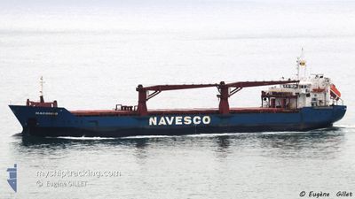
MACONDO
General Cargo
Current Trip
DO HAI
| Time Travelled | 12 days |
|---|---|
| Remaining Time | --- |
| Distance Travelled | 1652.07 nm |
| Remaining Distance | --- |
| AVG Speed | 9.5 Knots |
| MAX Speed | 12 Knots |
| AVG Wind | 12.4 knots |
| MAX Wind | 20 knots |
| MIN Temp | 25.2°C / 77.36°F |
| MAX Temp | 28.6°C / 83.48°F |
| Draught | 5.4 m |
| Position Received | 6 d ago |
Current Position
| Longitude | --- |
|---|---|
| Latitude | --- |
| Status | Under way using engine |
| Speed | 9.6 Knots |
| Course | 117.5° |
| Area | South Atlantic Ocean |
| Station | T-AIS |
| Position Received | 6 d ago |
Info
Information
The current position of MACONDO is in South Atlantic Ocean with coordinates -3.57553° / -37.35721° as reported on 2025-02-19 12:18 by AIS to our vessel tracker app. The vessel's current speed is 9.6 Knots
The vessel MACONDO (IMO: 9299109, MMSI: 371293000) is a General Cargo that was built in 2005 ( 20 years old ). It's sailing under the flag of [PA] Panama.
In this page you can find informations about the vessels current position, last detected port calls, and current voyage information. If the vessels is not in coverage by AIS you will find the latest position.
The current position of MACONDO is detected by our AIS receivers and we are not responsible for the reliability of the data. The last position was recorded while the vessel was in Coverage by the Ais receivers of our vessel tracking app.
The current draught of MACONDO as reported by AIS is 5.4 meters
Weather
| Temperature | 26.9°C / 80.42°F |
|---|---|
| Wind Speed | 7 knots |
| Direction | 130° SE |
| Pressure | 1013.3 hPa |
| Humidity | 73.4 % |
| Cloud Coverage | 9 % |
Featured Company
Last Port Calls
| Port | Arrival | Departure | Time In Port |
|---|---|---|---|
| 2025-02-11 11:03 | 2025-02-13 19:15 | 2 d | |
| 2025-02-08 07:31 | 2025-02-10 08:26 | 2 d | |
| 2025-02-03 17:05 | 2025-02-04 10:17 | 17 h | |
| 2025-01-27 17:58 | 2025-01-31 05:57 | 3 d | |
| 2025-01-24 21:15 | 2025-01-24 21:25 | 10 m | |
| 2025-01-17 17:12 | 2025-01-17 18:08 | 55 m | |
| 2025-01-07 18:50 | 2025-01-08 21:11 | 1 d | |
| 2025-01-04 01:07 | 2025-01-05 00:29 | 23 h | |
| 2024-12-22 22:57 | 2024-12-23 14:51 | 15 h | |
| 2024-12-12 23:56 | 2024-12-15 21:11 | 2 d |
Most Visited Ports (Last year)
| Port | Arrivals | |
|---|---|---|
| 13 | ||
| 11 | ||
| 4 | ||
| 4 | ||
| 3 | ||
| 3 |
Last Trips
| Origin | Departure | Destination | Arrival | Distance | |
|---|---|---|---|---|---|
| 2025-02-10 04:26 | 2025-02-11 08:03 | 227.58 nm | |||
| 2025-02-04 06:17 | 2025-02-08 03:31 | 405.85 nm | |||
| 2025-01-31 01:57 | 2025-02-03 13:05 | 698.28 nm | |||
| 2025-01-24 16:25 | 2025-01-27 13:58 | 540.44 nm | |||
| 2025-01-17 13:08 | 2025-01-24 16:15 | 20.31 nm | |||
| 2025-01-08 16:11 | 2025-01-17 12:12 | 885.51 nm | |||
| 2025-01-04 18:29 | 2025-01-07 13:50 | 518.12 nm | |||
| 2024-12-23 08:51 | 2025-01-03 19:07 | 774.72 nm | |||
| 2024-12-15 15:11 | 2024-12-22 16:57 | 61.39 nm | |||
| 2024-12-08 07:58 | 2024-12-12 17:56 | 1092.98 nm |
Events
| Time | Event | Details | Position / Dest | Info |
|---|---|---|---|---|
| 2025-02-23 04:20 | STOP Moving | 2.02 nm, East of RECIFE |
-8.06986 / -34.84336
DO HAI
|
Speed: 0.1 kn Course: 148° |
| 2025-02-20 23:44 | STOP Moving | 2.03 nm, East of RECIFE |
-8.07005 / -34.84320
DO HAI
|
Speed: Course: 123° |
| 2025-02-19 12:26 | Status Changed | Default Under way using engine |
-3.58586 / -37.33965
DO HAI
|
Speed: 9.6 kn Course: 117.5° |
| 2025-02-19 12:18 | OUT of Coverage |
-3.57553 / -37.35721
South Atlantic Ocean
|
Speed: 9.6 kn Course: 117.5° |
|
| 2025-02-19 12:13 | Detected in Sea | Brazilian part of the South Atlantic Ocean |
-3.56868 / -37.36879
South Atlantic Ocean
|
Speed: 9.7 kn Course: 120.2° |
| 2025-02-19 12:13 | Status Changed | Under way using engine Default |
-3.56868 / -37.36879
DO HAI
|
Speed: 9.8 kn Course: 120° |
| 2025-02-19 12:13 | IN Coverage |
-3.56868 / -37.36879
South Atlantic Ocean
|
Speed: 9.7 kn Course: 120.2° |