
LUTIN
Cargo
Current Trip
| Time Travelled | 2 days |
|---|---|
| Remaining Time | --- |
| Distance Travelled | 130.96 nm |
| Remaining Distance | --- |
| AVG Speed | 6.2 Knots |
| MAX Speed | 7.8 Knots |
| AVG Wind | 11.2 knots |
| MAX Wind | 15.7 knots |
| MIN Temp | -2.4°C / 27.68°F |
| MAX Temp | 3.6°C / 38.48°F |
| Draught | 1.2 m |
| Position Received | 22 h, 6 m ago |
Current Position
| Longitude | --- |
|---|---|
| Latitude | --- |
| Status | Under way using engine |
| Speed | 7.3 Knots |
| Course | 222.4° |
| Area | North Sea |
| Station | T-AIS |
| Position Received | 22 h, 6 m ago |
Info
Information
The current position of LUTIN is in North Sea with coordinates 49.72174° / 6.61583° as reported on 2026-01-04 13:12 by AIS to our vessel tracker app. The vessel's current speed is 7.3 Knots
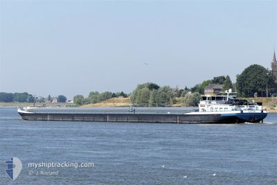
The vessel LUTIN (MMSI: 244620704) is a Cargo It's sailing under the flag of [NL] Netherlands.
In this page you can find informations about the vessels current position, last detected port calls, and current voyage information. If the vessels is not in coverage by AIS you will find the latest position.
The current position of LUTIN is detected by our AIS receivers and we are not responsible for the reliability of the data. The last position was recorded while the vessel was in Coverage by the Ais receivers of our vessel tracking app.
The current draught of LUTIN as reported by AIS is 1.2 meters
Weather
| Temperature | -0.4°C / 31.28°F |
|---|---|
| Wind Speed | 8 knots |
| Direction | 257° WSW |
| Pressure | 1012.9 hPa |
| Humidity | 76.5 % |
| Cloud Coverage | 93 % |
Featured Company
Last Port Calls
| Port | Arrival | Departure | Time In Port |
|---|---|---|---|
| 2026-01-02 12:30 | |||
| 2025-12-19 18:14 | 2025-12-20 04:55 | 10 h | |
| 2025-12-11 19:27 | 2025-12-11 20:31 | 1 h | |
| 2025-12-10 20:45 | 2025-12-10 20:58 | 13 m | |
| 2025-12-08 20:24 | 2025-12-10 18:47 | 1 d | |
| 2025-11-30 06:05 | 2025-11-30 07:09 | 1 h | |
| 2025-11-28 17:07 | 2025-11-29 10:00 | 16 h | |
| 2025-11-27 19:27 | 2025-11-28 16:06 | 20 h | |
| 2025-11-27 16:34 | 2025-11-27 16:53 | 18 m | |
| 2025-11-26 12:17 | 2025-11-27 04:06 | 15 h |
Last Trips
| Origin | Departure | Destination | Arrival | Distance | |
|---|---|---|---|---|---|
| 2025-12-11 20:31 | 2025-12-19 18:14 | 243.20 nm | |||
| 2025-12-10 20:58 | 2025-12-11 19:27 | 139.59 nm | |||
| 2025-12-10 18:47 | 2025-12-10 20:45 | 18.36 nm | |||
| 2025-11-30 07:09 | 2025-12-08 20:24 | 439.80 nm | |||
| 2025-11-29 10:00 | 2025-11-30 06:05 | 126.25 nm | |||
| 2025-11-28 16:06 | 2025-11-28 17:07 | 8.62 nm | |||
| 2025-11-27 16:53 | 2025-11-27 19:27 | 18.03 nm | |||
| 2025-11-27 04:06 | 2025-11-27 16:34 | 102.01 nm | |||
| 2025-11-25 16:28 | 2025-11-26 12:17 | 74.53 nm | |||
| 2025-11-20 13:05 | 2025-11-25 16:21 | 77.82 nm |
Events
| Time | Event | Details | Position / Dest | Info |
|---|---|---|---|---|
| 2026-01-04 13:12 | OUT of Coverage |
49.72174 / 6.61583
North Sea
|
Speed: 7.3 kn Course: 222.4° |
|
| 2026-01-04 10:35 | IN Coverage |
49.78916 / 6.84626
North Sea
|
Speed: 6.4 kn Course: 277.4° |
|
| 2026-01-03 06:16 | OUT of Coverage |
50.53765 / 7.28895
North Sea
METZ
|
Speed: 5.7 kn Course: 165.6° |
|
| 2026-01-03 04:13 | START Moving | 1.92 nm, South East of BONN |
50.71707 / 7.14967
METZ
|
Speed: 5.2 kn Course: 120° |
| 2026-01-03 04:11 | Status Changed | Under way using engine Moored |
50.71816 / 7.14652
METZ
|
Speed: Course: 115° |
| 2026-01-02 22:04 | Status Changed | Moored Under way using engine |
50.71819 / 7.14641
METZ
|
Speed: Course: 115° |
| 2026-01-02 21:49 | STOP Moving | 1.78 nm, South East of BONN |
50.71801 / 7.14622
METZ
|
Speed: Course: 108° |
| 2026-01-02 15:37 | IN Coverage |
51.13222 / 6.84854
North Sea
METZ
|
Speed: 5.8 kn Course: 157.7° |
|
| 2026-01-02 14:28 | OUT of Coverage |
51.18039 / 6.79579
North Sea
METZ
|
Speed: 6.4 kn Course: 145.6° |
|
| 2026-01-02 13:46 | Draught Changed | 1.2 2.6 |
51.21431 / 6.72854
METZ
|
Speed: 6.4 kn Course: 157.3° |