

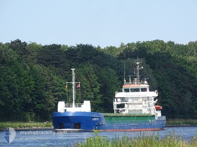
LUCIA B
Container Ship

Current Trip
| Time Travelled | 6 h, 54 mins |
|---|---|
| Remaining Time | 3 days |
| Distance Travelled | 77.09 nm |
| Remaining Distance | 618.11 nm |
| AVG Speed | 11.3 Knots |
| MAX Speed | 17.9 Knots |
| AVG Wind | 23.8 knots |
| MAX Wind | 33.9 knots |
| MIN Temp | 9.1°C / 48.38°F |
| MAX Temp | 11°C / 51.8°F |
| Draught | 6.2 m |
| Position Received | 1 m ago |
Current Position
| Longitude | --- |
|---|---|
| Latitude | --- |
| Status | Under way using engine |
| Speed | 7.6 Knots |
| Course | 205.5° |
| Area | Irish Sea and St. George's Channel |
| Station | T-AIS |
| Position Received | 1 m ago |
Information
The current position of LUCIA B is in Irish Sea and St. George's Channel with coordinates 53.34954° / -4.95814° as reported on 2025-02-20 13:17 by AIS to our vessel tracker app. The vessel's current speed is 7.6 Knots and is heading at the port of SANTANDER. The estimated time of arrival as calculated by MyShipTracking vessel tracking app is 2025-02-24 03:32 LT
The vessel LUCIA B (IMO: 9404077, MMSI: 255806171) is a Container Ship that was built in 2007 ( 18 years old ). It's sailing under the flag of [PT] Portugal.
In this page you can find informations about the vessels current position, last detected port calls, and current voyage information. If the vessels is not in coverage by AIS you will find the latest position.
The current position of LUCIA B is detected by our AIS receivers and we are not responsible for the reliability of the data. The last position was recorded while the vessel was in Coverage by the Ais receivers of our vessel tracking app.
The current draught of LUCIA B as reported by AIS is 6.2 meters
Weather
| Temperature | 10.8°C / 51.44°F |
|---|---|
| Wind Speed | 31 knots |
| Direction | 207° SSW |
| Pressure | 1001.9 hPa |
| Humidity | 86.5 % |
| Cloud Coverage | 100 % |


Featured Company
Last Port Calls
| Port | Arrival | Departure | Time In Port |
|---|---|---|---|
| 2025-02-19 08:28 | 2025-02-20 06:25 | 21 h | |
| 2025-02-17 23:06 | 2025-02-18 23:29 | 1 d | |
| 2025-02-15 07:29 | 2025-02-16 01:19 | 17 h | |
| 2025-02-11 07:34 | 2025-02-12 09:03 | 1 d | |
| 2025-02-10 07:48 | 2025-02-11 05:26 | 21 h | |
| 2025-02-08 18:22 | 2025-02-09 18:26 | 1 d | |
| 2025-02-06 04:46 | 2025-02-07 03:20 | 22 h | |
| 2025-02-03 01:06 | 2025-02-04 00:34 | 23 h | |
| 2025-02-01 20:58 | 2025-02-02 23:21 | 1 d | |
| 2025-01-31 08:31 | 2025-02-01 10:42 | 1 d |
Most Visited Ports (Last year)
| Port | Arrivals | |
|---|---|---|
| 48 | ||
| 41 | ||
| 40 | ||
| 10 | ||
| 10 | ||
| 8 |
Last Trips
| Origin | Departure | Destination | Arrival | Distance | |
|---|---|---|---|---|---|
| 2025-02-18 23:29 | 2025-02-19 08:28 | 117.77 nm | |||
| 2025-02-16 02:19 | 2025-02-17 23:06 | 621.11 nm | |||
| 2025-02-12 09:03 | 2025-02-15 08:29 | 701.95 nm | |||
| 2025-02-09 18:26 | 2025-02-11 07:34 | 126.35 nm | |||
| 2025-02-09 18:26 | 2025-02-10 07:48 | 106.11 nm | |||
| 2025-02-07 04:20 | 2025-02-08 18:22 | 619.21 nm | |||
| 2025-02-04 00:34 | 2025-02-06 05:46 | 703.17 nm | |||
| 2025-02-01 10:42 | 2025-02-03 01:06 | 125.94 nm | |||
| 2025-02-01 10:42 | 2025-02-01 20:58 | 105.47 nm | |||
| 2025-01-29 06:33 | 2025-01-31 08:31 | 668.54 nm |
Events
| Time | Event | Details | Position / Dest | Info |
|---|---|---|---|---|
| 2025-02-20 12:37 | ETA Changed | 2025/02/22 14:00 2025/02/22 06:00 |
53.42267 / -4.88880
ESSDR
|
Speed: 7.2 kn Course: 215.9° |
| 2025-02-20 12:23 | Status Changed | Under way using engine Default |
53.44314 / -4.86382
ESSDR
|
Speed: 6.4 kn Course: 214° |
| 2025-02-20 12:19 | Status Changed | Default Under way using engine |
53.44939 / -4.85609
ESSDR
|
Speed: 5.6 kn Course: 215.9° |
| 2025-02-20 12:13 | Status Changed | Under way using engine Default |
53.45757 / -4.84617
ESSDR
|
Speed: 5.9 kn Course: 216° |
| 2025-02-20 12:11 | Status Changed | Default Under way using engine |
53.45990 / -4.84306
ESSDR
|
Speed: 4.7 kn Course: 208° |
| 2025-02-20 11:51 | Status Changed | Under way using engine Default |
53.48174 / -4.81749
ESSDR
|
Speed: 4.8 kn Course: 211° |
| 2025-02-20 11:47 | IN Coverage |
53.48103 / -4.81846
Irish Sea and St. George's Channel
ESSDR
|
Speed: 3.8 kn Course: 222° |
|
| 2025-02-20 10:19 | Status Changed | Default Under way using engine |
53.56343 / -4.62030
ESSDR
|
Speed: 14.7 kn Course: 265.9° |
| 2025-02-20 10:14 | OUT of Coverage |
53.56431 / -4.58862
Irish Sea and St. George's Channel
ESSDR
|
Speed: 14.7 kn Course: 265.9° |
|
| 2025-02-20 10:13 | Status Changed | Under way using engine Default |
53.56475 / -4.57801
ESSDR
|
Speed: 14.5 kn Course: 266° |