

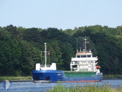
LUCIA B
Container Ship

Current Trip
| Time Travelled | 22 h, 30 mins |
|---|---|
| Remaining Time | 17 h, 53 mins |
| Distance Travelled | 360.84 nm |
| Remaining Distance | 356.72 nm |
| AVG Speed | 15.6 Knots |
| MAX Speed | 18.9 Knots |
| AVG Wind | 20.9 knots |
| MAX Wind | 33.3 knots |
| MIN Temp | 9.1°C / 48.38°F |
| MAX Temp | 13.1°C / 55.58°F |
| Dybgang | 6.1 m |
| Position Modtaget | 5 h, 33 m siden |
Current Position
| Longitude | --- |
|---|---|
| Latitude | --- |
| Status | Under way using engine |
| Fart | 18.7 Knots |
| Kurs | 181.2° |
| Område | Celtic Sea |
| Station | T-AIS |
| Position Modtaget | 5 h, 33 m siden |
Information
The current position of LUCIA B is in Celtic Sea with coordinates 50.15060° / -6.00755° as reported on 2025-03-28 07:58 by AIS to our vessel tracker app. The vessel's current speed is 18.7 Knots and is heading at the port of SANTANDER. The estimated time of arrival as calculated by MyShipTracking vessel tracking app is 2025-03-29 08:25 LT
The vessel LUCIA B (IMO: 9404077, MMSI: 255806171) is a Container Ship that was built in 2007 ( 18 år gamle ). It's sailing under the flag of [PT] Portugal.
In this page you can find informations about the vessels current position, last detected port calls, and current voyage information. If the vessels is not in coverage by AIS you will find the latest position.
The current position of LUCIA B is detected by our AIS receivers and we are not responsible for the reliability of the data. The last position was recorded while the vessel was in Coverage by the Ais receivers of our vessel tracking app.
The current draught of LUCIA B as reported by AIS is 6.1 meters
Weather
| Temperature | 10.5°C / 50.9°F |
|---|---|
| Wind Speed | 19 knots |
| Direction | 328° NNW |
| Pressure | 1019.5 hPa |
| Humidity | 65.9 % |
| Cloud Coverage | 10 % |


Featured Company
Last Port Calls
| Port | Arrival | Departure | Time In Port |
|---|---|---|---|
| 2025-03-26 15:56 | 2025-03-27 15:02 | 23 h | |
| 2025-03-25 07:52 | 2025-03-26 07:02 | 23 h | |
| 2025-03-22 16:26 | 2025-03-23 10:19 | 17 h | |
| 2025-03-19 05:17 | 2025-03-19 22:02 | 16 h | |
| 2025-03-17 18:28 | 2025-03-18 19:26 | 1 d | |
| 2025-03-15 10:54 | 2025-03-16 05:09 | 18 h | |
| 2025-03-12 07:25 | 2025-03-13 01:56 | 18 h | |
| 2025-03-10 18:45 | 2025-03-11 22:58 | 1 d | |
| 2025-03-08 10:25 | 2025-03-09 04:59 | 18 h | |
| 2025-03-05 10:44 | 2025-03-06 08:55 | 22 h |
Most Visited Ports (Last year)
| Port | Arrivals | |
|---|---|---|
| 48 | ||
| 40 | ||
| 40 | ||
| 10 | ||
| 9 | ||
| 8 |
Last Trips
| Origin | Departure | Destination | Arrival | Distance | |
|---|---|---|---|---|---|
| 2025-03-26 07:02 | 2025-03-26 15:56 | 120.57 nm | |||
| 2025-03-23 10:19 | 2025-03-25 07:52 | 619.46 nm | |||
| 2025-03-19 22:02 | 2025-03-22 16:26 | 733.19 nm | |||
| 2025-03-18 19:26 | 2025-03-19 05:17 | 118.30 nm | |||
| 2025-03-16 05:09 | 2025-03-17 18:28 | 619.84 nm | |||
| 2025-03-13 01:56 | 2025-03-15 10:54 | 706.90 nm | |||
| 2025-03-11 22:58 | 2025-03-12 07:25 | 119.76 nm | |||
| 2025-03-09 04:59 | 2025-03-10 18:45 | 621.61 nm | |||
| 2025-03-06 08:55 | 2025-03-08 10:25 | 705.81 nm | |||
| 2025-03-05 00:53 | 2025-03-05 10:44 | 120.55 nm |
Events
| Tid | Hændelsen | Detaljer | Position / Dest | Info |
|---|---|---|---|---|
| 2025-03-28 08:04 | Status er ændret | Default Under way using engine |
50.12156 / -6.00849
ESSDR
|
Fart: 18.7 kn Kurs: 181.2° |
| 2025-03-28 07:58 | Status er ændret | Under way using engine Default |
50.15060 / -6.00755
ESSDR
|
Fart: 18.8 kn Kurs: 181° |
| 2025-03-28 07:58 | Udenfor Dækning |
50.15060 / -6.00755
Celtic Sea
ESSDR
|
Fart: 18.7 kn Kurs: 181.2° |
|
| 2025-03-28 07:44 | Status er ændret | Default Under way using engine |
50.22572 / -6.00496
ESSDR
|
Fart: 18.3 kn Kurs: 181.9° |
| 2025-03-28 07:36 | Status er ændret | Under way using engine Default |
50.26729 / -6.00350
ESSDR
|
Fart: 18.4 kn Kurs: 183° |
| 2025-03-28 07:32 | Status er ændret | Default Under way using engine |
50.28770 / -6.00264
ESSDR
|
Fart: 18.1 kn Kurs: 182.6° |
| 2025-03-28 07:26 | Status er ændret | Under way using engine Default |
50.31886 / -6.00130
ESSDR
|
Fart: 18 kn Kurs: 180° |
| 2025-03-28 07:20 | Status er ændret | Default Under way using engine |
50.34866 / -6.00020
ESSDR
|
Fart: 18.3 kn Kurs: 180.4° |
| 2025-03-28 07:19 | Status er ændret | Under way using engine Default |
50.35280 / -5.99998
ESSDR
|
Fart: 18.1 kn Kurs: 178° |
| 2025-03-28 06:52 | Status er ændret | Default Under way using engine |
50.48836 / -5.99654
ESSDR
|
Fart: 17.8 kn Kurs: 164.9° |