

LONIAN
Pleasure Craft

Current Trip
CABO MEXICO
| Time Travelled | --- |
|---|---|
| Remaining Time | --- |
| Distance Travelled | 2243.07 nm |
| Remaining Distance | --- |
| AVG Speed | 10.9 Knots |
| MAX Speed | 15.6 Knots |
| AVG Wind | 7.6 knots |
| MAX Wind | 17 knots |
| MIN Temp | 17.5°C / 63.5°F |
| MAX Temp | 31.3°C / 88.34°F |
| Draught | 4 m |
| Position Received | 2 m ago |
Current Position
| Longitude | --- |
|---|---|
| Latitude | --- |
| Status | Under way using engine |
| Speed | 14 Knots |
| Course | 332° |
| Area | Gulf of California |
| Station | T-AIS |
| Position Received | 2 m ago |
Information
The current position of LONIAN is in Gulf of California with coordinates 23.45816° / -109.31986° as reported on 2025-03-23 02:48 by AIS to our vessel tracker app. The vessel's current speed is 14 Knots
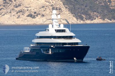
The vessel LONIAN (IMO: 9800087, MMSI: 319139700) is a Pleasure Craft It's sailing under the flag of [KY] Cayman Is.
In this page you can find informations about the vessels current position, last detected port calls, and current voyage information. If the vessels is not in coverage by AIS you will find the latest position.
The current position of LONIAN is detected by our AIS receivers and we are not responsible for the reliability of the data. The last position was recorded while the vessel was in Coverage by the Ais receivers of our vessel tracking app.
The current draught of LONIAN as reported by AIS is 4 meters
Weather
| Temperature | 21.6°C / 70.88°F |
|---|---|
| Wind Speed | 4 knots |
| Direction | 199° SSW |
| Pressure | 1012.6 hPa |
| Humidity | 60.1 % |
| Cloud Coverage | 97 % |


Featured Company
Last Port Calls
| Port | Arrival | Departure | Time In Port |
|---|---|---|---|
| 2025-01-06 09:01 | 2025-01-06 16:53 | 7 h |
Most Visited Ports (Last year)
| Port | Arrivals | |
|---|---|---|
| 2 | ||
| 2 | ||
| 2 | ||
| 1 | ||
| 1 | ||
| 1 |
Last Trips
| Origin | Departure | Destination | Arrival | Distance | |
|---|---|---|---|---|---|
| 2024-12-19 07:33 | 2025-01-06 09:01 | 1356.24 nm |
Events
| Time | Event | Details | Position / Dest | Info |
|---|---|---|---|---|
| 2025-03-22 23:52 | Change Sea Area | Mexican part of the Gulf of California Mexican part of the North Pacific Ocean |
22.95527 / -109.73950
Gulf of California
|
Speed: 14.9 kn Course: 81.9° |
| 2025-03-22 23:36 | START Moving | 9.55 nm, South West of LA PLAYA |
22.94886 / -109.79692
CABO MEXICO
|
Speed: 4.9 kn Course: 80° |
| 2025-03-22 23:31 | Status Changed | Under way using engine At anchor |
22.94918 / -109.79917
CABO MEXICO
|
Speed: 0.3 kn Course: 174° |
| 2025-03-22 20:43 | IN Coverage |
22.94996 / -109.79849
North Pacific Ocean
|
Speed: 0.2 kn Course: 117.8° |
|
| 2025-03-22 17:01 | OUT of Coverage |
22.94964 / -109.79940
North Pacific Ocean
|
Speed: 0.1 kn Course: 309.9° |
|
| 2025-03-22 17:01 | IN Coverage |
22.94964 / -109.79940
North Pacific Ocean
|
Speed: 0.1 kn Course: 309.9° |
|
| 2025-03-21 15:22 | OUT of Coverage |
22.94928 / -109.79908
North Pacific Ocean
|
Speed: Course: 180.4° |
|
| 2025-03-21 15:19 | IN Coverage |
22.94928 / -109.79905
North Pacific Ocean
|
Speed: 0.3 kn Course: 175.5° |
|
| 2025-03-21 00:10 | OUT of Coverage |
22.94999 / -109.79923
North Pacific Ocean
|
Speed: 0.1 kn Course: 121° |
|
| 2025-03-21 00:01 | IN Coverage |
22.94975 / -109.79825
North Pacific Ocean
|
Speed: 0.2 kn Course: 141.4° |