
LONIAN
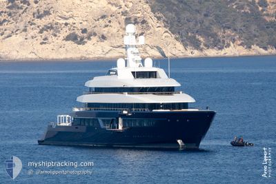
Pleasure Craft
Current Trip
CABO MEXICO
| Time Travelled | --- |
|---|---|
| Remaining Time | --- |
| Distance Travelled | 2336.52 nm |
| Remaining Distance | --- |
| AVG Speed | 11 Noeuds |
| MAX Speed | 15.6 Noeuds |
| AVG Wind | 7.5 knots |
| MAX Wind | 17 knots |
| MIN Temp | 17.5°C / 63.5°F |
| MAX Temp | 31.3°C / 88.34°F |
| Tirant d eau | 4 m |
| Position reçue | 1 d depuis |
Current Position
| Longitude | --- |
|---|---|
| Latitude | --- |
| Etat | At anchor |
| Vitesse | 0.2 Noeuds |
| Parcours | 160° |
| Zone | Gulf of California |
| Station | T-AIS |
| Position reçue | 1 d depuis |
Information
The current position of LONIAN is in Gulf of California with coordinates 22.89077° / -109.89030° as reported on 2025-03-25 19:21 by AIS to our vessel tracker app. The vessel's current speed is 0.2 Noeuds
The vessel LONIAN (IMO: 9800087, MMSI: 319139700) is a Pleasure Craft It's sailing under the flag of [KY] Cayman Is.
In this page you can find informations about the vessels current position, last detected port calls, and current voyage information. If the vessels is not in coverage by AIS you will find the latest position.
The current position of LONIAN is detected by our AIS receivers and we are not responsible for the reliability of the data. The last position was recorded while the vessel was in Coverage by the Ais receivers of our vessel tracking app.
The current draught of LONIAN as reported by AIS is 4 meters
Weather
| Temperature | 26.9°C / 80.42°F |
|---|---|
| Wind Speed | 7 knots |
| Direction | 243° WSW |
| Pressure | 1013.5 hPa |
| Humidity | 31.2 % |
| Cloud Coverage | 45 % |
Featured Company
Last Port Calls
| Port | Arrival | Departure | Time In Port |
|---|---|---|---|
| 2025-01-06 13:01 | 2025-01-06 20:53 | 7 h |
Most Visited Ports (Last year)
| Port | Arrivals | |
|---|---|---|
| 2 | ||
| 2 | ||
| 2 | ||
| 1 | ||
| 1 | ||
| 1 |
Last Trips
| Origin | Departure | Destination | Arrival | Distance | |
|---|---|---|---|---|---|
| 2024-12-19 07:33 | 2025-01-06 09:01 | 1356.24 nm |
Events
| Heure | Evenement | Détails | Position/ Destination | Info |
|---|---|---|---|---|
| 2025-03-25 19:21 | Hors de la zone couverte |
22.89077 / -109.89030
Gulf of California
|
Vitesse: 0.2 kn Parcours: 169.3° |
|
| 2025-03-25 19:21 | Dans la zone couverte |
22.89077 / -109.89030
Gulf of California
|
Vitesse: 0.2 kn Parcours: 169.3° |
|
| 2025-03-24 17:18 | Hors de la zone couverte |
22.89090 / -109.89078
Gulf of California
|
Vitesse: 0.1 kn Parcours: 293.9° |
|
| 2025-03-24 17:18 | Dans la zone couverte |
22.89090 / -109.89078
Gulf of California
|
Vitesse: 0.1 kn Parcours: 293.9° |
|
| 2025-03-23 23:31 | Hors de la zone couverte |
23.40138 / -109.31590
Gulf of California
|
Vitesse: 13 kn Parcours: 178° |
|
| 2025-03-23 22:05 | Démarrage | 2.62 nm, East of LA RIBERA |
23.61116 / -109.53837
CABO MEXICO
|
Vitesse: 12 kn Parcours: 102° |
| 2025-03-23 21:48 | Etat Changé | Under way using engine At anchor |
23.61401 / -109.57175
CABO MEXICO
|
Vitesse: Parcours: 97° |
| 2025-03-23 20:55 | Dans la zone couverte |
23.61382 / -109.57244
Gulf of California
|
Vitesse: Parcours: 340° |
|
| 2025-03-23 18:46 | Hors de la zone couverte |
23.61368 / -109.57185
Gulf of California
|
Vitesse: Parcours: 149° |
|
| 2025-03-23 18:46 | Dans la zone couverte |
23.61368 / -109.57185
Gulf of California
|
Vitesse: Parcours: 149° |