
LOMA
Cargo
Current Trip
| Time Travelled | 11 days |
|---|---|
| Remaining Time | 3 h, 8 mins |
| Distance Travelled | 202.81 nm |
| Remaining Distance | 48.22 nm |
| AVG Speed | 8.4 Knots |
| MAX Speed | 12.1 Knots |
| AVG Wind | 3.4 knots |
| MAX Wind | 7.8 knots |
| MIN Temp | 6.9°C / 44.42°F |
| MAX Temp | 20.3°C / 68.54°F |
| Draught | 0.2 m |
| Position Received | 3 h, 43 m ago |
Current Position
| Longitude | 6.12495° |
|---|---|
| Latitude | 51.52873° |
| Status | Under way using engine |
| Speed | 6.5 Knots |
| Course | 124° |
| Area | North Sea |
| Station | T-AIS |
| Position Received | 3 h, 43 m ago |
Info
Information
The current position of LOMA is in North Sea with coordinates 51.52873° / 6.12495° as reported on 2024-05-10 02:58 by AIS to our vessel tracker app. The vessel's current speed is 6.5 Knots and is heading at the port of MAASTRICHT. The estimated time of arrival as calculated by MyShipTracking vessel tracking app is 2024-05-10 09:50 LT
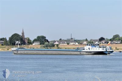
The vessel LOMA (MMSI: 205426390) is a Cargo It's sailing under the flag of [BE] Belgium.
In this page you can find informations about the vessels current position, last detected port calls, and current voyage information. If the vessels is not in coverage by AIS you will find the latest position.
The current position of LOMA is detected by our AIS receivers and we are not responsible for the reliability of the data. The last position was recorded while the vessel was in Coverage by the Ais receivers of our vessel tracking app.
The current draught of LOMA as reported by AIS is 0.2 meters
Weather
| Temperature | 10.1°C / 50.18°F |
|---|---|
| Wind Speed | 4 knots |
| Direction | 21° NNE |
| Pressure | 1024.3 hPa |
| Humidity | 91.4 % |
| Cloud Coverage | 45 % |
Featured Company
Last Port Calls
| Port | Arrival | Departure | Time In Port |
|---|---|---|---|
| 2024-04-28 19:05 | 2024-04-29 03:04 | 7 h | |
| 2024-04-24 17:14 | 2024-04-24 17:48 | 34 m | |
| 2024-04-20 05:53 | 2024-04-20 07:04 | 1 h | |
| 2024-04-16 17:14 | 2024-04-17 10:58 | 17 h | |
| 2024-04-11 15:30 | 2024-04-11 15:34 | 4 m | |
| 2024-04-07 13:22 | 2024-04-09 12:08 | 1 d | |
| 2024-04-03 20:47 | 2024-04-04 09:48 | 13 h | |
| 2024-04-03 09:55 | 2024-04-03 10:20 | 24 m | |
| 2024-04-02 16:37 | 2024-04-02 17:33 | 55 m | |
| 2024-04-02 12:44 | 2024-04-02 16:24 | 3 h |
Last Trips
| Origin | Departure | Destination | Arrival | Distance | |
|---|---|---|---|---|---|
| 2024-04-24 19:48 | 2024-04-28 21:05 | 168.39 nm | |||
| 2024-04-20 09:04 | 2024-04-24 19:14 | 79.65 nm | |||
| 2024-04-17 12:58 | 2024-04-20 07:53 | 219.16 nm | |||
| 2024-04-11 17:34 | 2024-04-16 19:14 | 124.04 nm | |||
| 2024-04-09 14:08 | 2024-04-11 17:30 | 130.40 nm | |||
| 2024-04-04 11:48 | 2024-04-07 15:22 | 301.32 nm | |||
| 2024-04-03 12:20 | 2024-04-03 22:47 | 58.62 nm | |||
| 2024-04-02 19:33 | 2024-04-03 11:55 | 41.69 nm | |||
| 2024-04-02 18:24 | 2024-04-02 18:37 | 1.12 nm | |||
| 2024-04-02 14:40 | 2024-04-02 14:44 | 0.11 nm |
Events
| Time | Event | Details | Position / Dest | Info |
|---|---|---|---|---|
| 2024-05-10 02:58 | OUT of Coverage |
51.52873 / 6.12495
North Sea
MAASTRICHT VIA ALBER
|
Speed: 6.5 kn Course: 124° |
|
| 2024-05-10 02:18 | IN Coverage |
51.56354 / 6.04110
North Sea
MAASTRICHT VIA ALBER
|
Speed: 4.5 kn Course: 149.7° |
|
| 2024-05-09 19:51 | OUT of Coverage |
51.61286 / 6.02401
North Sea
MAASTRICHT VIA ALBER
|
Speed: 6.5 kn Course: 179.6° |
|
| 2024-05-09 19:29 | START Moving | 2.03 nm, South East of BOXMEER |
51.63959 / 5.98438
MAASTRICHT VIA ALBER
|
Speed: 3.6 kn Course: 121° |
| 2024-05-09 19:20 | STOP Moving | 1.93 nm, South East of BOXMEER |
51.64063 / 5.98163
MAASTRICHT VIA ALBER
|
Speed: Course: 121° |
| 2024-05-09 16:38 | START Moving | 0.32 nm, North of NIJMEGEN |
51.85223 / 5.82163
MAASTRICHT VIA ALBER
|
Speed: 3.2 kn Course: 211° |
| 2024-05-09 16:28 | STOP Moving | 0.42 nm, North of NIJMEGEN |
51.85406 / 5.82317
MAASTRICHT VIA ALBER
|
Speed: 0.3 kn Course: 208° |
| 2024-05-09 14:18 | IN Coverage |
51.83797 / 6.17551
North Sea
MAASTRICHT VIA ALBER
|
Speed: 10.5 kn Course: 301° |
|
| 2024-05-09 11:33 | OUT of Coverage |
51.56792 / 6.62346
North Sea
MAASTRICHT VIA ALBER
|
Speed: 10.4 kn Course: 249.4° |
|
| 2024-05-09 02:57 | START Moving | 8.39 nm, South East of BONN |
50.61275 / 7.21262
MAASTRICHT VIA ALBER
|
Speed: 3.2 kn Course: 16° |