
LNG DUBHE
Tanker
Current Trip
NE ASIA
| Time Travelled | --- |
|---|---|
| Remaining Time | --- |
| Distance Travelled | 18212.13 nm |
| Remaining Distance | --- |
| AVG Speed | 18.4 Knots |
| MAX Speed | 23.6 Knots |
| AVG Wind | 13.9 knots |
| MAX Wind | 38 knots |
| MIN Temp | -3.8°C / 25.16°F |
| MAX Temp | 29.7°C / 85.46°F |
| Draught | 11.6 m |
| Position Received | 12 h, 24 m ago |
Current Position
| Longitude | 8.68889° |
|---|---|
| Latitude | -24.30385° |
| Status | Under way using engine |
| Speed | 18.6 Knots |
| Course | 142.2° |
| Area | South Atlantic Ocean |
| Station | T-AIS |
| Position Received | 12 h, 24 m ago |
Info
Information
The current position of LNG DUBHE is in South Atlantic Ocean with coordinates -24.30385° / 8.68889° as reported on 2024-05-14 05:53 by AIS to our vessel tracker app. The vessel's current speed is 18.6 Knots
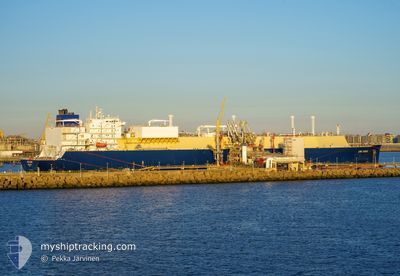
The vessel LNG DUBHE (IMO: 9834296, MMSI: 477327900) is a Tanker It's sailing under the flag of [HK] Hong Kong.
In this page you can find informations about the vessels current position, last detected port calls, and current voyage information. If the vessels is not in coverage by AIS you will find the latest position.
The current position of LNG DUBHE is detected by our AIS receivers and we are not responsible for the reliability of the data. The last position was recorded while the vessel was in Coverage by the Ais receivers of our vessel tracking app.
The current draught of LNG DUBHE as reported by AIS is 11.6 meters
Weather
| Temperature | 18.6°C / 65.48°F |
|---|---|
| Wind Speed | 15 knots |
| Direction | 145° SE |
| Pressure | 1018.6 hPa |
| Humidity | 91 % |
| Cloud Coverage | 3 % |
Featured Company
Last Port Calls
Most Visited Ports (Last year)
| Port | Arrivals | |
|---|---|---|
| 5 | ||
| 2 | ||
| 1 | ||
| 1 | ||
| 1 | ||
| 1 |
Last Trips
| Origin | Departure | Destination | Arrival | Distance |
|---|
Events
| Time | Event | Details | Position / Dest | Info |
|---|---|---|---|---|
| 2024-05-14 05:59 | Status Changed | Default Under way using engine |
-24.32618 / 8.70791
NE ASIA
|
Speed: 18.6 kn Course: 142.2° |
| 2024-05-14 05:53 | OUT of Coverage |
-24.30385 / 8.68889
South Atlantic Ocean
NE ASIA
|
Speed: 18.6 kn Course: 142.2° |
|
| 2024-05-14 05:28 | Status Changed | Under way using engine Default |
-24.19780 / 8.60056
NE ASIA
|
Speed: 18.6 kn Course: 144° |
| 2024-05-14 05:22 | Status Changed | Default Under way using engine |
-24.17360 / 8.58089
NE ASIA
|
Speed: 18.7 kn Course: 144.1° |
| 2024-05-14 05:14 | Status Changed | Under way using engine Default |
-24.14099 / 8.55475
NE ASIA
|
Speed: 18.6 kn Course: 144° |
| 2024-05-14 05:06 | IN Coverage |
-24.14942 / 8.56146
South Atlantic Ocean
NE ASIA
|
Speed: 18.7 kn Course: 144.1° |
|
| 2024-05-14 03:15 | Status Changed | Default Under way using engine |
-23.65254 / 8.16699
NE ASIA
|
Speed: 18.2 kn Course: 147° |
| 2024-05-14 03:10 | Change Sea Area | High seas of the South Atlantic Ocean Western Saharan part of the North Atlantic Ocean |
-23.62994 / 8.15097
South Atlantic Ocean
NE ASIA
|
Speed: 18.2 kn Course: 147° |
| 2024-05-14 03:10 | Status Changed | Under way using engine Default |
-23.62994 / 8.15097
NE ASIA
|
Speed: 18.3 kn Course: 147° |
| 2024-05-14 03:10 | OUT of Coverage |
-23.62994 / 8.15097
South Atlantic Ocean
NE ASIA
|
Speed: 18.2 kn Course: 147° |