
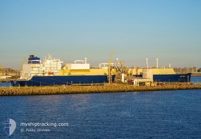
LNG DUBHE
Tanker
Current Trip
NW EUROPE
| Time Travelled | --- |
|---|---|
| Remaining Time | --- |
| Distance Travelled | 18541.72 nm |
| Remaining Distance | --- |
| AVG Speed | 18.4 Noeuds |
| MAX Speed | 23.6 Noeuds |
| AVG Wind | 13.8 knots |
| MAX Wind | 38 knots |
| MIN Temp | -3.8°C / 25.16°F |
| MAX Temp | 29.7°C / 85.46°F |
| Tirant d eau | 9.5 m |
| Position reçue | 4 h, 50 m depuis |
Current Position
| Longitude | 103.46717° |
|---|---|
| Latitude | 1.20719° |
| Etat | Under way using engine |
| Vitesse | 17.7 Noeuds |
| Parcours | 284.3° |
| Zone | Singapore Strait |
| Station | T-AIS |
| Position reçue | 4 h, 50 m depuis |
Info
Information
The current position of LNG DUBHE is in Singapore Strait with coordinates 1.20719° / 103.46717° as reported on 2024-06-08 19:46 by AIS to our vessel tracker app. The vessel's current speed is 17.7 Noeuds
The vessel LNG DUBHE (IMO: 9834296, MMSI: 477327900) is a Tanker It's sailing under the flag of [HK] Hong Kong.
In this page you can find informations about the vessels current position, last detected port calls, and current voyage information. If the vessels is not in coverage by AIS you will find the latest position.
The current position of LNG DUBHE is detected by our AIS receivers and we are not responsible for the reliability of the data. The last position was recorded while the vessel was in Coverage by the Ais receivers of our vessel tracking app.
The current draught of LNG DUBHE as reported by AIS is 9.5 meters
Weather
| Temperature | 28.8°C / 83.84°F |
|---|---|
| Wind Speed | 8 knots |
| Direction | 308° NW |
| Pressure | 1009.7 hPa |
| Humidity | 76.6 % |
| Cloud Coverage | 95 % |
Featured Company
Last Port Calls
Most Visited Ports (Last year)
| Port | Arrivals | |
|---|---|---|
| 4 | ||
| 2 | ||
| 1 | ||
| 1 | ||
| 1 | ||
| 1 |
Last Trips
| Origin | Departure | Destination | Arrival | Distance |
|---|
Events
| Heure | Evenement | Détails | Position/ Destination | Info |
|---|---|---|---|---|
| 2024-06-08 19:53 | Etat Changé | Default Under way using engine |
1.21961 / 103.43265
NW EUROPE
|
Vitesse: 17.7 kn Parcours: 284.3° |
| 2024-06-08 19:46 | Hors de la zone couverte |
1.20719 / 103.46717
Singapore Strait
|
Vitesse: 17.7 kn Parcours: 284.3° |
|
| 2024-06-08 19:34 | Etat Changé | Under way using engine At anchor |
1.19708 / 103.52088
NW EUROPE
|
Vitesse: 16.4 kn Parcours: 278.2° |
| 2024-06-08 19:22 | Changement de zone | Malaysian part of the Singapore Strait Indonesian part of the Singapore Strait |
1.19054 / 103.57313
Singapore Strait
|
Vitesse: 14.6 kn Parcours: 277.5° |
| 2024-06-08 18:58 | Changement de zone | Indonesian part of the Singapore Strait Singaporean part of the Singapore Strait |
1.18005 / 103.66103
Singapore Strait
|
Vitesse: 11.3 kn Parcours: 273.5° |
| 2024-06-08 18:45 | Démarrage | 4.7 nm, South of JURONG ISLAND |
1.18169 / 103.69074
NW EUROPE
|
Vitesse: 3.2 kn Parcours: 260° |
| 2024-06-08 18:14 | Etat Changé | At anchor Default |
1.18346 / 103.69396
NW EUROPE
|
Vitesse: Parcours: 223° |
| 2024-06-08 18:11 | Etat Changé | Default At anchor |
1.18342 / 103.69398
NW EUROPE
|
Vitesse: Parcours: 223° |
| 2024-06-08 17:50 | Etat Changé | At anchor Default |
1.18298 / 103.69399
NW EUROPE
|
Vitesse: Parcours: 235° |
| 2024-06-08 17:47 | Etat Changé | Default At anchor |
1.18292 / 103.69399
NW EUROPE
|
Vitesse: Parcours: 241° |