
LINK GALAXY
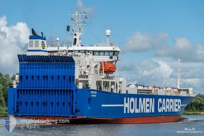
Ro-Ro Cargo
Current Trip
| Time Travelled | 8 h, 22 mins |
|---|---|
| Remaining Time | 17 h, 53 mins |
| Distance Travelled | 101.01 nm |
| Remaining Distance | 230.25 nm |
| AVG Speed | 12.6 Knots |
| MAX Speed | 13.5 Knots |
| AVG Wind | 6.3 knots |
| MAX Wind | 11 knots |
| MIN Temp | 2.2°C / 35.96°F |
| MAX Temp | 8.7°C / 47.66°F |
| Draught | 6.5 m |
| Position Received | 2 m ago |
Current Position
| Longitude | --- |
|---|---|
| Latitude | --- |
| Status | Under way using engine |
| Speed | 12 Knots |
| Course | 200.3° |
| Area | Norwegian Sea |
| Station | T-AIS |
| Position Received | 2 m ago |
Info
Information
The current position of LINK GALAXY is in Norwegian Sea with coordinates 62.46792° / 6.05604° as reported on 2025-12-12 08:08 by AIS to our vessel tracker app. The vessel's current speed is 12 Knots and is heading at the port of HUSOYA. The estimated time of arrival as calculated by MyShipTracking vessel tracking app is 2025-12-13 03:04 LT
The vessel LINK GALAXY (IMO: 8820860, MMSI: 257306000) is a Ro-Ro Cargo that was built in 1991 ( 34 years old ). It's sailing under the flag of [NO] Norway.
In this page you can find informations about the vessels current position, last detected port calls, and current voyage information. If the vessels is not in coverage by AIS you will find the latest position.
The current position of LINK GALAXY is detected by our AIS receivers and we are not responsible for the reliability of the data. The last position was recorded while the vessel was in Coverage by the Ais receivers of our vessel tracking app.
The current draught of LINK GALAXY as reported by AIS is 6.5 meters
Weather
| Temperature | 7.9°C / 46.22°F |
|---|---|
| Wind Speed | 10 knots |
| Direction | 164° SSE |
| Pressure | 1010.9 hPa |
| Humidity | 85.5 % |
| Cloud Coverage | 100 % |
Featured Company
Last Port Calls
| Port | Arrival | Departure | Time In Port |
|---|---|---|---|
| 2025-12-11 17:41 | 2025-12-12 00:49 | 7 h | |
| 2025-12-10 06:46 | 2025-12-10 13:47 | 7 h | |
| 2025-12-09 07:53 | 2025-12-09 12:25 | 4 h | |
| 2025-12-08 14:12 | 2025-12-09 04:05 | 13 h | |
| 2025-12-08 10:57 | 2025-12-08 13:25 | 2 h | |
| 2025-12-07 08:01 | 2025-12-07 16:01 | 7 h | |
| 2025-12-04 21:02 | 2025-12-05 14:32 | 17 h | |
| 2025-12-03 07:32 | 2025-12-03 20:18 | 12 h | |
| 2025-12-01 07:04 | 2025-12-01 09:14 | 2 h | |
| 2025-11-30 07:02 | 2025-11-30 08:52 | 1 h |
Most Visited Ports (Last year)
| Port | Arrivals | |
|---|---|---|
| 52 | ||
| 27 | ||
| 26 | ||
| 24 | ||
| 24 | ||
| 22 |
Last Trips
| Origin | Departure | Destination | Arrival | Distance | |
|---|---|---|---|---|---|
| 2025-12-10 13:47 | 2025-12-11 17:41 | 313.18 nm | |||
| 2025-12-09 12:25 | 2025-12-10 06:46 | 182.88 nm | |||
| 2025-12-09 04:05 | 2025-12-09 07:53 | 41.24 nm | |||
| 2025-12-08 13:25 | 2025-12-08 14:12 | 10.06 nm | |||
| 2025-12-07 16:01 | 2025-12-08 10:57 | 294.58 nm | |||
| 2025-12-05 14:32 | 2025-12-07 08:01 | 558.23 nm | |||
| 2025-12-03 20:18 | 2025-12-04 21:02 | 206.95 nm | |||
| 2025-12-01 09:14 | 2025-12-03 07:32 | 483.52 nm | |||
| 2025-11-30 08:52 | 2025-12-01 07:04 | 268.34 nm | |||
| 2025-11-28 13:11 | 2025-11-30 07:02 | 270.93 nm |
Events
| Time | Event | Details | Position / Dest | Info |
|---|---|---|---|---|
| 2025-12-12 08:10 | Status Changed | Under way using engine Default |
62.46233 / 6.05214
NOHSO
|
Speed: 12.1 kn Course: 196° |
| 2025-12-12 08:09 | Status Changed | Default Under way using engine |
62.46685 / 6.05531
NOHSO
|
Speed: 12 kn Course: 200.3° |
| 2025-12-12 04:18 | Status Changed | Under way using engine Default |
63.03165 / 7.18372
NOHSO
|
Speed: 11.8 kn Course: 244° |
| 2025-12-12 04:17 | Status Changed | Default Under way using engine |
63.03359 / 7.19244
NOHSO
|
Speed: 11.4 kn Course: 244° |
| 2025-12-12 03:35 | Status Changed | Under way using engine Default |
63.08083 / 7.44958
NOHSO
|
Speed: 11.3 kn Course: 242° |
| 2025-12-12 03:33 | Status Changed | Default Under way using engine |
63.08342 / 7.46321
NOHSO
|
Speed: 11.5 kn Course: 239.9° |
| 2025-12-12 01:18 | Status Changed | Under way using engine Default |
62.91954 / 8.13003
NOHSO
|
Speed: 13 kn Course: 11° |
| 2025-12-12 01:17 | Status Changed | Default Under way using engine |
62.91530 / 8.12813
NOHSO
|
Speed: 12.9 kn Course: 10.8° |
| 2025-12-12 00:35 | Status Changed | Under way using engine Default |
62.79729 / 8.29308
NOHSO
|
Speed: 13.1 kn Course: 309° |
| 2025-12-12 00:33 | Status Changed | Default Under way using engine |
62.79301 / 8.30448
NOHSO
|
Speed: 13.1 kn Course: 309.7° |