
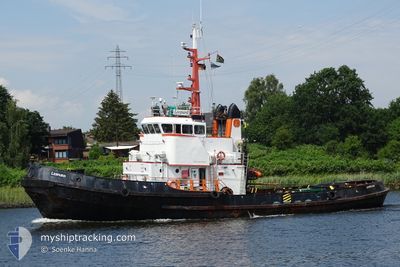
LEOPARD
Tug
Current Trip
| Time Travelled | 4 days |
|---|---|
| Remaining Time | 3 days |
| Distance Travelled | 451.76 nm |
| Remaining Distance | 485.24 nm |
| AVG Speed | 4 Knots |
| MAX Speed | 9.3 Knots |
| AVG Wind | 16.3 knots |
| MAX Wind | 21.6 knots |
| MIN Temp | 9.8°C / 49.64°F |
| MAX Temp | 18°C / 64.4°F |
| Draught | 4.5 m |
| Position Received | Now |
Current Position
| Longitude | 8.87129° |
|---|---|
| Latitude | 57.30376° |
| Status | At anchor |
| Speed | 5.9 Knots |
| Course | 59.7° |
| Area | Skaggerak |
| Station | T-AIS |
| Position Received | Now |
Info
Information
The current position of LEOPARD is in Skaggerak with coordinates 57.30376° / 8.87129° as reported on 2024-05-04 01:37 by AIS to our vessel tracker app. The vessel's current speed is 5.9 Knots and is heading at the port of GDANSK. The estimated time of arrival as calculated by MyShipTracking vessel tracking app is 2024-05-07 13:07 LT
The vessel LEOPARD (IMO: 6819697, MMSI: 576909000) is a Tug that was built in 1969 ( 55 years old ). It's sailing under the flag of [VU] Vanuatu.
In this page you can find informations about the vessels current position, last detected port calls, and current voyage information. If the vessels is not in coverage by AIS you will find the latest position.
The current position of LEOPARD is detected by our AIS receivers and we are not responsible for the reliability of the data. The last position was recorded while the vessel was in Coverage by the Ais receivers of our vessel tracking app.
The current draught of LEOPARD as reported by AIS is 4.5 meters
Weather
| Temperature | 10.7°C / 51.26°F |
|---|---|
| Wind Speed | 7 knots |
| Direction | 131° SE |
| Pressure | 1013 hPa |
| Humidity | 88.6 % |
| Cloud Coverage | 92 % |
Featured Company
Last Port Calls
| Port | Arrival | Departure | Time In Port |
|---|---|---|---|
| 2024-04-28 09:54 | 2024-04-29 14:32 | 1 d | |
| 2024-04-26 06:38 | 2024-04-26 07:42 | 1 h | |
| 2024-04-18 04:56 | 2024-04-23 12:29 | 5 d | |
| 2024-04-17 05:34 | 2024-04-17 10:44 | 5 h | |
| 2024-03-25 09:17 | 2024-04-11 07:52 | 16 d | |
| 2024-03-21 09:43 | 2024-03-23 10:41 | 2 d | |
| 2024-03-09 11:12 | 2024-03-18 05:02 | 8 d | |
| 2024-03-08 19:34 | 2024-03-08 20:48 | 1 h | |
| 2024-03-07 05:58 | 2024-03-07 15:07 | 9 h | |
| 2024-03-03 19:11 | 2024-03-05 07:27 | 1 d |
Most Visited Ports (Last year)
| Port | Arrivals | |
|---|---|---|
| 13 | ||
| 7 | ||
| 4 | ||
| 4 | ||
| 4 | ||
| 3 |
Last Trips
| Origin | Departure | Destination | Arrival | Distance | |
|---|---|---|---|---|---|
| 2024-04-26 09:42 | 2024-04-28 11:54 | 236.91 nm | |||
| 2024-04-23 14:29 | 2024-04-26 08:38 | 365.79 nm | |||
| 2024-04-17 13:44 | 2024-04-18 06:56 | 117.58 nm | |||
| 2024-04-11 09:52 | 2024-04-17 08:34 | 138.53 nm | |||
| 2024-03-23 11:41 | 2024-03-25 10:17 | 288.47 nm | |||
| 2024-03-18 06:02 | 2024-03-21 10:43 | 261.96 nm | |||
| 2024-03-08 21:48 | 2024-03-09 12:12 | 120.29 nm | |||
| 2024-03-07 16:07 | 2024-03-08 20:34 | 228.36 nm | |||
| 2024-03-05 08:27 | 2024-03-07 06:58 | 227.93 nm | |||
| 2024-03-02 15:31 | 2024-03-03 20:11 | 141.83 nm |
Events
| Time | Event | Details | Position / Dest | Info |
|---|---|---|---|---|
| 2024-05-03 23:14 | Change Sea Area | Danish part of the Skaggerak Danish part of the North Sea |
57.17829 / 8.51409
Skaggerak
PL GDN
|
Speed: 5.7 kn Course: 33.5° |
| 2024-05-01 22:03 | START Moving | 9.75 nm, South of THORSMINDE |
56.21495 / 8.04871
PL GDN
|
Speed: 3.1 kn Course: 187° |
| 2024-05-01 17:52 | Status Changed | At anchor Restricted manoeuverability |
56.32507 / 8.08086
PL GDN
|
Speed: 0.3 kn Course: 339° |
| 2024-05-01 17:52 | STOP Moving | 3.11 nm, South West of THORSMINDE |
56.32511 / 8.08091
PL GDN
|
Speed: 0.3 kn Course: 352° |
| 2024-04-30 19:16 | Change Sea Area | Danish part of the North Sea German part of the North Sea |
55.07773 / 8.21753
North Sea
PL GDN
|
Speed: 4.3 kn Course: 4.5° |
| 2024-04-30 10:47 | Status Changed | Restricted manoeuverability Default |
54.49715 / 8.12692
PL GDN
|
Speed: 3.3 kn Course: 356° |
| 2024-04-30 10:39 | Status Changed | Default Restricted manoeuverability |
54.48994 / 8.12639
PL GDN
|
Speed: 3.4 kn Course: 357° |
| 2024-04-30 10:34 | Status Changed | Restricted manoeuverability Default |
54.48524 / 8.12589
PL GDN
|
Speed: 3.4 kn Course: 8° |
| 2024-04-30 10:34 | IN Coverage |
54.48524 / 8.12589
North Sea
PL GDN
|
Speed: 3.4 kn Course: 2.9° |
|
| 2024-04-30 01:03 | OUT of Coverage |
53.88926 / 7.46057
North Sea
PL GDN
|
Speed: 6.5 kn Course: 67.3° |