
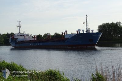
LEIRO
General Cargo
Current Trip
| Trip Time | 9 days |
|---|---|
| Trip Distance | 778.92 nm |
| AVG Speed | 7.3 Knots |
| MAX Speed | 10.6 Knots |
| Draught | 3.4 m |
| AVG Wind | 12.3 knots |
| MAX Wind | 21.6 knots |
| MIN Temp | -18.9°C / -2.02°F |
| MAX Temp | 7.7°C / 45.86°F |
| Position Received | 1 d ago |
Current Position
| Longitude | --- |
|---|---|
| Latitude | --- |
| Status | Under way using engine |
| Speed | 8.9 Knots |
| Course | 149.1° |
| Area | Baltic Sea |
| Station | T-AIS |
| Position Received | 1 d ago |
Info
Information
The current position of LEIRO is in Baltic Sea with coordinates 54.90579° / 13.37626° as reported on 2025-02-25 05:02 by AIS to our vessel tracker app. The vessel's current speed is 8.9 Knots and is currently inside the port of SWINOUJSCIE.
The vessel LEIRO (IMO: 8017085, MMSI: 314298000) is a General Cargo that was built in 1981 ( 44 years old ). It's sailing under the flag of [BB] Barbados.
In this page you can find informations about the vessels current position, last detected port calls, and current voyage information. If the vessels is not in coverage by AIS you will find the latest position.
The current position of LEIRO is detected by our AIS receivers and we are not responsible for the reliability of the data. The last position was recorded while the vessel was in Coverage by the Ais receivers of our vessel tracking app.
The current draught of LEIRO as reported by AIS is 3.4 meters
Weather
| Temperature | 3.5°C / 38.3°F |
|---|---|
| Wind Speed | 7 knots |
| Direction | 8° N |
| Pressure | 1013.5 hPa |
| Humidity | 99.7 % |
| Cloud Coverage | 100 % |
Featured Company
Last Port Calls
| Port | Arrival | Departure | Time In Port |
|---|---|---|---|
| 2025-02-26 16:14 | |||
| 2025-02-15 13:04 | 2025-02-17 15:49 | 2 d | |
| 2025-02-14 13:32 | 2025-02-15 08:17 | 18 h | |
| 2025-02-10 09:30 | 2025-02-10 22:05 | 12 h | |
| 2025-02-04 19:52 | 2025-02-05 11:17 | 15 h | |
| 2025-01-31 23:59 | 2025-02-01 11:31 | 11 h | |
| 2025-01-24 20:53 | 2025-01-25 19:19 | 22 h | |
| 2025-01-24 06:21 | 2025-01-24 16:54 | 10 h | |
| 2025-01-20 06:07 | 2025-01-20 17:45 | 11 h | |
| 2025-01-08 01:06 | 2025-01-14 08:07 | 6 d |
Most Visited Ports (Last year)
| Port | Arrivals | |
|---|---|---|
| 15 | ||
| 13 | ||
| 8 | ||
| 8 | ||
| 6 | ||
| 5 |
Last Trips
| Origin | Departure | Destination | Arrival | Distance | |
|---|---|---|---|---|---|
| 2025-02-17 15:49 | 2025-02-26 16:14 | 778.92 nm | |||
| 2025-02-15 08:17 | 2025-02-15 13:04 | 35.84 nm | |||
| 2025-02-10 22:05 | 2025-02-14 13:32 | 709.56 nm | |||
| 2025-02-05 11:17 | 2025-02-10 09:30 | 840.68 nm | |||
| 2025-02-01 11:31 | 2025-02-04 19:52 | 730.22 nm | |||
| 2025-01-25 19:19 | 2025-01-31 23:59 | 663.52 nm | |||
| 2025-01-24 16:54 | 2025-01-24 20:53 | 37.31 nm | |||
| 2025-01-20 17:45 | 2025-01-24 06:21 | 601.55 nm | |||
| 2025-01-14 08:07 | 2025-01-20 06:07 | 598.28 nm | |||
| 2025-01-02 21:10 | 2025-01-08 01:06 | 713.65 nm |
Events
| Time | Event | Details | Position / Dest | Info |
|---|---|---|---|---|
| 2025-02-26 15:42 | STOP Moving |
53.91725 / 14.28334
[PL] SWINOUJSCIE
|
Speed: Course: 187° |
|
| 2025-02-26 15:14 | PORT ARRIVAL |
|
53.92015 / 14.28352
[PL] SWINOUJSCIE
|
Speed: 9.7 kn Course: 158° |
| 2025-02-26 14:56 | START Moving | 2.83 nm, North of SWINOUJSCIE |
53.95189 / 14.26770
PLSWI
|
Speed: 9.7 kn Course: 158° |
| 2025-02-25 12:23 | STOP Moving | 4.31 nm, North of SWINOUJSCIE |
53.97617 / 14.24536
PLSWI
|
Speed: 0.2 kn Course: 264° |
| 2025-02-25 05:10 | Status Changed | Default Under way using engine |
54.88954 / 13.39324
PLSWI
|
Speed: 8.9 kn Course: 149.1° |
| 2025-02-25 05:02 | OUT of Coverage |
54.90579 / 13.37626
Baltic Sea
PLSWI
|
Speed: 8.9 kn Course: 149.1° |
|
| 2025-02-25 04:13 | Change Sea Area | German part of the Baltic Sea Swedish part of the Baltic Sea |
55.01046 / 13.26528
Baltic Sea
PLSWI
|
Speed: 9.1 kn Course: 149.4° |
| 2025-02-25 01:08 | Change Sea Area | Swedish part of the Baltic Sea Danish part of the Baltic Sea |
55.29187 / 12.65519
Baltic Sea
PLSWI
|
Speed: 8.7 kn Course: 113.8° |
| 2025-02-25 00:53 | Change Sea Area | Danish part of the Baltic Sea Swedish part of the Kattegat |
55.32119 / 12.63935
Baltic Sea
PLSWI
|
Speed: 8.4 kn Course: 189.4° |
| 2025-02-24 23:49 | Change Sea Area | Swedish part of the Kattegat Danish part of the Kattegat |
55.46942 / 12.68159
Kattegat
PLSWI
|
Speed: 8.5 kn Course: 189.3° |