
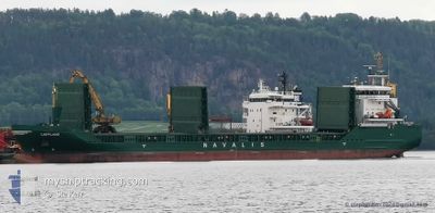
LAPPLAND
Cargo
Current Trip
| Trip Time | 12 days |
|---|---|
| Trip Distance | 1549.98 nm |
| AVG Speed | 9.3 Knots |
| MAX Speed | 13.3 Knots |
| Draught | 4.2 m |
| AVG Wind | 20 knots |
| MAX Wind | 33 knots |
| MIN Temp | -3.9°C / 24.98°F |
| MAX Temp | 8.3°C / 46.94°F |
| Position Received | 1 d ago |
Current Position
| Longitude | --- |
|---|---|
| Latitude | --- |
| Status | Under way using engine |
| Speed | 11.8 Knots |
| Course | 155.4° |
| Area | Gulf of Riga |
| Station | T-AIS |
| Position Received | 1 d ago |
Info
Information
The current position of LAPPLAND is in Gulf of Riga with coordinates 58.07179° / 23.73717° as reported on 2024-11-24 00:30 by AIS to our vessel tracker app. The vessel's current speed is 11.8 Knots and is currently inside the port of SKULTE.
The vessel LAPPLAND (IMO: 9505132, MMSI: 255806291) is a Cargo It's sailing under the flag of [PT] Portugal.
In this page you can find informations about the vessels current position, last detected port calls, and current voyage information. If the vessels is not in coverage by AIS you will find the latest position.
The current position of LAPPLAND is detected by our AIS receivers and we are not responsible for the reliability of the data. The last position was recorded while the vessel was in Coverage by the Ais receivers of our vessel tracking app.
The current draught of LAPPLAND as reported by AIS is 4.2 meters
Weather
| Temperature | 5.6°C / 42.08°F |
|---|---|
| Wind Speed | 14 knots |
| Direction | 174° S |
| Pressure | 1012.3 hPa |
| Humidity | 82.8 % |
| Cloud Coverage | 63 % |
Featured Company
Last Port Calls
| Port | Arrival | Departure | Time In Port |
|---|---|---|---|
| 2024-11-24 20:12 | |||
| 2024-11-11 05:32 | 2024-11-12 06:16 | 1 d | |
| 2024-11-03 23:06 | 2024-11-05 07:06 | 1 d | |
| 2024-10-30 20:44 | 2024-11-01 15:24 | 1 d | |
| 2024-10-21 10:03 | 2024-10-24 09:23 | 2 d | |
| 2024-10-19 00:24 | 2024-10-20 00:01 | 23 h | |
| 2024-10-15 16:28 | 2024-10-16 16:36 | 1 d | |
| 2024-10-13 01:57 | 2024-10-14 16:21 | 1 d | |
| 2024-10-07 10:53 | 2024-10-09 06:49 | 1 d | |
| 2024-10-05 15:13 | 2024-10-06 09:37 | 18 h |
Last Trips
| Origin | Departure | Destination | Arrival | Distance | |
|---|---|---|---|---|---|
| 2024-11-12 08:16 | 2024-11-24 22:12 | 1549.98 nm | |||
| 2024-11-05 09:06 | 2024-11-11 07:32 | 1051.46 nm | |||
| 2024-11-01 17:24 | 2024-11-04 01:06 | 459.38 nm | |||
| 2024-10-24 12:23 | 2024-10-30 22:44 | 985.55 nm | |||
| 2024-10-20 03:01 | 2024-10-21 13:03 | 358.00 nm | |||
| 2024-10-16 19:36 | 2024-10-19 03:24 | 367.90 nm | |||
| 2024-10-14 19:21 | 2024-10-15 19:28 | 266.20 nm | |||
| 2024-10-09 09:49 | 2024-10-13 04:57 | 658.64 nm | |||
| 2024-10-06 12:37 | 2024-10-07 13:53 | 293.46 nm | |||
| 2024-10-03 14:25 | 2024-10-05 18:13 | 344.96 nm |
Events
| Time | Event | Details | Position / Dest | Info |
|---|---|---|---|---|
| 2024-11-24 20:20 | STOP Moving |
57.31748 / 24.40443
[LV] SKULTE
|
Speed: Course: 264° |
|
| 2024-11-24 20:12 | PORT ARRIVAL |
|
57.31683 / 24.40255
[LV] SKULTE
|
Speed: 5.2 kn Course: 99° |
| 2024-11-24 19:56 | START Moving | 1.49 nm, West of SKULTE |
57.31923 / 24.35834
SKULTE
|
Speed: 6.3 kn Course: 89° |
| 2024-11-24 05:53 | STOP Moving | 1.85 nm, West of SKULTE |
57.31183 / 24.34747
SKULTE
|
Speed: 0.2 kn Course: 209° |
| 2024-11-24 00:30 | OUT of Coverage |
58.07179 / 23.73717
Gulf of Riga
SKULTE
|
Speed: 11.8 kn Course: 155.4° |
|
| 2024-11-24 00:29 | ETA Changed | 2024/11/24 04:40 2024/11/24 04:00 |
58.07780 / 23.73215
SKULTE
|
Speed: 11.7 kn Course: 155.7° |
| 2024-11-23 23:12 | Detected in Sea | Estonian part of the Gulf of Riga |
58.30396 / 23.54496
Gulf of Riga
SKULTE
|
Speed: 11.6 kn Course: 156.6° |
| 2024-11-23 23:12 | IN Coverage |
58.30396 / 23.54496
Gulf of Riga
SKULTE
|
Speed: 11.6 kn Course: 156.6° |
|
| 2024-11-23 15:43 | Status Changed | Default Under way using engine |
59.42876 / 23.70812
SKULTE
|
Speed: 10.4 kn Course: 238° |
| 2024-11-23 15:43 | OUT of Coverage |
59.42975 / 23.71133
Gulf of Finland
SKULTE
|
Speed: 10.4 kn Course: 238° |