
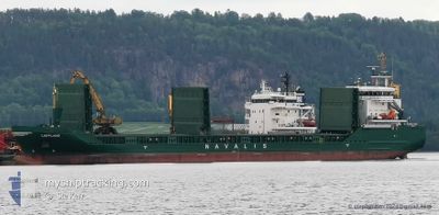
LAPPLAND
Cargo
Current Trip
KARLSBORG
| Time Travelled | 18 h, 22 mins |
|---|---|
| Remaining Time | --- |
| Distance Travelled | 204.65 nm |
| Remaining Distance | --- |
| AVG Speed | 11.3 Knopen |
| MAX Speed | 11.8 Knopen |
| AVG Wind | 9.1 knots |
| MAX Wind | 15.2 knots |
| MIN Temp | -4.9°C / 23.18°F |
| MAX Temp | -0.7°C / 30.74°F |
| Diepgang | 6.6 M |
| Positie ontvangen | 3 h, 10 m geleden |
Current Position
| Lengtegraad | --- |
|---|---|
| Breedtegraat | --- |
| Status | Under way using engine |
| Snelheid | 10.8 Knopen |
| Koers | 340.2° |
| Gebied | Gulf of Bothnia |
| Station | T-AIS |
| Positie ontvangen | 3 h, 10 m geleden |
Info
Information
The current position of LAPPLAND is in Gulf of Bothnia with coordinates 60.23535° / 19.06825° as reported on 2025-02-18 03:17 by AIS to our vessel tracker app. The vessel's current speed is 10.8 Knopen
The vessel LAPPLAND (IMO: 9505132, MMSI: 255806291) is a Cargo It's sailing under the flag of [PT] Portugal.
In this page you can find informations about the vessels current position, last detected port calls, and current voyage information. If the vessels is not in coverage by AIS you will find the latest position.
The current position of LAPPLAND is detected by our AIS receivers and we are not responsible for the reliability of the data. The last position was recorded while the vessel was in Coverage by the Ais receivers of our vessel tracking app.
The current draught of LAPPLAND as reported by AIS is 6.6 meters
Weather
| Temperature | -0.8°C / 30.56°F |
|---|---|
| Wind Speed | 15 knots |
| Direction | 290° WNW |
| Pressure | 1018 hPa |
| Humidity | 81.1 % |
| Cloud Coverage | 19 % |
Featured Company
Last Port Calls
| Port | Arrival | Departure | Time In Port |
|---|---|---|---|
| 2025-02-16 14:24 | 2025-02-17 14:05 | 23 h | |
| 2025-02-14 07:12 | 2025-02-15 11:21 | 1 d | |
| 2025-02-12 02:46 | 2025-02-12 23:37 | 20 h | |
| 2025-02-07 18:23 | 2025-02-11 20:50 | 4 d | |
| 2025-02-04 22:29 | 2025-02-06 07:11 | 1 d | |
| 2025-02-02 09:21 | 2025-02-03 02:57 | 17 h | |
| 2025-01-29 21:13 | 2025-01-31 13:01 | 1 d | |
| 2025-01-22 19:01 | 2025-01-24 21:05 | 2 d | |
| 2025-01-20 08:33 | 2025-01-21 02:15 | 17 h | |
| 2025-01-06 19:13 | 2025-01-07 21:49 | 1 d |
Last Trips
| Origin | Departure | Destination | Arrival | Distance | |
|---|---|---|---|---|---|
| 2025-02-15 11:21 | 2025-02-16 14:24 | 279.66 nm | |||
| 2025-02-12 23:37 | 2025-02-14 07:12 | 363.88 nm | |||
| 2025-02-11 20:50 | 2025-02-12 02:46 | 67.18 nm | |||
| 2025-02-06 07:11 | 2025-02-07 18:23 | 393.10 nm | |||
| 2025-02-03 02:57 | 2025-02-04 22:29 | 196.17 nm | |||
| 2025-01-31 13:01 | 2025-02-02 09:21 | 457.27 nm | |||
| 2025-01-24 21:05 | 2025-01-29 21:13 | 1012.10 nm | |||
| 2025-01-21 02:15 | 2025-01-22 19:01 | 423.26 nm | |||
| 2025-01-07 21:49 | 2025-01-20 08:33 | 1681.41 nm | |||
| 2025-01-03 09:26 | 2025-01-06 19:13 | 439.45 nm |
Events
| Tijd | Evenement | Details | Positie / Bestemming | Info |
|---|---|---|---|---|
| 2025-02-18 03:22 | Status Changed | Default Under way using engine |
60.24913 / 19.05837
KARLSBORG
|
Snelheid: 10.8 kn Koers: 340.2° |
| 2025-02-18 03:17 | Buitenbereik |
60.23535 / 19.06825
Gulf of Bothnia
KARLSBORG
|
Snelheid: 10.8 kn Koers: 340.2° |
|
| 2025-02-18 03:08 | Wijzig zee gebeid | Swedish part of the Gulf of Bothnia Finnish part of the Gulf of Bothnia |
60.20943 / 19.08649
Gulf of Bothnia
KARLSBORG
|
Snelheid: 10.8 kn Koers: 339.8° |
| 2025-02-17 23:56 | Status Changed | Under way using engine Default |
59.78161 / 19.84836
KARLSBORG
|
Snelheid: 11.2 kn Koers: 275° |
| 2025-02-17 23:53 | Status Changed | Default Under way using engine |
59.78099 / 19.86479
KARLSBORG
|
Snelheid: 11.2 kn Koers: 274.6° |
| 2025-02-17 23:48 | Wijzig zee gebeid | Finnish part of the Gulf of Bothnia Finnish part of the Baltic Sea |
59.77949 / 19.90081
Gulf of Bothnia
KARLSBORG
|
Snelheid: 11.2 kn Koers: 274.6° |
| 2025-02-17 23:47 | Status Changed | Under way using engine Default |
59.77945 / 19.90194
KARLSBORG
|
Snelheid: 11.2 kn Koers: 275° |
| 2025-02-17 23:45 | Binnenbereik |
59.77949 / 19.90081
Gulf of Bothnia
KARLSBORG
|
Snelheid: 11.2 kn Koers: 274.6° |
|
| 2025-02-17 19:47 | Buitenbereik |
59.57298 / 21.30001
Baltic Sea
KARLSBORG
|
Snelheid: 11.5 kn Koers: 283.2° |
|
| 2025-02-17 19:00 | Binnenbereik |
59.56726 / 21.58631
Baltic Sea
KARLSBORG
|
Snelheid: 11.5 kn Koers: 269.1° |