

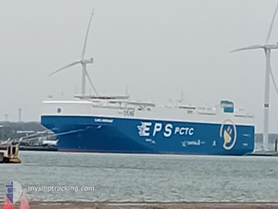
LAKE SHIRASAGI
Cargo

Current Trip
| Time Travelled | 1 day |
|---|---|
| Remaining Time | 4 days |
| Distance Travelled | 253.93 nm |
| Remaining Distance | 2402.26 nm |
| AVG Speed | 12.5 Knots |
| MAX Speed | 19.6 Knots |
| AVG Wind | 3.3 knots |
| MAX Wind | 6 knots |
| MIN Temp | 8.1°C / 46.58°F |
| MAX Temp | 12.2°C / 53.96°F |
| Draught | 9.9 m |
| Position Received | 20 h, 58 m ago |
Current Position
| Longitude | --- |
|---|---|
| Latitude | --- |
| Status | Under way using engine |
| Speed | 16.4 Knots |
| Course | 248.7° |
| Area | Celtic Sea |
| Station | T-AIS |
| Position Received | 20 h, 58 m ago |
Information
The current position of LAKE SHIRASAGI is in Celtic Sea with coordinates 49.29297° / -6.37943° as reported on 2025-03-27 11:13 by AIS to our vessel tracker app. The vessel's current speed is 16.4 Knots and is heading at the port of HALIFAX. The estimated time of arrival as calculated by MyShipTracking vessel tracking app is 2025-04-02 02:15 LT
The vessel LAKE SHIRASAGI (IMO: 1024869, MMSI: 636023592) is a Cargo It's sailing under the flag of [LR] Liberia.
In this page you can find informations about the vessels current position, last detected port calls, and current voyage information. If the vessels is not in coverage by AIS you will find the latest position.
The current position of LAKE SHIRASAGI is detected by our AIS receivers and we are not responsible for the reliability of the data. The last position was recorded while the vessel was in Coverage by the Ais receivers of our vessel tracking app.
The current draught of LAKE SHIRASAGI as reported by AIS is 9.9 meters
Weather
| Temperature | 12°C / 53.6°F |
|---|---|
| Wind Speed | 5 knots |
| Direction | 234° SW |
| Pressure | 1022.8 hPa |
| Humidity | 78.9 % |
| Cloud Coverage | 100 % |


Featured Company
Last Port Calls
| Port | Arrival | Departure | Time In Port |
|---|---|---|---|
| 2025-03-25 13:49 | 2025-03-26 19:17 | 1 d | |
| 2025-03-23 13:20 | 2025-03-24 23:54 | 1 d | |
| 2025-03-21 04:37 | 2025-03-22 01:00 | 20 h | |
| 2025-03-18 11:57 | 2025-03-19 19:47 | 1 d | |
| 2025-03-06 10:32 | 2025-03-06 17:25 | 6 h | |
| 2025-03-03 19:27 | 2025-03-05 21:09 | 2 d | |
| 2025-02-27 10:46 | 2025-02-28 18:58 | 1 d | |
| 2025-02-24 17:04 | 2025-02-25 18:53 | 1 d | |
| 2025-02-09 07:00 | 2025-02-10 05:35 | 22 h | |
| 2025-02-06 18:04 | 2025-02-08 16:02 | 1 d |
Most Visited Ports (Last year)
| Port | Arrivals | |
|---|---|---|
| 2 | ||
| 2 | ||
| 2 | ||
| 2 | ||
| 1 | ||
| 1 |
Last Trips
| Origin | Departure | Destination | Arrival | Distance | |
|---|---|---|---|---|---|
| 2025-03-24 23:54 | 2025-03-25 13:49 | 205.06 nm | |||
| 2025-03-22 01:00 | 2025-03-23 13:20 | 582.04 nm | |||
| 2025-03-19 19:47 | 2025-03-21 04:37 | 391.99 nm | |||
| 2025-03-06 17:25 | 2025-03-18 11:57 | 4004.90 nm | |||
| 2025-03-05 21:09 | 2025-03-06 10:32 | 147.73 nm | |||
| 2025-02-28 18:58 | 2025-03-03 19:27 | 732.17 nm | |||
| 2025-02-25 18:53 | 2025-02-27 10:46 | 558.35 nm | |||
| 2025-02-10 05:35 | 2025-02-24 17:04 | 2582.08 nm | |||
| 2025-02-08 16:02 | 2025-02-09 07:00 | 205.72 nm | |||
| 2025-02-04 20:16 | 2025-02-06 18:04 | 584.36 nm |
Events
| Time | Event | Details | Position / Dest | Info |
|---|---|---|---|---|
| 2025-03-27 11:13 | OUT of Coverage |
49.29297 / -6.37943
Celtic Sea
CA HAL
|
Speed: 16.4 kn Course: 248.7° |
|
| 2025-03-27 08:43 | Change Sea Area | United Kingdom part of the Celtic Sea United Kingdom part of the English Channel |
49.57580 / -5.34770
Celtic Sea
CA HAL
|
Speed: 18.1 kn Course: 249.5° |
| 2025-03-27 03:01 | Change Sea Area | United Kingdom part of the English Channel Guernsey part of the English Channel |
50.00386 / -2.98893
English Channel
CA HAL
|
Speed: 16.6 kn Course: 253.3° |
| 2025-03-27 01:32 | Detected in Sea | Guernsey part of the English Channel |
50.10406 / -2.34801
English Channel
CA HAL
|
Speed: 18.7 kn Course: 248.9° |
| 2025-03-26 19:17 | PORT DEPARTURE |
|
50.86903 / -1.37646
CA HAL
|
Speed: 7.7 kn Course: 132° |
| 2025-03-26 19:09 | START Moving |
50.87954 / -1.39142
[GB] SOUTHAMPTON
|
Speed: 3.1 kn Course: 149° |
|
| 2025-03-26 18:51 | Status Changed | Under way using engine Moored |
50.88490 / -1.39685
[GB] SOUTHAMPTON
|
Speed: Course: 338° |
| 2025-03-26 14:40 | Draught Changed | 9.9 9.8 |
50.88493 / -1.39687
[GB] SOUTHAMPTON
|
Speed: Course: 337° |
| 2025-03-26 14:40 | Destination Changed | CA HAL GBSOU |
50.88493 / -1.39687
[GB] SOUTHAMPTON
|
Speed: Course: 337° |
| 2025-03-26 14:40 | ETA Changed | 2025/04/03 02:30 2025/03/25 11:45 |
50.88493 / -1.39687
[GB] SOUTHAMPTON
|
Speed: Course: 337° |